Monday, December 19, 2022

Houston Ship Channel (HSC) & Bayport Ship Channel (BSC) Expansion Channel Improvement Project (ECIP) Project 11 REDFISH TO BAYPORT (and what's up on Bacliff, Tx. Shoreline?

Houston Ship Channel (HSC) & Bayport Ship Channel (BSC) Expansion Channel Improvement Project (ECIP) Project 11: REDFISH TO BAYPORT HSC STA 78+844 TO HSC STA 16+000 & BAYPORT SHIP CHANNEL


Howdy Neighbors, if any of you were curious about the tugs and barge that have been working outback just off Bacliff shoreline. a few weeks ago, crews showed up in work boats outback, they worked placing markers orange flag or paint at top, this is a large area just out back behind our house, runs back towards San Leon, and out towards the ship channel. well then after the markers were all set, these tugs, large and small showed up, with work boats, and a big barge that can dump materials from the bottom. that big barge running night and day, for about a week now. well, i got to wondering what the hell was going on, and i called everybody i could, TPWD, Dickinson Lab, TGLO, GBF, Prestige, nobody knew. well this is what i found out, seems they thought it a good idea to dredge the ship channel wider and deeper and dump the dredge materials (?) in our back yards. you can see photos below... Merry Christmas!


Houston Ship Channel (HSC) & Bayport Ship Channel (BSC) Expansion Channel Improvement Project (ECIP) Project 11: REDFISH TO BAYPORT HSC STA 78+844 TO HSC STA 16+000 & BAYPORT SHIP CHANNEL

Eighth Coast Guard District (Sector Houston-Galveston) 13411 Hillard St. Houston, TX 77034 (281) 464-4800

Subject: Notice to Mariners

Reference: Houston Ship Channel (HSC) & Bayport Ship Channel (BSC) Expansion Channel Improvement Project (ECIP) Project 11: REDFISH TO BAYPORT HSC STA 78+844 TO HSC STA 16+000 & BAYPORT SHIP CHANNEL

 Mariners:

Curtin Maritime request that a Notice to Mariners be posted regarding our dredging operations in the Houston Ship Channel from approximately channel marker G-75/R-76 to G-71/R-72.

Please be advised that Curtin Maritime (CMC) will be conducting dredging activities commencing on or about December 15, 2022 and conclude on or about May 3rd, 2023. Sediment will be dredged within the main ship channel and existing barge lane and will be loaded into scows. The mechanical clamshell dredge, DB Avalon, will be utilizing spuds without any anchors and does not have any associated dredge pipeline.

From approximately Dec 15, 2022 to Feb 16, 2023, scows will be pushed directly from the DB Avalon to the San Leon oyster mitigation site located at 29d 31.602000' N, 094d 57.52920' W. From approximately Feb 17, 2023 to Apr 16, 2023 the scows will be pushed from the DB Avalon in the HSC utilizing the barge lane, where possible, to the vicinity of light 45. The tug will take the scow within 300ft outside of the western toe of the main ship channel and swap the loaded scow to shallower draft tugs. The shallower draft tugs will pass a light scow to the larger tug to take back to the DB Avalon and the loaded scow will be transported to the Dollar Reef oyster mitigation site located at 29d 26.899043' N, 094d 53.128969' W.

From approximately Feb 3, 2023 to Apr 6, 2023, a placement barge, DB Ironbound, will be located at the San Leon oyster mitigation site placing material. Then the placement barge will relocate to Dollar Reef oyster mitigation site on approximately Apr 7, 2023 and conclude operations on or about May 3, 2023.

Our fleet for this operation will consist of:

Equipment Name LxWxDraft

Dredge DB Avalon 250’x77’x9’

Placement Barge DB Ironbound 144’x54’x6’

Split Hull Scow Arrow Point 174’x48’x10’

Split Hull Scow Long Point 174’x48’x10’

Split Hull Scow Telsiai 200’x44’x10’

Split Hull Scow Thomas Desmond 250’x52’x10’

Split Hull Scow GL33 234’x53’x10’

Split Hull Scow GL35 234’x53’x10’

Dredge Tending Tug Elizabeth C 90’x28’x12’

Scow Tending Tug Alice C 120’x31’x15’

Scow Tending Tug Karen C 126’x34’x16’

Scow Tending Tug Taurus 69’x24’x9’

Scow Tending Tug Baby T 26’x14’x5’

CMC will be operating 24 hours per day / 7 days per week (Monday through Sunday). Mariners are urged to transit at their slowest safest speed to minimize wake between lights 43/44 and 47/48 while a scow swap is occurring. While approaching the DB Avalon, mariners are urged to proceed with caution after passing arrangements have been made.

All manned equipment will monitor VHF-FM Channels 13, 11 and 05A. The dredge DB Avalon can be reached by phone at (562) 600-9854. Our Project Manager, Mr. Mike Patria can be reached at (630) 418-1190). Regards,

Mike Patria, Project Manager mpatria@curtinmaritime.com 


HOUSTON SHIP CHANNEL (HSC) & BAYPORT SHIP CHANNEL (BSC) EXPANSION CHANNEL IMPROVEMENT PROJECT (ECIP) PROJECT 11: SOUTH BOATERS CUT TO BAYPORT (BEACON 76): HSC STA 57+000 TO HSC STA 14+500 & BAYPORT SHIP CHANNEL

GENERAL NOTES:

1. ALL EXISTING CHANNEL CONDITIONS SHALL BE VERIFIED BY THE CONTRACTOR PRIOR TO COMMENCING CONSTRUCTION ACTIVITIES. THE CONTRACTOR SHALL NOTIFY THE PORT OF HOUSTON AUTHORITY AND ENGINEER IMMEDIATELY OF ANY CONFLICT OR DISCREPANCIES.

2. THE CONTRACTOR SHALL MAKE HIS OWN ARRANGEMENTS AND OBTAIN PERMISSION FROM APPLICABLE PROPERTY OWNERS FOR STAGING AREAS AND LOADING BARGES ON PUBLIC OR PRIVATE PROPERTY. ALL COSTS ASSOCIATED WITH PREPARATION AND USE OF SUPPORT FACILITIES FOR THIS PROJECT SHALL BE PAID BY THE CONTRACTOR AT NO COST TO THE PORT OF HOUSTON AUTHORITY. THESE AREAS SHALL BE RESTORED TO PRE-PROJECT CONDITIONS UPON COMPLETION OF WORK.

3. THE CONTRACTOR SHALL TAKE MEASURES TO PROTECT ALL EXISTING IMPROVEMENTS WITHIN AND ADJACENT TO THE WORK AREA. ANY DAMAGE CAUSED BY THE CONTRACTOR'S ACTIVITIES SHALL BE REPLACED OR REPAIRED AT THE EXPENSE OF THE CONTRACTOR AND AT NO COST TO THE PORT OF HOUSTON AUTHORITY. STRUCTURES THAT ARE TO BE PROTECTED FROM DAMAGE OR REPAIRED IF DAMAGED INCLUDE BUT ARE NOT LIMITED TO FENCES, LEVEE EMBANKMENTS, OUTLET STRUCTURES, DRAINAGE PIPES, ROADS, DITCHES, PRIVATE OR PUBLIC GROUNDS, AND OTHER STRUCTURES OR IMPROVEMENTS.

4. THE CONTRACTOR SHALL TAKE PRECAUTIONS, SECURE EQUIPMENT AND PROTECT THE WORK AGAINST ADVERSE WEATHER CONDITIONS AND SURGE / WAKE INFLUENCES FROM PASSING VESSELS. PROVISIONS SHALL BE MADE TO ACCESS SHALLOW AREAS THROUGH THE USE OF LIGHT-LOADED BARGES OR OTHER EQUIPMENT SUITABLE FOR SHALLOWER WATER. EXCAVATION FOR ACCESS AND FLOTATION SHALL BE SUBMITTED TO AND OBTAINED IN WRITING BY THE PORT OF HOUSTON AUTHORITY.

5. THE DREDGING PROJECT MAY BE ADJACENT TO ENVIRONMENTALLY SENSITIVE AREAS. THE CONTRACTOR SHALL AVOID / MINIMIZE DAMAGES TO THESE AREAS DURING THE COURSE OF CONSTRUCTION. ANY DAMAGES CAUSED BY THE CONTRACTOR'S ACTIVITIES SHALL BE RESTORED AT THE EXPENSE OF THE CONTRACTOR AND AT NO COST TO THE PORT OF HOUSTON AUTHORITY. THE CONTRACTOR SHALL COMPLY WITH APPLICABLE ENVIRONMENTAL LAWS AND REQUIREMENTS FROM ALL RELEVANT STATE AND FEDERAL AGENCIES. FOR PURPOSES OF CONTRACT MODIFICATIONS, SCOPE CHANGES, OR CHANGE ORDERS, THE PORT OF HOUSTON AUTHORITY WILL BE THE SOLE DETERMINANT OF DAMAGES. THIS PROVISION IN NO WAY RELIEVES THE CONTRACTOR FROM COMPLIANCE WITH APPLICABLE ENVIRONMENTAL REQUIREMENTS AND DOES NOT CONSTITUTE A WAIVER OF ANY COLLATERAL FEDERAL PERMITTING REQUIREMENTS OR LEGAL OBLIGATION OF THE CONTRACTOR. THE PORT OF HOUSTON AUTHORITY RESERVES THE RIGHT TO SUSPEND WORK AT ANYTIME IF DAMAGES OCCUR AND UNTIL SATISFACTORY CORRECTIVE MEASURES ARE IMPLEMENTED BY THE CONTRACTOR. 6 CONSTRUCTION EQUIPMENT SHALL NOT OPERATE ON PRIVATE PROPERTY UNLESS PERMISSION HAS BEEN ACQUIRED BY THE CONTRACTOR FROM THE LAND OWNER.

7. THE PROJECT IS LOCATED WITHIN THE THE HOUSTON SHIP AND BAYPORT SHIP CHANNELS, WHICH ARE HIGHLY UTILIZED BY MARINE TRAFFIC. THE CONTRACTOR SHALL NOT STAGE EQUIPMENT WITHIN THE NAVIGATION CHANNEL NOR INTERFERE WITH OR INTERRUPT COMMERCIAL VESSEL NAVIGATION.

8. THE CONTRACTOR SHALL REQUEST A NOTICE TO MARINERS FROM THE U.S. COAST GUARD PRIOR TO COMMENCING CONSTRUCTION ACTIVITIES.

9. THE CONTRACTOR SHALL REMOVE ANY ENCOUNTERED DEBRIS AND DISPOSE OF IN ACCORDANCE WITH LOCAL, STATE AND FEDERAL REGULATIONS.

10. THE LOCATIONS OF EXISTING UTILITIES AND SUBSTRUCTURES SHOWN HEREIN HAVE BEEN TAKEN FROM AVAILABLE RECORDS. THE PORT OF HOUSTON AUTHORITY DOES NOT WARRANT THE COMPLETENESS OR CORRECTNESS OF THE LOCATIONS OF UTILITIES AND SUBSTRUCTURES. IT SHALL BE THE CONTRACTOR'S RESPONSIBILITY TO IDENTIFY AND PROTECT EXISTING UTILITIES AND SUBSTRUCTURES. SHOULD UTILITIES, PIPELINES, CABLING OR OTHER SUBSTRUCTURES BE ENCOUNTERED THAT ARE NOT IDENTIFIED AND INDICATED ON THESE PLANS, THE PORT OF HOUSTON AUTHORITY SHALL BE NOTIFIED IMMEDIATELY.

11. ATTENTION IS DIRECTED TO THE SPECIFICATIONS WHERE BIDDERS ARE REQUIRED TO EXAMINE AND DETERMINE, AS THEIR OWN RESPONSIBILITY THE LOCATION, PHYSICAL CONDITIONS, AND SURROUNDINGS OF THE PROPOSED WORK.

12. THE CONTRACTOR SHALL OBTAIN THE REQUIRED PERMITS AS MAY BE REQUIRED BEYOND THE AUTHORIZATIONS PROVIDED TO PERFORM THE WORK.

13. THE CONTRACTOR SHALL ADHERE TO ALL SAFETY CODES, REGULATIONS AND SPECIFICATIONS FOR THE DURATION OF THIS CONTRACT.

14. THE CONTRACTOR SHALL COMPLETE ALL WORK SHOWN ON THE DRAWINGS AND IN THE SPECIFICATIONS, UNLESS INDICATED AS NOT IN PACKAGE(N.I.P.)


ARMY CORP ENGINEERS


December 13, 2022

Army Corps Must Reevaluate Toxic Dredging Project After Gulf and Environmental Groups’ Lawsuit

Victory: Dredging Matagorda Bay to increase oil exports would have devastated the fishing community, increased climate pollution, and harmed public health

CONTACTS

Alexandria Trimble, atrimble@earthjustice.org

Legal document

WASHINGTON, D.C. — Today, a coalition of Gulf and environmental groups represented by Earthjustice announced the U.S. Army Corps of Engineers has withdrawn approval to dredge the Matagorda Bay shipping channel through an EPA Superfund site, and committed to extensive additional environmental review, including a full Supplemental Environmental Impact Statement (“SEIS”).


The Corps action comes in response to a lawsuit filed by the groups after new information came to light about the anticipated use of the shipping channel and the risks of mercury contamination, increased greenhouse gas emissions, and significant impacts on the lives and livelihoods of people working in the fishing industry.


Our fishing community will not stand by and let this toxic dredging project upend decades of hard work to bury industrial waste dumped in the bay,” said Diane Wilson, fourth-generation shrimper and executive director of San Antonio Estuarine Bay Waterkeeper. “We’re celebrating today but we know the fight isn’t over to protect our health and livelihoods from dirty fossil fuel companies trying to make a profit.”

“Matagorda Bay is in a state of an environmental emergency as a result of Alcoa’s industry practices which permanently depleted the life of the oyster population,” said Chrystal Beasley, Texas Gulf Coast campaigner at Earthworks. “Texas Gulf Coast residents deserve a full risk assessment that not only focuses on the environmental impacts but the human health risk and toxicity exposure through consumption of food.”

“The dredging project’s risks to human health, marine life, and the climate are significant and were not carefully considered in the Corps’ analysis,” said Lauren Fleer, Environmental Engineer at Environmental Integrity Project. “Dredging up a contaminated site to ship more oil overseas is simply not worth the risks to human health and the environment.”

The Corps agreed to go back to the drawing board and redo its environmental analysis of the dredging project. No work can continue until after a complete analysis of the project’s impact on public health, the surrounding ecosystem, and the damage the project would do to the local fishing economy. The extensive additional review will provide opportunities for public and expert input.

“The proposed dredge project for the Matagorda Bay system would have substantial negative environmental effects on the estuarine system including the resuspension of mercury, intensification of low dissolved oxygen levels, placement of dredge spoils potentially contaminated with mercury and clay, increased turbidity and salinity, and harm to sea grasses, oyster beds, fish, and sea turtles,” said Joanie Steinhaus, Gulf Program Director at the Turtle Island Restoration Network. “The EIS did not properly evaluate these potential impacts and I am thrilled to learn the Corps has decided to do a comprehensive environmental review of the Matagorda Bay Project.”

“The law requires agencies to fully understand and disclose the impacts of their actions. The federal proposal to dredge up a toxic waste site so that we can export more crude oil failed that test,” said Erin Gaines, senior attorney at Earthjustice. “We’re glad that the Corps has chosen to follow the law without further litigation, and we look forward to ensuring the full assessment properly considers the environmental, human health, and local economic impacts.”

The timeline for the revised SEIS has not been announced, but such processes can take years to complete. In addition to the revised SEIS, the Corps has committed to reinitiating federal consultation under the Endangered Species Act and performing a new analysis under the Clean Water Act. The lawsuit challenged the Corps’ compliance with all three statutes.

Plaintiffs San Antonio Bay Estuarine Waterkeeper, Earthworks, Environmental Integrity Project, Turtle Island Restoration Project, and Texas Campaign for the Environment are represented by lawyers Erin Gaines and Jan Hasselman of Earthjustice.

BACKGROUND

In 2019, the U.S. Army Corps of Engineers proposed to deepen and widen the Matagorda Bay shipping channel to allow for “Suezmax”-size oil tankers, which are as long as football fields and can carry about one million barrels of oil, to pass into the Gulf of Mexico.

The project would also include dredging through an EPA Superfund site located in a shipping channel contaminated with mercury by a now closed Alcoa aluminum smelting plant. The Army Corps performed an initial Environmental Impact Statement in 2019 for the dredging of the channel for a much smaller oil terminal project, but that did not capture the scale of the current proposal or include an examination of the most recent data on mercury contamination in the sediment.

Earthjustice, Environmental Integrity Project, and allies sent letters to the Army Corps in October and December 2021 and February 2022 requesting additional study of the possible impacts of the dredging project in a Supplemental Environmental Impact Statement. In the letters, expert reports supported the need for a re-evaluation of the risks from mercury contamination, including sediment sampling data which found mercury levels six times higher than EPA’s goal for the Superfund Site in the dredging area.

In May 2022, Earthjustice represented San Antonio Bay Estuarine Waterkeeper, Earthworks, Environmental Integrity Project, Turtle Island Restoration Project, and Texas Campaign for the Environment in filing a lawsuit against the U.S. Army Corps of Engineers over its proposal to dredge the Matagorda Bay shipping channel.


The project to dredge the Matagorda Bay shipping channel has faced strong community-led opposition since its proposal. Max Midstream, the company which hoped to profit from the dredging project to allow larger oil tankers to reach the company’s proposed oil export terminal, had previously stated it would pay for the entire federal dredging project. It has since had significant financial troubles and is facing legal challenges from community groups. In September, the U.S. Army Corps of Engineers announced it would delay seeking bids on the dredging project.


Since 1988, an area of Lavaca Bay has been closed to fishing because of high levels of mercury in finfish and crabs. Matagorda Bay and Port Lavaca, across the bay from Point Comfort, historically had a thriving fishing, shrimping, and oystering industry that has sharply declined in part due to industrial pollution. Despite the setbacks, the fishing community is fighting hard to survive. The dredging project would have increased greenhouse gas emissions, harmed public health, and dumped 20 million cubic yards of dredging spoils in areas that are important aquatic and fisheries habitats.


NOTICE OF WITHDRAWAL OF RECORD OF DECISION

Federal Defendants Michael L. Connor, in his official capacity as Assistant Secretary of the Army for Civil Works, and the U.S. Army Corps of Engineers (“Corps”) hereby provide notice that on December 5, 2022, the Corps signed the attached Memorandum for Record withdrawing the Record of Decision for the Matagorda Ship Channel Improvement Project Feasibility Report and Environmental Impact Statement that is challenged in this case. See Exhibit A, Memorandum dated December 5, 2022, signed by Michael L. Connor, Assistant Secretary of the Army for Civil Works. As addressed in the attached Memorandum, the withdrawal is based on the Corps’ decision to prepare a supplemental environmental impact statement for the Project. See Ex. A.

Dated: December 13, 2022 

DEPARTMENT OF THE ARMY OFFICE OF THE ASSSISTANT SECRETARY CIVIL WORKS

108 ARMY PENTAGON WASHINGTON, DC 20310-0108 SACW

MEMORANDUM FOR RECORD

SUBJECT: Withdrawing Record of Decision for Matagorda Ship Channel Improvement

Project, Port Lavaca, Texas Feasibility Report and Environmental Impact Statement

1. In 2019, the U.S. Army Corps of Engineers (USACE) completed an environmental impact statement (EIS) for the Matagorda Ship Channel Improvement Project. The Record of Decision was signed on April 22, 2020. During the pre-construction, engineering, and design (PED) phase, the USACE reported a discrepancy between its PED calculations concerning the quantity of material to be dredged from the Matagorda Ship Channel and the quantity of such material that was evaluated in the EIS.

2. Due to the discrepancy in dredged material quantities, the USACE has determined it will prepare a supplement to the EIS. Accordingly, I am withdrawing the Record of Decision signed on April 22, 2020, for further consideration in light of findings in the supplemental EIS.


1 July 2010

Impacts of Dredging Activities on the Accumulation of Dioxins in Surface Sediments of the Houston Ship Channel, Texas

Kevin M. Yeager, Robin Brinkmeyer, Chet F. Rakocinski, Kimberly J. Schindler, Peter H. Santschi

Author Affiliations +

J. of Coastal Research, 2010(264):743-752 (2010). https://doi.org/10.2112/JCOASTRES-D-09-00009.1

Abstract

The Houston Ship Channel (HSC) and upper Galveston Bay (GB), Texas, are known to be contaminated with dioxins (polychlorinated dibenzo-p-dioxins and polychlorinated dibenzofurans), the majority of which are associated with sediments. Since 1914, dredging operations to establish, sporadically expand, and consistently maintain a navigable channel for large ships has been and remains continuous here. The objectives of this research focus on determining if dredging activities have any significant impact on the quantities of dioxins associated with surface sediments in the HSC and GB. Four transects were sampled, located on the dredged and undredged sides of two dredge-spoil islands. Sediment samples were characterized in terms of their organic carbon contents, grain size fractions, indicator dioxin concentrations (2,3,7,8-tetrachlorinated dibenzo-p-dioxin [TCDD], 2,3,7,8-tetrachlorodibenzofuran [TCDF], and toxic equivalents), and fallout radionuclide activities. The physical and geochemical data were examined using a combination of principal components analysis and one-way analysis of variance. Results of the statistical tests show that (1) sedimentary dioxin concentrations are significantly higher adjacent to the northernmost dredge-spoil island, which is located closer to a recently identified dioxin point source (San Jacinto waste pits); and (2) while mean sedimentary dioxin concentrations were slightly higher for undredged as compared to dredged transect samples as a whole, these differences were not significant (p > 0.05). Mean fallout isotope ratio values (7Be/137Cs, 7Be/210Pbxs) were greater for the dredged sample population, indicating that dredged sediments contain more of the shorter-lived radionuclides (i.e., 7Be), as their buildup is more rapid after dredging than those isotopes with longer half-lives (210Pb) or those for which a longer time has passed since introduction into the environment (137Cs).

Citation Download Citation

Kevin M. Yeager, Robin Brinkmeyer, Chet F. Rakocinski, Kimberly J. Schindler, and Peter H. Santschi "Impacts of Dredging Activities on the Accumulation of Dioxins in Surface Sediments of the Houston Ship Channel, Texas," Journal of Coastal Research 2010(264), 743-752, (1 July 2010). https://doi.org/10.2112/JCOASTRES-D-09-00009.1

Received: 20 February 2009; Accepted: 19 May 2009; Published: 1 July 2010


DSHS Revises Fish Consumption Advisories for Houston and Galveston Area Waters 

News Release June 26, 2013 The Texas Department of State Health Services has issued revised fish consumption advisories for certain Texas waters. The following advisories are in effect:

San Jacinto River – Houston Ship Channel: People should limit or avoid the consumption of all species of fish and blue crab from the Houston Ship Channel, the San Jacinto River below the Lake Houston Dam and all contiguous waters north of Highway 146. The advisory was issued after laboratory testing of fish and blue crab from the San Jacinto River and Houston Ship Channel indicated that concentrations of dioxins, pesticides and polychlorinated biphenyls or PCBs exceeded DSHS health guidelines. Regular or long-term consumption of fish or blue crab from these waters may increase the likelihood of long-term health risks.

Women of childbearing age and children under 12 years old should not consume any species of fish or blue crab taken from the San Jacinto River and Houston Ship Channel. Women past childbearing age and adult men should consume no more than one meal per month.

Galveston Bay: DSHS has removed the consumption advisory for spotted seatrout from a portion of Galveston and Trinity Bays and all of East and West Bays. The area is south of a line from Red Bluff Point to Five-Mile Cut Marker to Houston Point. Laboratory testing of spotted seatrout from these areas indicated that concentrations of dioxins and PCBs have decreased to acceptable levels and no longer pose a significant health risk.

Upper Galveston Bay: Consumption of spotted seatrout from the Upper Galveston Bay continues to pose a health risk and the advisory remains in effect for this area. Concentrations of dioxins and PCBs exceed DSHS health guidelines. Regular or long-term consumption of spotted seatrout from these waters may result in adverse health effects. An advisory also remains in effect for blue crab from this area.

Women of childbearing age and children under 12 years old should not consume spotted seatrout from Upper Galveston Bay. Women past childbearing age and adult men are advised to consume no more than one meal per month. Upper Galveston Bay includes the portion of the Galveston Bay estuary north of a line from Red Bluff Point to Five-Mile Cut Marker to Houston Point.

An advisory for all species of catfish remains in effect for all of the Galveston Bay System.

To view the map, advisories and other information about fish testing, go to www.dshs.state.tx.us/seafood.

-30-

(News Media Contact: Christine Mann, DSHS Assistant Press Officer, 512-776-7511.)


DSHS Recalls Oysters Harvested in Area of Southeastern Galveston Bay

The Texas Department of State Health Services has ordered a recall of all oysters harvested in the TX 1 area of southeastern Galveston Bay after reports of a few dozen cases of gastrointestinal illness among people who ate oysters from those waters. The recall includes oysters in the shell and shucked oysters harvested in the area from Nov. 17 through Dec. 7. A map of Galveston Bay oyster areas is available at 


Consumers who purchased Texas oysters since Nov. 17 should check the packaging to see if they were harvested in TX 1. If the oysters were unpackaged, they should contact the seller to find the source. Restaurants should contact their distributor for information on the source of their oysters. Any oysters from TX 1 should be discarded.

DSHS closed the TX 1 area to harvesting on Dec. 8 after receiving reports from health departments in Southeast Texas and Florida that people who had consumed oysters from the area had gotten sick. Reported symptoms include fever, nausea, diarrhea, vomiting, abdominal cramps, chills and headache. People experiencing any of these symptoms after eating oysters should contact their health care provider and tell them about the exposure to oysters. No hospitalizations have been reported at this time.

DSHS epidemiologists are working with local health departments to investigate cases of illness, and DSHS will test water samples collected in the recall area to determine when it may safely reopen to oyster harvesting. No other species of seafood is affected.

-30-

(News Media Contact: pressofficer@dshs.texas.gov)


SATURDAY, DECEMBER 17, 2022 

DSHS Recalls Oysters Harvested in Area of Southeastern Galveston Bay 


very sad imo...

Terry S. Singeltary Sr.

Saturday, December 17, 2022

DSHS Recalls Oysters Harvested in Area of Southeastern Galveston Bay


DSHS Recalls Oysters Harvested in Area of Southeastern Galveston Bay


The Texas Department of State Health Services has ordered a recall of all oysters harvested in the TX 1 area of southeastern Galveston Bay after reports of a few dozen cases of gastrointestinal illness among people who ate oysters from those waters. The recall includes oysters in the shell and shucked oysters harvested in the area from Nov. 17 through Dec. 7. A map of Galveston Bay oyster areas is available at 


Consumers who purchased Texas oysters since Nov. 17 should check the packaging to see if they were harvested in TX 1. If the oysters were unpackaged, they should contact the seller to find the source. Restaurants should contact their distributor for information on the source of their oysters. Any oysters from TX 1 should be discarded.

DSHS closed the TX 1 area to harvesting on Dec. 8 after receiving reports from health departments in Southeast Texas and Florida that people who had consumed oysters from the area had gotten sick. Reported symptoms include fever, nausea, diarrhea, vomiting, abdominal cramps, chills and headache. People experiencing any of these symptoms after eating oysters should contact their health care provider and tell them about the exposure to oysters. No hospitalizations have been reported at this time.

DSHS epidemiologists are working with local health departments to investigate cases of illness, and DSHS will test water samples collected in the recall area to determine when it may safely reopen to oyster harvesting. No other species of seafood is affected.

-30-

(News Media Contact: pressofficer@dshs.texas.gov)


FDA Advises Restaurants, Retailers and Consumers to Avoid Potentially Contaminated Oysters from Harvest Area TX 1, Texas December 15, 2022

Audience

Restaurants and food retailers that have received shipments of oysters harvested between 11/17/2022 and 12/7/2022 from harvest area TX 1, Galveston Bay, Texas.

Consumers who have recently purchased oysters in Alabama (AL), Florida (FL), Georgia (GA), Louisiana (LA), Mississippi (MS), North Carolina (NC), Tennessee (TN) or Texas (TX).

Product

Oysters harvested between 11/17/2022 and 12/7/2022 from harvest area TX 1, Galveston Bay, Texas. The oysters were distributed to restaurants and retailers in Alabama (AL), Florida (FL), Georgia (GA), Louisiana (LA), Mississippi (MS), North Carolina (NC), Tennessee (TN) and Texas (TX). It is possible that additional states received these oysters through further distribution.

Packaged oysters include harvest area information on the packaging.

Purpose

The FDA is advising consumers not to eat, and restaurants and food retailers not to sell, and to dispose of oysters that were harvested between 11/17/2022 and 12/7/2022 from area TX 1, Galveston Bay, Texas due to possible norovirus contamination. These oysters were sold in Alabama (AL), Florida (FL), Georgia (GA), Louisiana (LA), Mississippi (MS), North Carolina (NC), Tennessee (TN) and Texas (TX). Consumers who purchased oysters after November 17 should check the packaging to see if they were harvested in TX 1. Contaminated oysters can cause illness if eaten raw, particularly in people with compromised immune systems. Food contaminated with norovirus may look, smell, and taste normal. Consumers of these products who are experiencing symptoms of norovirus illness should contact their healthcare provider, who should report their symptoms to their local Health Department.

Summary of Problem and Scope The Texas Department of State Health Services and the Florida Department of Health notified the FDA of illnesses associated with the consumption of raw oysters harvested from TX 1, Galveston Bay, Texas. On December 8, 2022, the Texas Department of State Health Services issued a recall order for all oysters harvested between 11/17/2022 and 12/7/2022 from harvest area TX 1, Galveston Bay, Texas and informed the Interstate Shellfish Sanitation Conference External Link Disclaimer who subsequently notified the other member states. Other states also initiated recall procedures consistent with the Interstate Shellfish Sanitation Conference agreement. The states are continuing to conduct trace forward investigations. The FDA is assisting with and coordinating interstate notification efforts as a result of the states’ investigations.

FDA Actions

The FDA is issuing this alert advising consumers to not eat, and restaurants and food retailers to not sell, oysters harvested between 11/17/2022 and 12/7/2022 from harvest area TX 1, Galveston Bay, Texas due to possible norovirus contamination. The FDA is awaiting information on further interstate distribution of the oysters and will continue to monitor the investigation and provide assistance to state authorities as needed.

Symptoms of Norovirus

People of all ages can get infected and sick with norovirus. The most common symptoms of norovirus are diarrhea, vomiting, nausea, and stomach pain. Other symptoms include fever, headache, and body ache.

A person usually develops symptoms 12 to 48 hours after being exposed to norovirus. Most people with norovirus illness get better within 1 to 3 days.

If you have norovirus illness, you can feel extremely ill, and vomit or have diarrhea many times a day. This can lead to dehydration, especially in young children, older adults, and people with other illnesses. Symptoms of dehydration include decrease in urination, dry mouth and throat, and feeling dizzy when standing up. Children who are dehydrated may cry with few or no tears and be unusually sleepy or fussy. 

If you think you or someone you are caring for is severely dehydrated, call your healthcare provider.

Recommendations for Consumers

Consumers who have symptoms of norovirus should contact their healthcare provider to report their symptoms and receive care. Healthcare providers should report their patient’s symptoms to their local Health Department.

To report a complaint or adverse event, you can

Call an FDA Consumer Complaint Coordinator if you wish to speak directly to a person about your problem.

Complete an electronic Voluntary MedWatch form online.

Complete a paper Voluntary MedWatch form that can be mailed to FDA.

Visit www.fda.gov/fcic for additional consumer and industry assistance.

Recommendations for Restaurants and Retailers

Restaurants and retailers should not sell the potentially contaminated oysters. Restaurants and retailers should dispose of any products by throwing them in the garbage or returning to their distributor for destruction.

Restaurants and retailers should also be aware that the oysters may be a source of pathogens and should control the potential for cross-contamination of food processing equipment and the food processing environment. They should follow the steps below:

Wash hands with warm water and soap following the cleaning and sanitation process.

Retailers, restaurants, and other food service operators who have processed and packaged any potentially contaminated products need to be concerned about cross-contamination of cutting surfaces and utensils through contact with the potentially contaminated products.

Retailers that have sold bulk product should clean and sanitize the containers used to hold the product.

Regular frequent cleaning and sanitizing of food contact surfaces and utensils used in food preparation may help to minimize the likelihood of cross-contamination.

Additional Information


Multistate Norovirus Outbreak Linked to Raw Oysters from Texas Print Updated December 15, 2022

The Centers for Disease Control and Prevention (CDC), the U.S. Food and Drug Administration (FDA), the Texas Department of State Health Services, and other public health partners, are investigating a multistate outbreak of norovirus illnesses linked to raw oysters from Texas.

FDA Advises Restaurants, Retailers and Consumers to Avoid Potentially Contaminated Oysters from Harvest Area TX 1, Texas | FDA

Fast Facts Illnesses: 211 illnesses* have been reported as of December 15, 2022.

States affected: Alabama (AL), Florida (FL), Georgia (GA), Louisiana (LA), Mississippi (MS) North Carolina (NC), Tennessee (TN), Texas (TX)

Recall: Yes DSHS Recalls Oysters Harvested in Area of Southeastern Galveston Bay | Texas DSHS

Investigation Status: Active

*This number is an estimate based on the information we have at this time. CDC is working with state and local partners and will update this number as more information is gathered.

Raw Oysters and Norovirus If eaten raw, oysters and other filter-feeding shellfish can contain viruses and bacteria that can cause illness or death. Anyone who consumes raw shellfish is at risk of contracting norovirus. Children younger than five years old, the elderly, and those people with weakened immune systems are more likely to have severe infections. Food contaminated with norovirus may look, smell, or taste normal. To avoid food poisoning from oysters, cook them well to a temperature of at least 145 degrees F.

What Businesses Should Do Do not serve or sell raw oysters harvested between 11/17/2022 and 12/7/2022 from harvest area TX 1, Galveston Bay, Texas:

Restaurants and food retailers should not serve raw oysters from harvest area TX 1, Galveston Bay, Texas, harvested between 11/17/2022 and 12/7/2022, which will be printed on product tags. The FDA has confirmed that raw oysters harvested in area TX 1, Galveston Bay, Texas were potentially contaminated with norovirus and distributed to restaurants and retailers in Alabama (AL), Florida (FL), Georgia (GA), Louisiana (LA), Mississippi (MS) North Carolina (NC), Tennessee (TN) and Texas (TX). It is possible that additional states received these oysters through further distribution within the U.S. Throw away any remaining oysters or return them to your distributor for destruction.

These oysters may be contaminated with norovirus. Follow these steps:

Wash and sanitize containers and surfaces that may have come into contact with these oysters. Wash hands with warm water and soap following the cleaning and sanitation process.

What You Should Do

Do not eat any raw oysters from the areas listed above. If you have oysters at home from any of the areas listed above, throw them away. Clean any utensils or food preparation surfaces that may have touched the oysters.

If you think you might have gotten sick from eating possibly contaminated raw oysters, talk to your healthcare provider and report your illness to your local health department.

snip...

Investigation Details

CDC is working with the U.S. Food and Drug Administration (FDA), the Texas Department of State Health Services, along with other state and local officials to investigate a multistate norovirus outbreak linked to raw oysters from harvest area TX 1, Galveston Bay, Texas.

The Texas Department of State Health Services and the Florida Department of Health notified the FDA of illnesses associated with eating raw oysters harvested from TX 1, Galveston Bay, Texas. On December 8, 2022, the Texas Department of State Health Services issued a recall on all oysters harvested between 11/17/2022 and 12/7/2022 from harvest area TX 1, Galveston Bay, Texas. They also informed the Interstate Shellfish Sanitation Conference who notified other member states. This resulted in other states initiating recall measures consistent with the Interstate Shellfish Sanitation Conference agreement.

As of December 15, 2022, 211 norovirus illnesses have been reported from 8 states. CDC is working with state and local partners to determine a more accurate number of illnesses in this outbreak and will update this number as more information is gathered.

Norovirus is the leading cause of foodborne illness in the United States. However, state, local, and territorial health departments are not required to report individual cases of norovirus illness to a national surveillance system. That’s why we may not know about many cases, especially if people do not go to a doctor’s office or hospital. Each year, there are about 2,500 reported norovirus outbreaks in the United States. Norovirus outbreaks occur throughout the year but are most common from November to April.

State and local public health officials are interviewing people about the foods they ate a day to four days before they got sick. In interviews, many of the sick people reported eating raw oysters.

State and local officials have collected information about the source of oysters from restaurants where sick people ate. FDA has confirmed that potentially contaminated raw oysters were harvested in area TX 1, Galveston Bay, Texas. The FDA and the states are conducting a trace forward investigation to determine where the raw oysters were distributed and to ensure they’re removed from the food supply.

This investigation is ongoing. CDC will update the public as more information is gathered.


Shellfish Harvest Area Status and Maps

Status of Shellfish Harvesting Areas 12.13.2022

TX 1 Closed Closed Illness Report

TX 2 Closed n/a TPWD Action; Rainfall

TX 3 Closed n/a TPWD Action; Rainfall

TX 4 Closed n/a TPWD Action; Rainfall

TX 5 Closed n/a TPWD Action

TX 6 Closed Open TPWD Action

TX 7 Closed Open TPWD Action

TX 8 Open Open n/a

TX 9 Closed n/a TPWD Action 


STATE OF THE BAY A Characterization of the Galveston Bay Ecosystem

snip...

TDSHS determines the status of shellfish harvest areas in Texas estuaries. Shellfish harvest areas fall into four categories: prohibited (closed to shellfish harvest), restricted (closed to the harvesting of shellfish for direct marketing), conditionally approved (subject to closure based upon precipitation or water quality conditions), and approved (open to shellfish harvest) (Figure 7). In large areas of Galveston Bay, typically near the developed shore, harvesting oysters is restricted. Some areas near the Houston Ship Channel and along developed shorelines are prohibited to shellfish harvest. Areas in which oyster harvest is approved tend to be closer to the Gulf, away from development. The status of conditionally approved areas can be changed from open to closed in response to large or extreme storm events, flooding, major contaminate spills, and red tides. Figure 7 shows the classification of Galveston Bay waters for oyster harvest in 2017.


Inline image


CLASSIFICATION OF SHELLFISH HARVESTING AREAS OF GALVESTON BAY 

TEXAS DEPARTMENT OF STATE HEALTH SERVICES SEAFOOD AND AQUATIC LIFE OPERATIONS BRANCH 

DATE: NOVEMBER 1, 2022 ORDER NUMBER: MR-1767 

The status of shellfish growing waters in Texas estuaries is subject to change by the Texas Department of State Health Services at any time. These changes may be due to high rainfall and runoff, flooding, hurricanes and other extreme weather conditions, major spills, red tides, or the failure or inefficient operation of wastewater treatment facilities. Current status of shellfish harvesting areas may be obtained from your local Texas Parks and Wildlife Department office or by calling, toll-free (in state only), 1-800-685-0361. 

PROHIBITED AREAS: All areas not specifically designated as Prohibited, Restricted, Conditionally Approved, or Approved are classified as Prohibited and are closed to the harvesting of molluscan shellfish. 

PA 1A: That area off Umbrella Point from fishing pier (29.682127° N, 94.867264° W) to fishing pier (29.675655° N, 94.869723° W) out to 300 yards offshore. PA 1B: That area off Houston Point from fishing pier (29.662091° N, 94.889700° W) to fishing pier (29.657681° N, 94.900785° W) out to 300 yards offshore. 

PA 2: That area of the Houston Ship Channel and Tabbs Bay upstream of a line from the easternmost overhead power cable tower at Evergreen Point, to Cedar Bayou Channel Marker 8, to Houston Ship Channel Marker 92 to Morgan’s Point. 

PA 3: That area between the single story white house with the orange tile roof (29.647220° N, -95.012700°W) and the two-story white house with the blue roof (29.640204° N, 95.015096° W) out to 300 yards offshore. 

PA 4: That area between the two-story white house with the red roof (29.555195° N, 95.018661° W) and the two-story yellow house with brown roof (29.555195° N, 95.018661° W) out to 300 yards offshore. 

PA 5: That area westward from a line beginning on a point of land on the north side of the Clear Lake channel entrance (29.548810° N, 95.017800° W) southward to a point of land on the south side of the Clear Lake Channel entrance (29.548030° N, 95.017000° W). 

PA 6: That area between the white house with orange tile roof (29.537629° N, 95.013086° W) and the boat ramp by the painted beach barn (29.531671° N, 95.008295° W) out to 500 yards offshore. 

PA 7: That area between the three-story white house with blue roof (29.524713° N, 95.000978° W) and the fishing pier with the red roof (29.516015° N, 94.987748° W) out to 500 yards offshore. 

PA 8: That area between the three-story house with orange tile roof (29.507818° N, 94.963633° W) and southeast end of Spillway Park out to 400 yards offshore. 

PA 9: That area of Dickinson Bayou upstream from the fishing pier with the blue roof (29.475362° N, 94.947175° W) to Dickinson Bayou Channel Marker 27 to a point of land (29.467120° N, 94.951779° W). 

PA 10: That area of Moses Lake east of a line from north shoreline (29.432740° N, 94.905760° W) to the south shoreline (29.421199° N, 94.905089° W). 

All residential subdivision channels and harbor areas up to a radius of 300 yards offshore from the shoreline where the channels become land bound. 

All areas within a 50-yard radius of recreational cabins and houseboats located on the bay. 

All marked areas around transient or temporarily occupied structures (such as manned drilling rigs) which are potential pollution sources, but which are not indicated on this map because of their transient nature. These areas are described by separate Marine Order. Details can be obtained from the Texas Department of State Health Services or the Texas Parks and Wildlife Department. 

RESTRICTED AREAS: (closed to the harvesting of shellfish for direct marketing) 

The area of East Galveston Bay east of a line from a point on shore (29.571065° N, 94.572865° W), south to the tide gauge piling at Marsh Point, to a point on shore (29.524429° N, 94.578692° W) of Marsh Point. 

All of the Intracoastal Waterway where it becomes land bound at Bolivar Peninsula. 

All area South of a line beginning at the Port Bolivar Lighthouse, to Houston Ship Channel (HSC) Marker #25, to the end of the Texas City Dike. All areas excluding the prohibited areas described above and inshore of a line from the Dollar Point shoreline, to Dollar Point Shellfish Marker, to GAL Shellfish Marker (SM) UU, to GAL SM U, to Dickinson Channel Marker 4, to GAL SM T, to GAL SM S, to GAL SM EP 2, to Eagle Point Shellfish Marker, to GAL SM 55, to GAL SM 54, to GAL SM 53, to GAL SM 52, to GAL SM 51, to GAL SM 50, to Tenneco Platform State Land Tract 259 (29.55447° N, 94.94244° W), to HSC Marker 72, to Channel Marker 7, to GAL SM AA, to GAL SM BB, to GAL SM CC, to GAL SM DD, to GAL SM EE, to GAL SM FF, to GAL SM GG, to GAL SM HH, to GAL SM 20, to Abandoned Wooden Platform (29.66220° N, 94.78966° W), to GAL SM 7, to GAL SM 8,to C-2 Separator(29.67832° N, 94.75646° W), to GAL SM KK, to Anahuac Channel Marker 1, to GAL SM LL, to GAL SM MM, eastward to the shore. All areas inside a line starting at the Fereday Lighthouse tower (29.66479° N, 94.69696° W) north of the Double Bayou Channel entrance, to GAL SM NN, to GAL SM OO, to the three story light green house (29.64401° N, 94.69897° W) south of the Double Bayou Channel entrance. All areas inside a line starting from the shore at the tripod piling on Frankland Point, to GAL SM YY, to GAL SM PP, to GAL SM PT, to GAL SM WW, to GAL SM XX, to Trinity River Channel Marker #7, to northwest tip of Smith Point, along the shoreline eastward, returning to tripod piling on Frankland Point. 

CONDITIONALLY APPROVED AREAS: (Subject to status changes based upon meteorological or hydrological conditions) If unsure of current status, contact your local Texas Parks and Wildlife Department office, or call, toll-free (in state only), 1-800-685-0361. 

TX 2: 
TX 2 is located inside of a line from the abandoned Wooden platform(29.66220° N, 94.78966° W), to GAL SM 7, to GAL SM 8, to C-2 Separator(29.67832° N, 94.75646° W), GAL SM KK, to Anahuac Channel Marker 1, to GAL SM LL, to GAL SM MM, eastward to the shore, southward along the shoreline to the Fereday lighthouse tower(29.66479° N, 94.69696° W) north of the Double Bayou Channel entrance, to GAL SM NN, to GAL SM OO, to the three story light green house(29.64401° N, 94.69897° W) south of the Double Bayou Channel entrance, southwest along the shoreline, to the tripod piling in the Trinity River Channel, to GAL SM 1, to GAL SM 2, to GAL SM 3, to GAL SM 4, to GAL SM 5, to GAL SM 6, and returning to the Abandoned Wooded Platform(29.66220° N, 94.78966° W). 

TX 3: 
TX 3 is located inside of a line from GAL SM PT, to GAL SM QQ, to GAL SM RR, to GAL SM SS, to the Little Yellow Separator(29.58758° N, 94.87165° W), to GAL SM JJ, to GAL SM OY, to GAL SM II, to GAL SM HH, to GAL SM 20, to the Abandoned Wooden Platform(29.66220° N, 94.78966° W), to GAL SM 6, to GAL SM 5, to GAL SM 4, to GAL SM 3, to GAL SM 2, to GAL SM 1, to the tripod piling in the Trinity River Channel, southwest along the shoreline, to the tripod piling located on Frankland Point in the Trinity River Channel, to GAL SM YY, to GAL SM PP, and returning to GAL SM PT. 

TX 4: 
TX 4 is located inside of a line beginning at HSC Marker 72, to HSC Marker 68, to GAL SM TT, to the Little Yellow Separator(29.58758° N, 94.87165° W), to GAL SM JJ, to GAL SM OY, to GAL SM II, to GAL SM HH, to GAL SM GG, to GAL SM FF, to GAL SM EE, to GAL SM DD, to GAL SM CC, to GAL SM BB, to GAL SM AA, to Channel Marker #7(29.61128° N, 94.92178° W), and to HSC Marker 72. TX 6: TX 6 is located inside a line beginning at HSC Marker 33, following the HSC, to HSC Marker 60, to HSC Marker 68, to HSC Marker 72, to Tenneco Platform State Land Tract 259(29.55447° N, 94.94244° W), to GAL SM 50, to GAL SM 51, to GAL SM 52, to GAL SM 53, to GAL SM 54, to GAL SM 55, to Eagle Point Shellfish Marker, to GAL SM EP 2, to GAL SM S, to GAL SM T, to Dickinson Channel Marker 4, to GAL SM U, to GAL SM UU, to Dollar Point Shellfish Marker, to GAL SM VV, to GAL SM V, to GAL SM W, to GAL SM X, to GAL SM Y, and returning to HSC Marker 33. APPROVED AREAS: For current status, contact your local Texas Parks and Wildlife Department office, or call, toll-free (in state only), 1-800-685-0361. TX 1: TX 1 is an area inside of line beginning at the Intracoastal Waterway Channel Marker 4 at Siever’s Cove, to GAL SM A, to GAL SM B, to GAL SM C, to GAL SM D, to GAL SM E, to GAL SM F, to GAL SM G, to GAL SM H, to GAL SM I, to GAL SM J, to GAL SM K, to GAL SM L, to the two story tan house with orange roof(29.52772° N, 94.75216° W), along the shoreline to a point on shore (29.571065° N, 94.572865° W), south to the tide gauge piling at Marsh Point, to a point on shore (29.524429° N, 94.578692° W) then following the shoreline to Intracoastal Waterway Channel Marker 4 at Siever’s Cove. 

TX 5: 
TX 5 is an area inside of a line beginning at GAL SM PT, to GAL SM WW, to GAL SM M, to GAL SM N, to GAL SM O, to GAL SM P, to GAL SM Q, to GAL SM R, to HSC Channel Marker 60, to HSC Channel Marker 68, to GAL SM TT, to the Little Yellow Separator(29.58758° N, 94.87165° W), to GAL SM SS, to GAL SM RR, to GAL SM QQ, and returning to GAL SM PT. 

TX 7: 
TX 7 is an area inside of a line beginning at GAL SM WW, to GAL SM XX, to Smith Point Shellfish Marker, to the end of Little Baytown Pier(29.52717° N, 94.77710° W), to the shore, eastward along the shoreline to the two story tan house with orange roof(29.52772° N, 94.75216° W), to GAL SM L, to GAL SM K, to GAL SM J, to GAL SM I, to GAL SM H, to GAL SM G, to GAL SM F, to GAL SM E, to GAL SM D, to GAL SM C, to GAL SM B, to GAL SM A, to Intracoastal Waterway (ICWW) Marker 4 at Siever’s Cove, along the shoreline to a line from the Port Bolivar Lighthouse, to HSC Channel Marker 25, to the end of the Texas City Dike, along the north shoreline of the Texas City Dike, to the Texas City Levee and along the levee shoreline, to the tripod piling off Dollar Point, to GAL SM VV, to GAL SM V, to GAL SM W, to GAL SM X, to GAL SM Y, to HSC Marker 33, to HSC Marker 60, to GAL SM R, to GAL SM Q, to GAL SM P, to GAL SM O, to GAL SM N, to GAL SM M, and returning to GAL SM WW. 

TX 8: 
TX 8 is an area inside of a line beginning at the northwest tip of Smith Point, to Trinity River Channel Marker #7, to SM XX, to the Smith Point Shellfish Marker, to the end of the Little Baytown Pier(29.52717° N, 94.77710° W), to the shore, then following the shoreline to the northwest tip of Smith Point.


Sunday, April 17, 2022

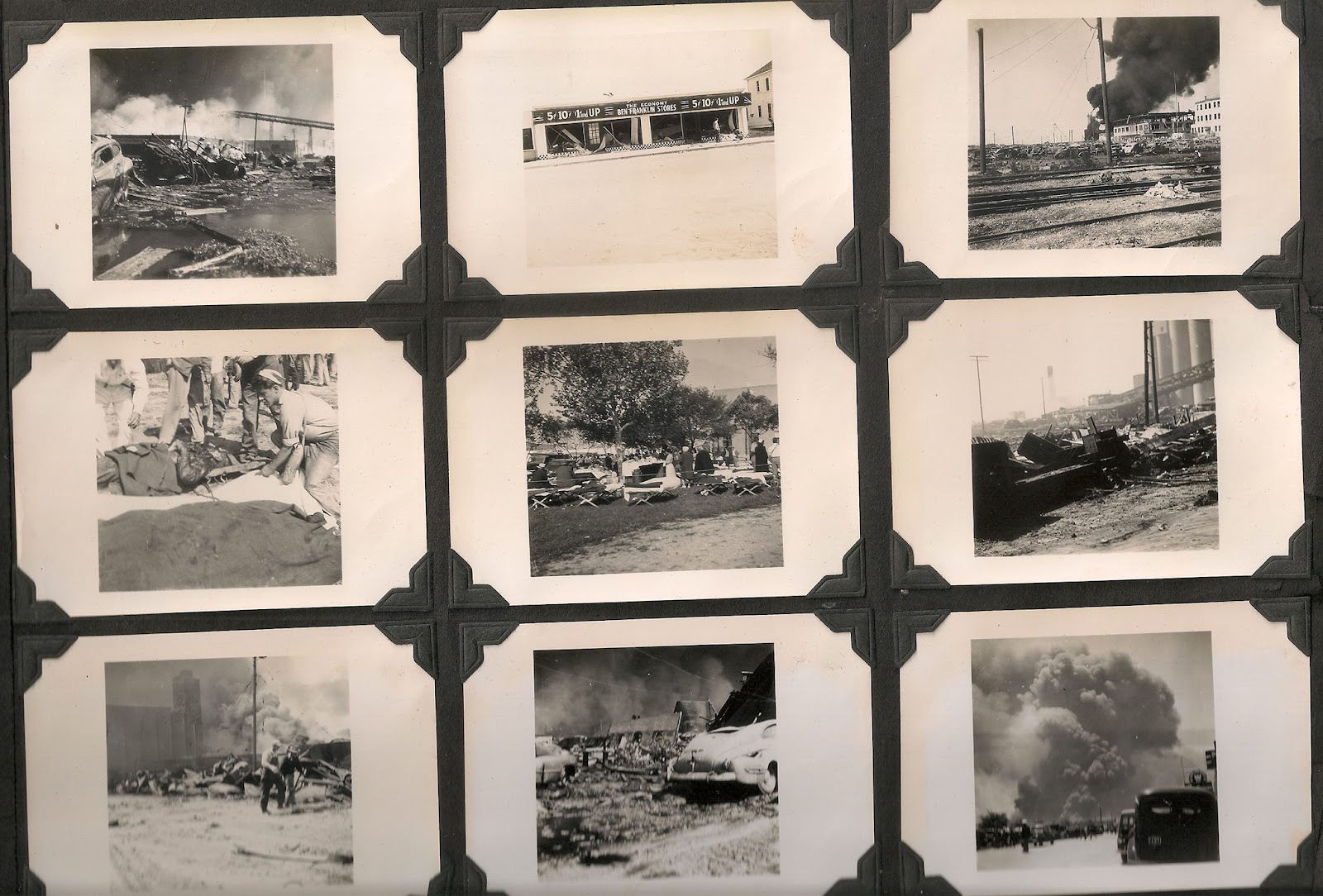
TEXAS CITY DISASTER April 16, 1947

TEXAS CITY DISASTER April 16, 1947

My Grandparents old photos


TEXAS CITY DISASTER April 16, 1947

My Grandparents old photos


TEXAS CITY DISASTER April 16, 1947 VIDEO


Texas City Museum


1947 Texas City Disaster


Terry S. Singeltary Sr.

Thursday, December 2, 2021

GALVESTON BAY FISH CONSUMPATION ADVISORY UPDATE November 2021

GALVESTON BAY FISH CONSUMPATION ADVISORY UPDATE November 2021

''Samples came from the areas outside Moses Lake floodgate and north of the Fred Hartman Bridge.'' 

''Forty fish were retained for this study.''

''I received an update from this study, and all samples were contaminated.'' 

Update on study reveals fish consumption advisories

By CAPT. DAVID DILLMAN

I'm going to jump right into my personal thoughts on the advisories.

My reason for writing about this subject was twofold. First, a column follower asked, and second, I thought it was important to those who keep fish and enjoy eating the resource.

A few years ago, I was approached by a graduate student at Baylor and her professor about taking them fishing. She was preparing a study on fish contamination in Galveston Bay and wanted recent samples of speckled trout, redfish and black drum. Speckled trout being top priority, because it's the most sought after species.

We agreed upon two dates in October, so they could obtain samples from two different areas of the bay. They fished with me on the first day and followed in their boat on the second. Samples came from the areas outside Moses Lake floodgate and north of the Fred Hartman Bridge. Forty fish were retained for this study.

I received an update from this study, and all samples were contaminated. The advice wasn't to consume more than one 8-ounce serving per month.

So what does all this mean, you might be asking. Fish in the Galveston Bay system don't live in one area year-round. They continually move around, some even into different bays. They move according to the time of year, especially those fish that are now in the northern reaches of our bay. Salinity levels play an important role in fish movement throughout the year.

In essence, any fish you catch, keep and eat might contain contaminates. I've been eating fish from the bay for more than 50 years, and I'll continue to do so.

Don't you think it's time that instead of addressing fish limits, priority should shift to the contaminates in Galveston Bay? This is something that should be addressed by the Galveston Bay Foundation, Texas Park & Wildlife Department, Coastal Conservation Association and any group associated with environmental protection.

Now, let's get to a fishing report I received.

Brian Castille fished the lower end of West Galveston Bay over the weekend. He along with his son Owen, and dad Gerry, found some speckled trout. The majority of those fish were undersized, but they did end up with some keepers. They also had a keeper red both days. All the fish were caught on soft plastics.

The weather looks great for fishing for the next few days. Send in those reports if you get out on the water.

Capt. David Dillman is a columnist for The Daily News. Report your catch to reel.report@galvnews.com or call 409-683-5273. 


''Samples came from the areas outside Moses Lake floodgate and north of the Fred Hartman Bridge.'' 

''Forty fish were retained for this study.''

''I received an update from this study, and all samples were contaminated.'' 

GALVESTON BAY ADVISORY MAP


''Samples came from the areas outside Moses Lake floodgate and north of the Fred Hartman Bridge.'' 

''Forty fish were retained for this study.''

''I received an update from this study, and all samples were contaminated.'' 

it's a damn shame we must live with this pollution in Galveston Bay, that it has become acceptable, like shitting in your own plate of food, or in your house, is o.k. now due to industry demands. so sad...

Terry S. Singeltary Sr.

Wednesday, November 24, 2021

Salinity and Water Temperature as Predictors of Bottlenose Dolphin (Tursiops truncatus) Encounter Rates in Upper Galveston Bay, Texas

BRIEF RESEARCH REPORT article

Front. Mar. Sci., 17 November 2021 | https://doi.org/10.3389/fmars.2021.754686

Salinity and Water Temperature as Predictors of Bottlenose Dolphin (Tursiops truncatus) Encounter Rates in Upper Galveston Bay, Texas

Vanessa J. Mintzer1,2,3*† and Kristi L. Fazioli4†

1Galveston Bay Foundation, Kemah, TX, United States

2Fisheries and Aquatic Sciences Program, School of Forest, Fisheries, and Geomatics Sciences, University of Florida, Gainesville, FL, United States 3Wildlife Research Partnerships, Asheville, NC, United States

4Environmental Institute of Houston, University of Houston – Clear Lake, Houston, TX, United States

Bottlenose dolphins (Tursiops truncatus) that inhabit urban estuaries like Galveston Bay, Texas, are exposed to cumulative stressors including pollution, fisheries, shipping, freshwater inflows, and construction operations. With continuing development, it is imperative to understand the key environmental variables that make the Galveston Bay estuary suitable habitat for this protected species. The Galveston Bay Dolphin Research Program conducted monthly photo identification surveys of bottlenose dolphins in a previously understudied 186 km2 area in upper Galveston Bay (UGB). To understand occurrence patterns in this region, we calculated monthly encounter rates of dolphins (dolphins/km) for four consecutive years (2016–2019). Using multiple linear regression models, we investigated the relationship between encounter rates, and water temperature and salinity. Monthly encounter rates ranged from 0.00 to 1.23 dolphins/km with an average of 0.34 dolphins/km (SE = 0.05). Over 80% of the variance was explained by the predictor variables water temperature and salinity (R2 = 0.820). Water temperature had a positive linear effect on encounter rates at over 23.37°C (SE = 1.42). Accordingly, higher encounter rates occurred during months with warm temperatures (May–September) compared to cooler months (November–April), indicating a predictable yearly movement pattern. Moreover, salinity was a highly significant predictor variable, with encounter rates dropping linearly with decreases in salinity. Higher numbers of dolphins are found in UGB during summer, but an exodus of dolphins occurs with low salinity levels, regardless of the time of year and water temperature. These findings should be considered during infrastructure projects (i.e., flood gate system) that may alter dolphin habitat and prey availability.

snip...

Discussion Our findings indicate that bottlenose dolphins can be found in UGB year-round, but most leave during the cooler months. Annually, encounter rates rise during months with the warmest water temperatures (>23°C). Peak encounter rates will typically occur June–September; however, during periods of low salinity, encounter rates will likely decrease regardless of water temperature. Concurrent high temperature and salinity represent optimal environment conditions for dolphin presence in UGB.

As endothermic animals, dolphins depend on blubber and internal metabolic processes to maintain a stable body temperature. During the study period, dolphins experienced water temperature ranging from 10 to 32°C. Coastal bottlenose dolphins generally tolerate this range with changes in integument thickness and whole body conductance (Meagher et al., 2008; Carmichael et al., 2012). However, temperature may be a limiting factor for smaller dolphins (i.e., juveniles, calves and their mothers) (Yeates and Houser, 2008; Carmichael et al., 2012). Exploratory analyses showed that mother/calf pairs can be found in the study area year-round, but the proportion of groups with calves was higher in the warm months (>23°C) compared to the cold months (<23°C). Peak calving season for dolphins in Texas coastal waters is in the spring (Urian et al., 1996; Fernandez and Hohn, 1998), coinciding with a time when fewer dolphins are present in UGB. Furthermore, sightings of early neonates in UGB are rare (GDRP, unpublished data). If mothers with neonates frequent the study area only during warm months due to their offspring’s metabolic constraints, this could, in part, explain the effect of temperature on encounter rates. The drivers of movements and habitat use of mother/calf groups and calving females should be studied.

Prey migration is likely an important underlining mechanism for the annual encounter rate patterns related to temperature fluctuations (Irvine et al., 1981; Scott et al., 1990; Wilson et al., 1997). In and near Sarasota, Florida, for example, dolphins are found inside bays year-round, but many shift their distribution toward the Gulf during cooler months (Scott et al., 1990). Mullet migration has been suggested as a primary factor for this change, as mullet migrate from inshore areas to the Gulf to spawn in the fall and return to the bays in the spring (Scott et al., 1990). A similar pattern occurs in Texas where mullet leave the bays, from October to January, to spawn 40–50 miles offshore (Boyd, 2011). For many Galveston Bay fish species, two migration patterns have been recorded: the migration of spawning adults leaving the Bay and the migration of postlarvae and juveniles entering the Bay (Bechtel and Copeland, 1970). Although the exact timing of these migrations varies by species, most correspond with seasonal temperature changes and many enter the Bay as the temperature increases (Bechtel and Copeland, 1970). Additionally, a commercial shrimp fishery operates within the estuary, with trawler activity increasing in UGB during warm months, following shrimp life cycle and migration patterns [TWPD, 2002; Houston Advanced Research Center (HARC), 2020]. The strong association of foraging dolphins with this fishery (Henningsen and Würsig, 1991; Fertl, 1994; Moreno, 2005; Piwetz, 2019) has the potential to affect dolphin movements. Accordingly, dolphins likely return to UGB with rising water temperatures due to a combination of factors related to food availability.

Our results suggest that the UGB study area does not encompass the entire home ranges of the observed dolphins. Many individuals known to frequent UGB have been sighted south of our study area, in lower Bay, during the cooler months of the year (GDRP, unpublished data). However, it is unknown if most remain in the lower Bay or if they leave the estuary to utilize nearby coastal waters, or travel to other estuaries. Travel between Texas bays has been documented in other studies for some individuals (Blaylock and Hoggard, 1994; Maze and Würsig, 1999; Lynn and Würsig, 2002; Ronje et al., 2020). Previous studies have identified changes in abundance aligning with annual temperature fluctuation in studies in Galveston and other Texas estuaries (Shane, 1980; Henningsen and Würsig, 1991; Fertl, 1994; Wilson et al., 1997; Ronje et al., 2020). As in UGB, dolphin abundance peaks during the summer in other northern Texas coastal locations and decreases with cooler temperatures (Fertl, 1994; Wilson et al., 1997; Ronje et al., 2020), while in central and south Texas the opposite pattern has been documented (Shane, 1980; McHugh, 1989). Telemetry studies will be required to map detailed range patterns, but future winter observational studies focused on lower Galveston Bay could help determine if most UGB dolphins remain in the estuary during the cooler months and could identify calving hotspots.

During the study period, most dolphins left the study area during low salinity events (i.e., when salinity dropped below 8–11 ppt) and returned once salinity level had increased. This trend was evident in June 2016 (“Tax Day Flood”), September 2017 (Hurricane Harvey), and September 2019, when heavy precipitation led to salinity levels below 3.5 ppt and encounter rates dropped well below expected levels for the time of year. 2018 was the only year covered in this study with no major low salinity event, and it had the highest annual encounter rate of 0.44 d/km. On the other hand, 2019, a year with an El Niño event, had an exceptionally wet spring and early summer (TWDB, 2021) likely explaining the relatively lower encounter rates during these months and the annual average of only 0.28 d/km. Although more research is needed to understand the mechanisms behind the apparent exodus of dolphins from the study area at low salinity, it is likely that reduced prey availability is a driver since many estuarine fish species emigrate to higher salinity water during freshwater events (Greenwood et al., 2006; Taylor et al., 2014).

Due to major river inflows and weak tidal influence, most of the Galveston Bay estuary may experience prolonged low salinity throughout the water column with heavy precipitation (Du et al., 2019); however, the HSC acts as a conduit for tidal waters. Water stratification in channels can lead to differences as large as 15 ppt between the surface and bottom (Bechtel and Copeland, 1970). After Hurricane Harvey, the average mid-column salinity in channel habitat was more than 4 ppt higher than in open bay habitat, and habitat-specific encounter rates suggested that dolphins moved toward deeper channels (Fazioli and Mintzer, 2020). However, studies in Pensacola Bay, FL and Barataria Bay, LA found that dolphins exposed to low salinity did not move to areas with higher salinities (McBride-Kebert and Toms, 2021; Takeshita et al., 2021). Future studies should examine fine-scale habitat distribution of dolphins within the Galveston Bay estuary to further evaluate movements in response to flooding.

It is important to reiterate that some dolphins remained in the study area during each freshwater event. Preliminary site fidelity analyses suggest that there is a resident population of dolphins that utilize UGB regularly as a portion of their range (Fazioli et al., 2017). Dolphins that demonstrate high site fidelity within an estuary are known to move within their home range as a response to environmental factors, but are unlikely to abandon it, even in unfavorable conditions (Mazzoil et al., 2008; Wells et al., 2017; McBride-Kebert and Toms, 2021; Takeshita et al., 2021). Dolphins are physiologically adapted to inhabit brackish to oceanic coastal waters with salinities that typically range from 15 to 35 ppt (Ewing et al., 2017; McClain et al., 2020; Booth and Thomas, 2021). Those that remain in an area subject to a low salinity event may suffer from freshwater intoxication due to oral ingestion and/or skin absorption, leading to serious negative health consequences (Ewing et al., 2017; Deming et al., 2020; Duignan et al., 2020; Fazioli and Mintzer, 2020; McClain et al., 2020; McBride-Kebert and Toms, 2021). Effects of freshwater exposure on dolphins can include development of hydropic degeneration and ulcerative or erosive skin lesions (e.g., Wilson et al., 1999; Mullin et al., 2015; Duignan et al., 2020; Fazioli and Mintzer, 2020; McClain et al., 2020; Toms et al., 2020; Townsend, 2020; Takeshita et al., 2021), corneal edema (Deming et al., 2020), and changes in blood chemistry and electrolytes (Ewing et al., 2017; Deming et al., 2020; McClain et al., 2020). Some of these effects were evident when both prevalence and extent of skin lesions increased significantly in the study population after Hurricane Harvey (Fazioli and Mintzer, 2020). Further effects on dolphin health and mortality are likely to occur during freshwater events due to the energetic costs associated with reduced prey availability (Meager and Limpus, 2014; Booth and Thomas, 2021).

Dolphins in UGB are subject to multiple stressors and could be particularly vulnerable to the effects of freshwater (Booth and Thomas, 2021). Epidermal degeneration may heighten exposure to disease and infection, compounded by the increase of pollutants, bacteria and other toxic substances in the water during flood events (Wilson et al., 1999; Kiaghadi and Rifai, 2019; Bacosa et al., 2020; Steichen et al., 2020). Additionally, immunosuppression and adrenal compromise caused by long-term accumulation of toxic pollutants and exposure to petroleum products (Schwacke et al., 2012, 2014) could make dolphins more susceptible to secondary infection and less capable of physiologically adapting to salinity changes in their environment (McClain et al., 2020). More research is needed to understand the population-level effects of freshwater events in Galveston Bay, and to identify which individuals or groups (i.e., age classes and residents) are more susceptible, either physiologically or due to high site fidelity and reluctance to leave the affected area.

In the United States, coastal bottlenose dolphin stocks are protected under the Marine Mammal Protection Act of 1972, and the results of this study have implications for the management of the Galveston Bay stock. Importantly, this study revealed that dolphins use UGB year-round. Continued monitoring is warranted to identify changes in the survival and health of UGB dolphins related to ongoing threats. Seafood advisories, legacy contaminants in sediment, chemical and hydrocarbon spills, and flood events, all make UGB a “high-risk” environment [Houston Advanced Research Center (HARC), 2020; and sources therein]. Heavy precipitation and flood events are expected to increase in intensity due to global climate change (Easterling et al., 2000; Knutson et al., 2010), and as occurred with Hurricane Harvey, these could severely decrease the salinity of Galveston Bay dolphin habitat (Fazioli and Mintzer, 2020). Furthermore, future dredging and infrastructure projects, including the planned widening of the HSC and proposed storm barriers (e.g., USACE and TGLO, 2021), could have considerable short and long-term effects (e.g., noise exposure, increased vessel traffic, and habitat availability). The proposed “Galveston Bay Storm Surge Barrier System” could lead to temporary or permanent changes to salinity and prey assemblages (USACE and TGLO, 2021). The results of our study, emphasizing the year-round presence of dolphins and the importance of salinity, should be considered during the development of these large-scale projects. Mitigation measures will likely be necessary to protect this population, but more information is needed on how dolphins utilize Galveston Bay, the nearshore waters of the Gulf of Mexico, and other Texas bays to identify critical habitats utilized during cooler months and freshwater events.


''These findings should be considered during infrastructure projects (i.e., flood gate system) that may alter dolphin habitat and prey availability.''

''The proposed “Galveston Bay Storm Surge Barrier System” could lead to temporary or permanent changes to salinity and prey assemblages (USACE and TGLO, 2021). The results of our study, emphasizing the year-round presence of dolphins and the importance of salinity, should be considered during the development of these large-scale projects. Mitigation measures will likely be necessary to protect this population, but more information is needed on how dolphins utilize Galveston Bay, the nearshore waters of the Gulf of Mexico, and other Texas bays to identify critical habitats utilized during cooler months and freshwater events.''