Sunday, May 12, 2019

Unified Command responding to collision on Houston Ship Channel near Bayport, Texas Report Updates

Unified Command responding to collision on Houston Ship Channel near Bayport, Texas

U.S. Coast Guard sent this bulletin at 05/10/2019 08:18 PM EDT

News Release U.S. Coast Guard 8th District Public Affairs Detachment Texas

Contact: 8th District Public Affairs Detachment Texas

Office: (281) 464-4810

After Hours: (832) 293-1293

PA Detachment Texas online newsroom 

Unified Command responding to collision on Houston Ship Channel near Bayport, Texas

HOUSTON — A unified command has been established to respond to a collision on the Houston Ship Channel at Light 71-74 between a 755-foot tanker and a tug pushing two barges near Bayport, Texas, Friday.

The unified command consists of the Coast Guard, Texas General Land Office and Kirby Inland Marine.

Sector Houston-Galveston watchstanders received a report that the tanker Genesis River and the tug Voyager collided. The tug was transporting two barges loaded with the gasoline blend stock Reformate. 

An Air Station Houston MH-65 Dolphin Helicopter aircrew and a Station Houston 29-foot Response Boat-Small boat crew were launched to assess the situation.

A Port Houston Fire Department fireboat plus oil spill response, air monitoring and salvage personnel are responding. 

One barge has capsized and one is reported damaged. 

An estimated 25,000 barrels of gasoline blend stock were loaded on each barge. An unknown amount of product has been released from the damaged barge. 

Air monitoring is being conducted along the shoreline from Sylvan Beach to Kemah. The first priority of the unified command is public safety. If any readings above actionable levels are detected, advisories will be provided to local emergency operations centers. 

The Houston Ship Channel is closed from Light 61-75. 

There are no reported injuries at the time. 

-USCG-


Incident Update: Water Sampling and Assessment Crews along waterfront areas

The Bayport Channel Collision Response Unified Command has contracted crews working in the local area conducting water sampling, shoreline assessments and, if needed, cleanup of any affected shoreline.

Waterfront property owners may see or be contacted by crews working along the Galveston Bay shoreline. These crews may request access to your property to do their work.

To verify their identity or if you have other questions, you may call the Unified Command at 281-757-3017. For additional information visit: www.bayport-response.com

This entry was posted in Incident Updates on May 12, 2019.

Media Advisory

Bayport Channel Collision Response Unified Command to hold press briefing at San Jacinto College Maritime Campus

The Unified Command of the Bayport Channel Collision Response is scheduled to hold a press briefing to provide an update on the status of response operations, Saturday.

Who: The Unified Command of the Bayport Channel Collision Response will provide a briefing on the status of response operations.

What: The Unified Command is inviting media to attend the press briefing.

Where: San Jacinto College Maritime Campus, 3700 Old Hwy 146, La Porte, TX 77571

When: Sunday, May 12, 2019 at 3 p.m.

Media interested in attending are requested to arrive no later than 2:30 p.m.

Information concerning response operations can be found at www.bayport-response.com

The joint information center can be contacted at 281-755-4670.

This entry was posted in Media Advisory on May 11, 2019.

Incident Update-Unified Command Issues Health Guidance

Officials with the Unified Command responding to Friday’s spill of a gasoline blend stock product into the Houston Ship Channel have urged area residents and others near the water to avoid direct contact with the product due to potential skin and eye irritations or other more serious risks if subject to long term exposure.

The product was released following Friday afternoon’s collision between a tanker and a tug and barges transporting the product in the Houston Ship Channel near mile Lights 71-74. The incident resulted in the release of approximately 9,000 barrels of Reformate into the water.

Since then, response teams under the direction of unified federal, state and local agencies in coordination with the vessel operator, have been working to contain the spill and implement a plan to safely remove the impacted barges from the ship channel.

The Unified Command urges that the public:

Avoid all visible sheens on the water

Thoroughly wash any impacted skin with soap and water

Stay clear of containment boom on the water

Consult a healthcare professional should specific and serious health concerns arise

Concerns regarding odors that may have resulted from the incident should be addressed to 281-757-3017. For information regarding on-going air monitoring efforts, residents and others in the area may visit www.bayport-response.com

Additionally, people should refrain from interfering with professional teams tasked with conducting air and water quality monitoring in the area, and those teams working to address any shoreline impact that may have occurred.

This entry was posted in Incident Updates on May 11, 2019.

Incident Update-Captain of the Port partially opens Houston Ship Channel The Captain of the Port in conjunction with the Unified Command partially opened the Houston Ship Channel near Bayport, Texas, Saturday after a collision between a 755-foot tanker and a tug pushing two barges at Lights 71-74.

The Houston Ship Channel has been opened to one-way tow traffic between Light 66-76. The ship channel remains closed for all other traffic from Light 61-75. The safety zone closing Clear Creek Channel from the entrance to Clear Lake and extending east to Light 66 on the Houston Ship Channel and north up to but not including the Bayport Ship Channel is still in effect.

As of 3 p.m., there is a queue of 33 vessels inbound and 27 vessels outbound with 91 vessels at anchorage. The Unified Command is working closely with the Port Coordination Team to prioritize vessel traffic movements on the Houston Ship Channel.

This entry was posted in Incident Updates on May 11, 2019.

Incident Update-Impacted Wildlife Concerns

The Unified Command continues to respond to a collision that occurred Friday on the Houston Ship Channel at Lights 71-74 between a 755-foot tanker and a tug pushing two barges near Bayport, Texas. The Unified Command’s wildlife rehabilitation team has this message for members of the public who encounter impacted wildlife:

If you encounter wildlife that has been impacted by the recent gasoline blend stock spill, there are things that you can do to protect both yourself and the animals that you observe.

Do not attempt to chase and/or catch the animals; impacted animals are already stressed, and this would only add to the stress they are already under. These animals can harm you and/or themselves while struggling to escape. For this reason, only trained, authorized wildlife professionals should attempt capture.

We are asking that you call the wildlife hotline number that has been established for this incident. The number is 979-215-8835.

Please be prepared to provide the following information:

(1) Number and species (if known) of animals impacted

(2) Date and time that the animals were seen

A 24/7 claims hotline is available at: 1-800-241-9010.

For all media inquiries, the joint information center can be reached at: 281-755-4670.

Incident Website: www.bayport-response.com

This entry was posted in Incident Updates on May 11, 2019.

Initial Statement

A unified command has been established to respond to a collision on the Houston Ship Channel at Light 71-74 between a 755-foot tanker and a tug pushing two barges near Bayport, Texas, Friday.

The unified command consists of the Coast Guard, Texas General Land Office and Kirby Inland Marine.

Sector Houston-Galveston watchstanders received a report that the tanker Genesis River and the tug Voyager collided. The tug was transporting two barges loaded with the gasoline blend stock Reformate. 

An Air Station Houston MH-65 Dolphin Helicopter aircrew and a Station Houston 29-foot Response Boat-Small boat crew were launched to assess the situation.

A Port Houston Fire Department fireboat plus oil spill response, air monitoring and salvage personnel are responding. 

One barge has capsized and one is reported damaged. 

An estimated 25,000 barrels of gasoline blend stock were loaded on each barge. An unknown amount of product has been released from the damaged barge. 

Air monitoring is being conducted along the shoreline from Sylvan Beach to Kemah. The first priority of the unified command is public safety. If any readings above actionable levels are detected, advisories will be provided to local emergency operations centers. 

The Houston Ship Channel is closed from Light 61-75. 

There are no reported injuries at the time. 

This entry was posted in New Releases on May 10, 2019.

News Release # 2

The Unified Command continues to respond to a collision on the Houston Ship Channel at Lights 71-74 between a 755-foot tanker and a tug pushing two barges near Bayport, Texas, Friday.

One barge has capsized and one is significantly damaged. An estimated 25,000 barrels of gasoline blend stock were loaded on each barge. An unknown amount of product has been released from the damaged barge.

The Center for Toxicology and Environmental Health is conducting around the clock air monitoring in the communities west of the bay. Air monitoring results will be published on the response website at www.bayport-response.com. At this time, no readings have been recorded above actionable levels, however, any readings above actionable levels will be immediately reported to the appropriate emergency operations center.

A 24/7 air monitoring hotline has been established for the public to report strong gasoline odors at: 281-757-3017. Members of the community who feel they may require medical attention should still call 911.

1600-feet of boom has been deployed around the barges. Additional boom is being deployed and staged to protect sensitive areas along the bay.

The Houston Ship Channel is closed from Light 61-75. A safety zone has closed Clear Creek Channel from the entrance to Clear Lake and extending east to Light 66 on the Houston Ship Channel and north up to but not including the Bayport Ship Channel.

Salvage teams are on scene assessing the damaged barges and additional salvage assets are in route.

A 24/7 claims hotline is available at: 1-800-241-9010.

There are no reported injuries at this time.

For all media inquiries, the joint information center can be reached at: 281-755-4670.

This entry was posted in New Releases on May 10, 2019


News Release # 3

The Unified Command, consisting of the Coast Guard, Texas General Land Office, Kirby Inland Marine and Port of Houston Fire Department, continues to respond to a collision on the Houston Ship Channel at Lights 71-74 between a 755-foot tanker and a tug pushing two barges near Bayport, Texas, Saturday.

One barge has capsized and one is significantly damaged. An estimated 25,000 barrels of gasoline blend stock were loaded on each barge. Current estimates predict a release of 9,000 barrels of the blend stock Reformate into the Houston Ship Channel.

There are no injuries reported at this time.

The Center for Toxicology and Environmental Health, Environmental Protection Agency and a Port of Houston Fire Boat are conducting around the clock air monitoring in the communities west of the bay and in locations reported through the Air Monitoring hotline.

Air monitoring performed under the Unified Command-approved plans indicate that petroleum-related compounds are not present at levels that would cause a health concern. Air monitoring results and details on the actionable levels being used by the Unified Command to evaluate real-time air monitoring data are provided in the Community Air Sampling and Analysis Plan, available at www.bayport-response.com.

A 24/7 hotline has been established for the public to report strong gasoline odors and waterway contamination: 281-757-3017. Members of the community who feel they may require medical attention should still call 911.

More than 3,800-feet of absorbent and containment boom has been deployed as of 8:30 a.m. with an additional 12,150-feet of containment boom scheduled to be deployed throughout the day with a focus on environmentally sensitive areas. Boom deployment is subject to delay due to weather, especially lightning in the area.

The Unified Command is monitoring the weather to ensure the safety of response personnel and revise the response action plan as necessary.

There have been no reported impacts on wildlife at this time. Animal wildlife rehabilitation crews are standing by to respond if a report should occur.

The Houston Ship Channel is closed from Light 61-75. Additionally, a safety zone has closed Clear Creek Channel from the entrance to Clear Lake and extending east to Light 66 on the Houston Ship Channel and north up to but not including the Bayport Ship Channel.

As of 9 a.m., there is a queue of 30 vessels inbound and 17 vessels outbound with 85 vessels at anchorage. The Unified Command is working closely with the Port Coordination Team to minimize the impact on the Houston Ship Channel.

Salvage teams are on scene assessing the damaged barges and additional salvage assets are in route.

A 24/7 claims hotline is available at: 1-800-241-9010.

For all media inquiries, the joint information center can be reached at: 281-755-4670.

This entry was posted in New Releases on May 11, 2019.


The expanded safety zone includes the area from the western shores of Lower Galveston Bay, starting at the south side of the Bayport Channel, then extending south to Eagle Point in San Leon, then east up to but not including the Houston Ship Channel, then extending north up to but not including the Bayport Ship Channel, then west to the shoreline.

Additionally, mariners are prohibited from exiting Clear Creek into the bay. 

News Release # 4

Unified Command Continues Aggressive Response to Bayport Channel Vessel Incident

 Members of the Unified Command established in response to Friday’s tanker / tug collision near Bayport, Texas continue to deploy material and personnel resources to limit environmental impacts and fully reopen the Houston Ship Channel to maritime commerce.

The incident occurred late Friday afternoon when the tug Voyager was stuck by the 755-foot tanker Genesis River near Lights 71-74 in the Houston Ship Channel. While there were no crew injuries associated with the incident, approximately 9000 barrels of gasoline blend stock was released into the channel from one of two barges being pushed by the tug. The second barge was overturned and remains near the channel. The cause of the incident remains under investigation.

Current response priorities established by the Unified Command of federal, state and local officials and representatives of Kirby Inland Marine are the health and safety of persons living or working in the area, including those responding to the incident, protection of water quality and marine life in Galveston Bay, shoreline protection and clean up, and the safe and timely removal of the two damaged barges.

Since the incident occurred, response officials have continually conducted air monitoring throughout the area, posting results of that monitoring on the response organization’s website, www.bayport-response.com. As of noon today, 2700 samples have been taken and analyzed. Concerns regarding odors that may have resulted from the incident should be addressed to 281-757-3017. For further health concerns or questions, the regional poison control center can be reached at 1-800-222-1222

Water quality testing teams are also contacting home and property owners along the bay to conduct sampling and assess the need for shoreline remediation. Shoreline residents wishing to verify the identity of spill response personnel seeking access to property may call 281-757-3017.

As of 12 pm today, the Unified Command reports a significant commitment of assets throughout the impacted area including:

334 federal, state and local response personnel engaged in both planning and implementing the response and clean-up operations

8 skimmers are in operation

The deployment of 20,550 feet of product containment and absorbent boom to limit the spread of spilled product

Salvage assets on site include multiple spud barges to secure the damaged barges in place, a crane barge, a lightering barge and lightering pumps.

Shoreline Cleanup Assessment Teams deployed to areas where product may have reached shore.

Salvage teams have secured the barges in their current locations near the channel and are beginning to remove cargo from those barges. Work is expected to continue throughout the day with an established priority of ensuring the protection of the Bay from the additional release of product from the barge. Once cargo is removed from the barges, they will be relocated from the incident area.

Although a partial closure of the ship channel remains in effect, one way ship and two way barge traffic has been restored. The United States Coast Guard reports that there are 47 outbound vessels and 48 inbound vessels waiting to make safe passage through the channel as of 2 p.m. Sunday.

The previously established navigation safety zone was expanded at 11 a.m. Sunday to include the area from the western shores of Lower Galveston Bay, extending south to Eagle Point in San Leon, east up to but not including the Houston Ship Channel, then extending north up to but not including the Bayport Ship Channel. All boaters are prohibited from exiting Clear Creek into the bay or operating in the area covered by the safety zone.

A telephone hotline has been established for persons wishing to report impacted fish or wildlife: 979/215-8835.

Persons wishing to pursue a claim in the response to the incident may call 800/241-9010.

This entry was posted in New Releases on May 12, 2019.

Incident Update: Unified Command Provides New Resources, Updated Guidance for Questions Regarding Health Concerns

Federal, state and local agencies responding to Friday’s vessel incident in Bayport, Texas have updated resources available to the public for persons who may be concerned regarding potential health impacts from the incident.

Information from the U.S. Center for Disease Control regarding the potential health impacts of the product spilled in Friday’s collision between the tug Voyager and the 755-foot tanker Genesis River may be accessed at:

https://www.atsdr.cdc.gov/substances/toxsubstance.asp?toxid=83

The Texas Poison Control Center may be reached at 800-222-1222 and can also respond to citizen questions about exposure to chemicals.

Teams continue to aggressively assess air quality throughout communities near the incident site. As of 12 p.m. Sunday, assessment teams have taken over 2700 readings with no findings above actionable levels. Air monitoring reports remain available at www.bayport-response.com. Reports of gasoline-like odors may be made to 281-757-3017.

Residents and others near the water are urged to avoid contact with water that may have been impacted by the gasoline blend stock product released from one of two barges struck by the tanker. That guidance includes:

Avoiding all visible sheens on the water

Thoroughly washing any impacted skin with soap and water

Staying clear of containment boom on the water and against the shoreline This entry was posted in Incident Updates on May 12, 2019.

Incident Update-Unified Command Expands Marine Safety Zone

Unified Command has expanded the previously established navigation safety zone around Friday’s vessel incident and product spill near Bayport, Texas Sunday morning,

The expanded safety zone includes the area from the western shores of Lower Galveston Bay, starting at the south side of the Bayport Channel, then extending south to Eagle Point in San Leon, then east up to but not including the Houston Ship Channel, then extending north up to but not including the Bayport Ship Channel, then west to the shoreline.

Additionally, mariners are prohibited from exiting Clear Creek into the bay.

These temporary restrictions are in place to protect mariners and response crews operating in the area, and to prevent the inadvertent spread of product into other parts of the bay.

This entry was posted in Incident Updates on May 12, 2019.

Incident Update: Water Sampling and Assessment Crews along waterfront areas

The Bayport Channel Collision Response Unified Command has contracted crews working in the local area conducting water sampling, shoreline assessments and, if needed, cleanup of any affected shoreline.

Waterfront property owners may see or be contacted by crews working along the Galveston Bay shoreline. These crews may request access to your property to do their work.

To verify their identity or if you have other questions, you may call the Unified Command at 281-757-3017. For additional information visit: www.bayport-response.com

This entry was posted in Incident Updates on May 12, 2019.

Media Advisory

Bayport Channel Collision Response Unified Command to hold press briefing at San Jacinto College Maritime Campus

The Unified Command of the Bayport Channel Collision Response is scheduled to hold a press briefing to provide an update on the status of response operations, Saturday.

Who: The Unified Command of the Bayport Channel Collision Response will provide a briefing on the status of response operations.

What: The Unified Command is inviting media to attend the press briefing.

Where: San Jacinto College Maritime Campus, 3700 Old Hwy 146, La Porte, TX 77571

When: Sunday, May 12, 2019 at 3 p.m.

Media interested in attending are requested to arrive no later than 2:30 p.m.

Information concerning response operations can be found at www.bayport-response.com

The joint information center can be contacted at 281-755-4670.

This entry was posted in Media Advisory on May 11, 2019.

Incident Update-Unified Command Issues Health Guidance

Officials with the Unified Command responding to Friday’s spill of a gasoline blend stock product into the Houston Ship Channel have urged area residents and others near the water to avoid direct contact with the product due to potential skin and eye irritations or other more serious risks if subject to long term exposure.

The product was released following Friday afternoon’s collision between a tanker and a tug and barges transporting the product in the Houston Ship Channel near mile Lights 71-74. The incident resulted in the release of approximately 9,000 barrels of Reformate into the water.

Since then, response teams under the direction of unified federal, state and local agencies in coordination with the vessel operator, have been working to contain the spill and implement a plan to safely remove the impacted barges from the ship channel.

The Unified Command urges that the public:

Avoid all visible sheens on the water

Thoroughly wash any impacted skin with soap and water

Stay clear of containment boom on the water

Consult a healthcare professional should specific and serious health concerns arise

Concerns regarding odors that may have resulted from the incident should be addressed to 281-757-3017. For information regarding on-going air monitoring efforts, residents and others in the area may visit www.bayport-response.com

Additionally, people should refrain from interfering with professional teams tasked with conducting air and water quality monitoring in the area, and those teams working to address any shoreline impact that may have occurred.

This entry was posted in Incident Updates on May 11, 2019.

https://bayport-response.com/


MSIB 39-19 Closure of Clear Creek Channel 5/10/19

Summary: As of May 10, 2019 at 6:00 P.M., the U.S. Coast Guard Sector Houston-Galveston Captain of the Port has established an emergency temporary safety zone and closure of the Clear Creek Channel from the entrance to Clear Lake extending east to Light 66 on the Houston Ship Channel and north up to but not including the Bayport Ship Channel. This emergency safety zone is required to protect persons, property, and infrastructure from potential damage and safety hazards associated with pollution and salvage operations of a collision between a deep draft vessel and a towing vessel with two barges. Please be advised that this closure coincides with an additional closure of the Houston Ship Channel between Light 61 and 75, as established by VTS Houston/Galveston.

​Coast Guard Sector Houston-Galveston

Marine Safety Information Bulletin 39-19

Closure of Clear Creek Channel 5/10/19

As of May 10, 2019 at 6:00 P.M., the U.S. Coast Guard Sector Houston-Galveston Captain of the Port has established an emergency temporary safety zone and closure of the Clear Creek Channel from the entrance to Clear Lake extending east to Light 66 on the Houston Ship Channel and north up to but not including the Bayport Ship Channel. This emergency safety zone is required to protect persons, property, and infrastructure from potential damage and safety hazards associated with pollution and salvage operations of a collision between a deep draft vessel and a towing vessel with two barges. Please be advised that this closure coincides with an additional closure of the Houston Ship Channel between Light 61 and 75, as established by VTS Houston/Galveston.

The U.S. Coast Guard Captain of the Port is working in close coordination with local and state authorities to continuously evaluate the Houston Ship Channel and affected waterways to reassess the status of the closures and will continue to update mariners. Local residents should continue to follow any direction provided by the County officials.

This bulletin shall remain active until rescinded or superseded by future direction.

K. D. Oditt

Captain, United States Coast Guard

Captain of the Port


Bayport Channel Collision – May 11, 2019 Due to Friday’s shipping collision and chemical release in northwestern Galveston Bay, DSHS is advising people not to fish or eat any seafood from the portions of Galveston and Trinity bays north of a line from the end of the Texas City Dike to Smith Point.

While the spill is not affecting the entire area at this time, changing tidal and weather conditions mean different parts of that area could be affected in the future. DSHS reminds everyone to avoid any fish or shellfish that has an oily or chemical look or smell.

The agency is taking the additional step of temporarily closing private oyster harvesting areas in Galveston Bay. Because oyster season is closed, harvesting is not open to the public at this time.

The chemical involved, a gasoline additive called reformate, evaporates quickly and is not expected to accumulate in fish tissue once it’s gone from the water, so any impact on seafood should be resolved in the coming days or weeks.

Exposure to the chemical vapor does not pose a long-term health concern, but it can cause short-term effects like headache, nausea, and eye irritation in people who come into contact with it. Anyone experiencing health effects should contact their health care provider. People with questions may contact the Texas Poison Center Network at 1-800-222-1222.

DSHS will continue to monitor the situation and update guidance as the situation changes.


People can be exposed to petroleum naphtha in the workplace by breathing it, swallowing it, skin contact, and eye contact. The Occupational Safety and Health Administration (OSHA) set the legal limit (permissible exposure limit) for petroleum naphtha exposure in the workplace as 500 ppm (2000 mg/m3) over an 8-hour workday. The National Institute for Occupational Safety and Health(NIOSH) has set a recommended exposure limit (REL) of 350 mg/m3 over an 8-hour workday and 1800 mg/m3 over 15 minutes. At levels of 1100 ppm, 10% of the lower explosive limit, petroleum naphtha is immediately dangerous to life and health.[15]


 The following acute (short-term) health effects may occur immediately or shortly after exposure to Naphtha: * Contact can irritate and burn the skin and eyes. * Breathing Naphtha can irritate the nose and throat. * Exposure to Naphtha can cause headache, dizziness, nausea and vomiting.

https://nj.gov/health/eoh/rtkweb/documents/fs/0518.pdf

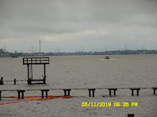
the smell has been bad, it has gotten in our house at times. there is a boom wrapped around the drainage out of the Del Mar Pier ass, i presume to keep the flammable hazardous product from coming up into Bacliff, Texas 77518 Galveston Bay via the drainage at Del Mar, because the Bay water, when tide is high, get's up into that pipe and under Bayshore Dr. seems the smell diminished a bit after this morning, but now i went back out, and it's terrible again. with the flow of flood water out of Clear Creek, this stuff has to come down the shore line, no stopping that. who is taking water samples along Bacliff, Texas 77518 Galveston Bay ? 

this is just horrible, how does this keep happening in the ship channel?


Terry S. Singeltary Sr.

Thursday, March 28, 2019

Galveston Bay Update ITC Tank Fire incident, Fish and Shellfish Consumption Advisory ADV-55 Updated March 27, 2019

Fish and Shellfish Consumption Advisory ADV-55 Updated March 27, 2019

TEXAS DEPARTMENT OF STATE HEALTH SERVICES 

FISH AND SHELLFISH CONSUMPTION ADVISORY ADV-55


This advisory is issued as a result of sampling of the Houston Ship Channel located in Harris County and revises ADV-49 issued June 26, 2013 for the Houston Ship Channel and the San Jacinto River below the Lake Houston Dam. Pesticide concentrations in fish from the Houston Ship Channel have decreased to acceptable levels. Blue crab and fish samples collected from the Houston Ship Channel continue to indicate the presence of polychlorinated biphenyls (PCBs) and polychlorinated dibenzo-p-dioxins and dibenzofurans (PCDDs/PCDFs; dioxins) at concentrations exceeding health assessment guidelines established by the Texas Department of State Health Services (DSHS). 

Consumption of blue crab and fish from the Houston Ship Channel and the San Jacinto River below the Lake Houston Dam may pose a threat to human health. 

COUNTY: Harris 

AREA: The Houston Ship Channel and all contiguous waters north of the Fred Hartman Bridge, State Highway 146 including the San Jacinto River below the Lake Houston Dam 

CONSUMPTION ADVISORY: 

Contaminants of Concern Dioxins, PCBs and Volatile Organic Compounds

Species Affected All species of fish and blue crab

Women of Childbearing Age and Children < 12 DO NOT EAT

Women Past Childbearing Age and Adult Men DO NOT EAT

1 A meal is eight ounces of fish.

page 2

Fish and Shellfish Consumption Advisory 55 Modified March 27, 2019

This advisory shall remain in effect until rescinded or modified in writing.

Modification to Fish and Shellfish Advisory 55

Due to the possible presence of volatile organic compounds resulting from releases related to the ITC Tank Fire incident, ADV 55 is modified as indicated on the table above.

This modification will remain in effect until rescinded or modified in writing.

Modified this 27th day of March, 2019

John Hellerstedt, M.D.
Commissioner


March 22, 2019 | Environment AG Pax­ton Files Law­suit Against Inter­con­ti­nen­tal Ter­mi­nals Com­pa­ny for Vio­la­tions of the Texas Clean Air Act 

Acting on behalf of the Texas Commission on Environmental Quality (TCEQ), Attorney General Ken Paxton today filed an environmental lawsuit against Intercontinental Terminals Company (ITC) seeking injunctive relief and civil penalties in connection with a fire at ITC’s Deer Park petrochemical storage site. The lawsuit alleges that the fire, which began last Sunday and continued burning until Wednesday, released air pollution in violation of the Texas Clean Air Act.

The fire caused the release of several air contaminants, including benzene. Most of the chemicals identified in the fire are used in the production of gasoline, and short-term exposure to their fumes can cause fatigue, dizziness, and headaches. Twice this week, residents of Deer Park and neighboring Galena Park were told to stay indoors because of concerns about unhealthy air quality. Those concerns also prompted Deer Park ISD and several other districts to cancel classes for several days.

“The state of Texas works hard to maintain good air quality and will hold ITC accountable for the damage it has done to our environment,” Attorney General Paxton said. “ITC has a history of environmental violations, and this latest incident is especially disturbing and frightening. No company can be allowed to disrupt lives and put public health and safety at risk.”

TCEQ continues to monitor the air quality in the affected areas about 20 miles east of Houston.

“I would like to thank the Attorney General for acting so quickly on TCEQ’s request to enforce against ICT, LLC,” stated TCEQ Executive Director Toby Baker. “Due to the dynamic, ongoing investigation of this incident, only air quality violations have been cited in the state of Texas lawsuit against ICT, LLC. Any additional violations, including surface water quality, will be referred to the Office of Attorney General for civil enforcement as part of this action.”

The federal Chemical Safety Board, which investigates serious chemical accidents, announced yesterday that it is opening an investigation into the ITC fire.

View a copy of the lawsuit here;


DISASTERS & ACCIDENTS

Harris County Attorney Vince Ryan sues ITC over Deer Park tank fire

Wednesday, March 27th, 2019 4:27PM

DEER PARK, Texas (KTRK) -- Harris County Attorney Vince Ryan has sued Intercontinental Terminals Company (ITC) over the tank fire that began March 17 at their facility in Deer Park. 

The Texas attorney general has already filed a lawsuit ITC. 

Harris County Commissioners approved the lawsuit which seeks a temporary restraining order and temporary and permanent injunctions in an environmental enforcement action. 

The County Attorney charges that ITC is responsible for burning and air emissions in violation of the state's Clean Air Act, discharging industrial waste into nearby waters in violation of state law and county regulations, and violation of county floodplain regulations by not having development permits for structures at its facility. 

"This company put the health of Harris County residents in danger in many ways for several days," said County Attorney Ryan. "We will hold them responsible for their actions." 

Harris County's Pollution Control, Emergency Management and Fire Marshall personnel responded to two tanks burning at ITC on March 17. Over the next few days, more tanks caught fire, releasing air contaminants. 

Firefighting foam sprayed on the burning tanks by ITC and industrial wastewater were discharged into the surrounding water. A containment dike breached on March 22, allowing the discharge into Tucker Bayou, before the tank reignited. 

In addition, benzene leaks from fire-damaged tanks and firefighting foam caused two local shelter-in-place advisories. 

On Wednesday, officials gave updates on the clean-up efforts, with the U.S. Coast Guard saying that the Houston Ship Channel is back open from Tucker Bayou to light 116 for vessel traffic inbound and outbound. 

The decision comes after 106 vessels were moved in and out of the area and only one required minor cleaning with hot water. It will be open during daylight hours only. 

The entire area had been closed since Friday due to oily product in the water. 

So far, more than 33,000 barrels of product have been recovered from the tank farm. 

ITC incident commander Brent Weber said that in another milestone, tank 80-10, the last of the pygas-containing tanks, has been secured. Pygas has benzene in it. 

ITC continues to pump tank 80-13. Officials say they've also seen an improvement in air quality in the affected area and surrounding communities. 

The company has made progress in remediating the ditches along Tidal Road, Independence Parkway and the property around the facility. 

If you have concerns about your health and you don't have a care provider, Harris Health System's Ask My Nurse hotline will remain open through 8:30 p.m. Tuesday. The number is 713-634-1110. 

SEE ALSO: Fireball erupts as Deer Park tank fire burns


ITC says that so far it has received 2,000 calls to its claims hotline. Hundreds of claims have been submitted. 

How to file a claim against ITC for illness or damage from smoke


As a precaution, Harris County Commissioner Precinct 2 has closed the following parks with waterfronts as cleanup continues: 

Bay Area Park in Houston 
Clear Lake Park in Seabrook 

Sylvan Beach in La Porte 
Juan Seguin in La Porte 
Rio Villa Nature Trail 
Meadow Brook 
River Terrace 
Moncrief Park 
The Lynchburg Ferry remains closed to the public. 

BAYTOWN: The Baytown Nature Center will also remain closed until further notice. 

LA PORTE: Seabreeze Park and Klein Retreat in La Porte will remain closed until further notice.


NOW, i have a question, what is to keep all this cancer causing products from reaching Galveston bay and beyond, past the Fred Hartman bridge?

WHAT wall/boom/gate is in place to stop that?

WHAT IF the Ike/Rice Dike was in place, not a hurricane event, just a man made catastrophic event such as this one right here from ITC in Deer Park, but what if there was a gate at the Fred Hartman bridge, would it be utilized to keep those cancer causing pollutants in place in the ship channel North of the Fred Hartman Bridge until a total cleanup is complete, to keep those cancer causing pollutants from reaching our precious Galveston Bay and Gulf of Mexico?

Once again Houston, Harris County, is flushing their pollutants on down the ship channel, into Galveston Bay, and beyond, to the Gulf of Mexico, and we are just a by product of friendly fire.

a very said state of affairs for Galveston bay and beyond, just another nail in the coffin...bon appetit!

Terry S. Singeltary Sr., Bacliff, Texas, 77518 USA, Galveston Bay, on the bottom...

Thursday, December 27, 2018

Coastal Barrier (previously known as the Ike Dike) Galveston Bay Update Army Corp. Engineers Statement Singeltary Comment Submission

Greetings Family, Friends, Neighbors, 

i oppose this Coastal Barrier (previously known as the Ike Dike) in totality. 

seems everything they said they would not do since inception of the IKE dike, when the RICE dike was brought forth, they are going to do, or they are not sure, or the might, or maybe not, yet, let's all vote and appropriate funds on it beforehand. i don't think so.

WHILE attending meetings on this, everything i saw and heard said they would NOT BUILD THE WALL i.e. RAISE STATE HIGHWAY 146, to protect the new home estates being built along the west side of the tracks on SH 146 in League City, by flooding everybody east of SH 146 our and making recreational park areas with our property's. NOW this is back on the table, along with hardened areas at clear lake and Dickinson Bayou Hillmans, then all the islands inside the bay, along now with huge gates, nobody yet has a clue to what will happen with Galveston Bay with such structures. well i know one thing, if SH 146 is raised, you may as well write your social security numbers on your arm now, and get ready for your property values to plummet. just say NO, until better solutions are brought forth. remember one thing, and we learned this from the Army Corp Eng. permit for HL&P spillway plant, formally known as PH Robinson, remember that permit back in 63 i believe (i have a link below to it), where they were to keep Dickinson Bayou Dredged, to the mouth of the ship channel, was NEVER done, so you can have a permit in one hand, but enforcing said permit years down the line is something else...just saying///

-----Original Message-----
From: CESWG-Coastal Texas
To: Terry Singeltary ; CESWG-Coastal Texas
Cc: sjones@galvbay.org ; Stokes, Bob
Sent: Thu, Dec 27, 2018 12:54 pm
Subject: RE: [Non-DoD Source] Coastal Barrier (previously known as the Ike Dike) Galveston Bay Update Army Corp. Engineers Statement Comment Submission

Thank you for your comments on the Coastal Texas and Protection Restoration Feasibility Study's Draft Integrated Feasibility Report and Environmental Impact Statement (DIFR-EIS), and the study's Tentatively Selected Plan (TSP).  Your comments have been received and will be included in the Administrative Record for the study.  

Please look for study updates on the Coastal Texas website at:  http://coastalstudy.texas.gov/. The U.S. Army Corps of Engineers and the Texas General Land Office will continue to add to the website as the feasibility study progresses.  Thank you again for taking the time to provide comments on the study.


Jennifer Morgan
Environmental Compliance Branch
Coastal Section
USACE, Regional Planning and Environmental Center
Office: 409-766-3131
Mobile:  409-651-2245

Teleconference: 877-402-9757
Access Code  7491860
Security Code  1234

WebEx Meeting:
Usace.webex.com/meet/Jennifer.b.morgan


-----Original Message-----
From: Terry Singeltary [mailto:flounder9@verizon.net
Sent: Tuesday, October 30, 2018 2:51 PM
To: CESWG-Coastal Texas <CoastalTexas@usace.army.mil>
Subject: [Non-DoD Source] Coastal Barrier (previously known as the Ike Dike) Galveston Bay Update Army Corp. Engineers Statement Comment Submission

ATTENTION USACE, Galveston District, Attn: Mrs. Jennifer Morgan, Environmental Compliance Branch, Regional Planning and Environmental

Coastal Barrier (previously known as the Ike Dike) Galveston Bay Update Army Corp. Engineers Statement

Terry S. Singeltary Sr. Comment Submission to ;

Coastal Barrier (previously known as the Ike Dike) Galveston Bay Update Army Corp. Engineers Statement

I was wrong, after having reassessed the Army Corp of Engineers statement that came out with this new assessment on the Ike Dike (now called coastal barrier), i now support Mr. Stokes and Galveston Bay Foundation   in regards to their call on this issue. 

i was very much against their decision at first. i think i was more worried about protecting our assets, our home. 

i see the bigger picture now, Galveston Bay and all it's inhabitants. 

now, after reassessing the Army Corp. statement, and risk factors to the bay there from, i think they should leave well enough alone, i do NOT want to take the risk that are addressed in this new assessment with our precious Galveston Bay, imo.

i now support Mr. Stokes and Galveston Bay Foundation   in regards to their call on this issue. 


Terry S. Singeltary Sr.
Bacliff, Texas USA 77518
on the bottom...


Physical Barrier. The operational presence of the surge barrier gates have the potential to act as a hindrance to dolphin movements. Operational closing of the gates for emergency hurricane preparations would entirely close off the pass. These closures have a potential for injury, noise disturbance, separation of social groups, effects on prey items, and disruption of foraging.

Prey Source. Dredging, changes in tidal prism, water quality, and the effects of physical barriers can all impact recruitment through passes by fish and shellfish, which are important prey sources for Texas bottlenose dolphin bay, sound, and estuary stocks. These factors have the potential to impact the availability of prey sources for Texas bottlenose dolphin BSE stocks.

snip...

Coastal Barrier CSRM System

The Coastal Barrier would result in a loss of 2,154 acres of open water and bay bottom habitat. The majority occurring at Bolivar Roads, which would be covered by the support structures and gates for the surge barrier gates. Open Bay and Bay Bottom. During construction of the Coastal Barrier, temporary disturbances and impacts to benthic organisms, plankton, and nekton assemblages would occur. Water column turbidity is expected to increase during dredging and construction operations, which can create a sediment plume that can impact a wide array of organisms; however, these impacts would be localized and temporary (Hirsch et al., 1978; Stern and Stickle, 1978; 5.0 Environmental Consequences (*NEPA Required)

DIFR-EIS 5-40

Wilber and Clarke, 2001; Wilber et al., 2005; Wright, 1978). Turbidity from total suspended solids tends to reduce light penetration and thus reduce photosynthetic activity by phytoplankton, algae, and seagrass (Wilber and Clarke, 2001). Reductions in primary productivity would be temporary and localized around the immediate area of the dredging and placement operations. Turbidities can be expected to return to near ambient conditions within a few months after dredging ceases in a given area, thus, no long-term effects are anticipated (Teeter et al., 2003). Increased concentrations of suspended sediment can temporarily impact benthic macroinvertebrates and juvenile and adult finfish and shellfish by disrupting foraging patterns, reducing feeding rates and effectiveness, burying habitat for feeding and reproduction, and reducing respiration rates by coating gills with sediment (Clarke and Wilber, 2000; Newcombe and Jensen, 1996; Wilber and Clarke, 2001). These impacts are expected to be localized and for short durations and would return to normal once activities are completed.

Although the bay bottom at Bolivar Roads is considered a loss, the area of the Houston Ship Channel between the surge barrier gate would be left as natural bay bottom and regularly maintenance dredged by the USACE. There would be direct impacts during construction due to the removal of material from the seabed that removes benthic organisms living on and in the sediment. Dredging can result in a reduction of species diversity by 30 to 70 percent; however, recolonization would occur through immigration of postlarval organisms from the surrounding area (Bolam and Rees, 2003; Newell et al., 1998; Newell et al., 2004). Communities in these dynamic ecosystems tend to be dominated by opportunistic species tolerant of a wide range of conditions (Bolam et al., 2010; Bolam and Rees; 2003, Newell et al., 1998; Newell et al., 2004). Although changes in community structure, composition, and function may occur, these impacts would be temporary in some dredging areas (Bolam and Rees, 2003).

Dredged material from construction of the Coastal Barrier features would be used beneficially for construction of ER measures, mitigation features, and/or other CSRM structures.

Salinity. Construction of the Coastal Barrier could slightly decrease bay salinities on average of 2 ppt based on the estuarine modeling conducted by the USACE (McAlpin et al., 2018). During normal flow conditions, average salinities range from less than 10 ppt in upper Trinity Bay to 30 ppt at Bolivar Roads (Lester and Gonzalez, 2011). Most organisms occupying these environments are ubiquitous along the Texas coast and can tolerate a wide range of salinities (Pattillo et al., 1997). Therefore, no adverse effects on fauna are expected due to changes in salinity that may result from the construction of the Coastal Barrier.

Fisheries. The predicted reduced flow and increased velocities through Bolivar Roads could impede the migrations and movements of various life stages of fish into and out of the Galveston Bay system. Eggs and larval stages of aquatic organisms are transported by currents, moving into the bay on the incoming tides. Larval forms of some species drop near the bottom on outgoing tides, particularly in the shallow areas nearshore to reduce transport out of the bay. An environmental gate along the shore of Bolivar Roads is expected to help alleviate some of the potential impacts to aquatic organisms that utilize shallow edge habitats. 5.0 Environmental Consequences (*NEPA Required)

DIFR-EIS 5-41

Fisheries productivity is dependent upon environmental conditions and habitats that are present in marshes. Marshes form a transition between aquatic and terrestrial ecosystems consisting of vegetation interspersed with shallow open water (Minello et al., 2008). The vegetation/edge of the marsh is important in providing access to the marsh surface, which is used by aquatic organisms when it is flooded. The less the marsh surface is flooded the less surface area is available for these species to utilize as nursery habitat (Minello et al., 2012; Minello et al., 2015). Tidal inundation is very important in determining marsh value and use (Minello et al., 2012). The predicted tidal amplitude reduction means less of the marsh would be flooded (McAlpin et al., 2018), which could result in a reduction of fish and shellfish densities thus reducing the overall populations in the bay. This, coupled with reduced immigration of eggs and larvae from the Gulf into the bay because of the flow constriction, could exacerbate the impacts further. It’s worth noting that numerous anthropogenic modifications have occurred in the Galveston Bay system (e.g., Causeway Bridge, Texas City Dike, Galveston Jetties, and the establishment of numerous dredge material placement areas), and while those modifications may have had adverse effects on fisheries, the ecosystem in Galveston Bay has proved resilient. For further discussion see Section 5.10 (Cumulative Impacts).

Oyster Reef. Information from the GLO GIS maps and database for oyster reefs was used to determine impacts to oysters. No mapped oyster reefs occur in the direct footprint of the Coastal Barrier; therefore, no direct impacts are anticipated. The interagency team has noted that oysters do occur in locations that are not included in the GLO dataset, specifically where the proposed Galveston ring levee/floodwall would cross Offatts Bayou. A more detailed impact assessment, including additional oyster information from the interagency team, will be conducted on the TSP in future planning and design phases.

Water column turbidity would increase during project construction that could affect survival or growth of oysters nearby. Turbidity increases from construction of the Coastal Barrier should be temporary and local (Cake, 1983; Newcombe and Jensen, 1996; Stern and Stickle, 1978; Wilber and Clarke, 2001). Indirect effects to oyster reef habitat may result from a lower salinity regime due to the reduced flow of water into and out of the bay and the longer retention times.

An overall decrease in salinity of about 2 ppt could be expected based on the estuarine modeling conducted by the USACE (McAlpin et al., 2018). It is not anticipated that this potential salinity decrease would cause any longterm impacts to oyster reefs in the Galveston Bay system. A benefit of a slight decrease in salinity is a potential reduction in exposure to oyster predators and pathogens, drills, and Dermo, which may occur more frequently with higher salinities (Cake, 1983; Soniat and Kortright, 1998). It is not anticipated that this potential salinity decrease would cause any long-term impacts to oyster reefs in the Galveston Bay system. 

snip...

The system also includes two closures at Clear Creek Channel and Dickinson Bayou to address wind-driven surges in the bay. The features at both areas consist of sector gates across the channel, associated barrier walls, and pump stations. For planning purposes, the elevation of the walls and gates were set at an elevation of 17.0 feet.

The plan would also include nonstructural measures along the west side of Galveston Bay to address residual damages from wind-driven bay surges. As discussed above, elevation is a common approach already being undertaken by residents and businesses in the study area. Due to the general uncertainty associated with structures’ first-floor elevations and locations in the floodplain, additional structure inventory investigations would be undertaken to evaluate which structures are at risk if this alternative moves forward. The focus would be on the approximately 10,000 structures between SH 146 and the bay rim.

snip...

The 1.3-mile crossing across Dickinson Bay east of SH 146 consists of combi-wall and a sector gate across the current authorized 60-foot channel, and would have a sill depth of –9 MLLW. A series of 100-foot environment gates to maintain tidal influence would be included. The system would tie into the existing Texas City HFPP 9,180 feet northwest of the Moses Lake gate structure.

snip...


Coastal Barrier CSRM System


Galveston Bay. The surge barrier gates at Bolivar Roads are not expected to affect watershed hydrology except for very localized impacts where the gates connect to the shore. The structures and support systems for the barrier 5.0 Environmental Consequences (*NEPA Required)


DIFR-EIS 5-23


that are constructed on or adjacent to land may influence the direction and rate of rainfall runoff from the land, and it may influence bay or Gulf water levels where the barrier meets the land. 


***>The surge barrier gates at Offatts Bayou, Dickinson Bayou, Clear Lake, and the GIWW near High Island may increase localized flooding upstream and downstream of the barriers during extreme rainfall runoff events or water-level fluctuations in the bay (extreme high tides or storm-generated waves). This flooding may occur if the barriers reduce the existing crosssectional area of the channels where the barriers are proposed for construction. Water might rise higher than it would without the constriction in place, flooding adjacent land that does not flood now under those conditions.


The extent of flooding would depend on the amount of rainfall runoff or rise in water elevation, which is anticipated to be managed and offset by the optimized sizing of the planned pump stations associated with each gate. Based on the estuarine modeling conducted by the USACE, the tidal amplitude in the bay would be reduced, meaning the shoreline around the bay would be less frequently exposed to higher tides (McAlpin et al., 2018). Galveston Island. The proposed ring levee around urbanized areas of Galveston would block some rainfall runoff from drainage channels and sheet flow from the watershed into the bay. Stormwater would be routed to pump stations and drainage gates, requiring hydrologic modification of watershed drainage.


snip....


5.4.1.2 Bay Rim Alternative


Bay Rim CSRM System


Construction of the Bay Rim could directly affect approximately 227.1 acres of non-tidal and 172.0 acres of tidal wetland and marsh habitat. The majority of these impacts would occur on private land. Construction of the levee/ floodwall features along the bay rim are proposed to start near the intersection of SH 99 and 146B in Baytown, Texas, and end northwest of the intersection of FM 2004 and SH 646 south of Santa Fe, Texas. Construction activities would include clearing, grubbing, levelling, and filling of wetland and marsh habitats. The potential for erosion and increased sedimentation during construction could affect the water quality, bury, and damage adjacent vegetation in marshes. However, proper best management practices, including implementation of a Storm Water Pollution Prevention Plan, and general avoidance and minimization measures can contain and prevent sediments 


5.0 Environmental Consequences (*NEPA Required)


DIFR-EIS 5-37


from entering wetlands. Silt fencing, silt curtains, rock berms, and mulch socks may be used to prevent sediment and contaminant transport to wetlands.


Direct and indirect impacts associated with constructing the surge barrier gates would be similar to those described for the Coastal Barrier (Section 5.4.1.1). Freshwater and tidal wetland and marsh habitats in Tabbs Bay and the Upper San Jacinto Bay would likely be impacted from construction of the crossing south of the Fred Hartman Bridge due to decreased tidal exchange. Once construction is complete, the Bay Rim would likely benefit freshwater wetlands situated inland of the structure, such as wetlands within Clear Creek Lake, Dickinson Bay, Dickinson Bayou, and Moses Bayou, by providing a physical barrier against erosion during storm surges and high winds.


However, tidal wetlands along the Bay Rim could be negatively impacted by the construction of the levee/floodwall by disconnecting the tidal exchange on the portion of those wetlands on the interior of the system. The wetlands outside of the system may also be negatively impacted by the changes in hydrology and sediment exchange that could occur as a result of construction.


snip...


5.4.2.1.1 Coastal Barrier Alternative


Coastal Barrier CSRM System


Although hypersaline (high salinity) and hyposaline (low salinity) events occur within Galveston Bay, depending on amounts of freshwater inflow (drought conditions result in hypersaline conditions, large amounts of rainfall lead to fresher conditions); the impacts of these events could have greater effects with the Coastal Barrier in place. Salinity modeling (McAlpin, et al., 2018) indicates portions of Galveston Bay upstream of the barrier would have lower salinities for longer periods when freshwater inflows are normal to high. Conversely, these areas would maintain higher salinities for longer periods when freshwater inflows are below normal for extended periods and evaporation is high or when a storm from the Gulf pushes large volumes of more-saline water upstream of the barrier. Areas upstream of the barrier, which are fresher for longer periods, may allow temporary expansion of freshwater fish, invertebrate, and plant communities into some of those areas. These areas with salinities most favorable to freshwater organisms are expected to be near freshwater inflows entering the bay. 5.0 Environmental Consequences (*NEPA Required)


DIFR-EIS 5-38


The exact design and positioning of the Coastal Barrier and surge barrier gates at Dickinson Bayou, Clear Lake, and Offatts Bayou would be optimized during future planning and design phases. Preliminary design includes gates placed near shore in shallow water at Bolivar Roads to facilitate ingress and egress of aquatic organisms moving along the shore. These barriers may be designed and operated in ways that avoid or minimize impacts on movements of freshwater organisms. The Coastal Barrier might have the greatest impact on American eel, because it may reduce access to the bay system at its confluence with the Gulf and its tributaries which provide habitat for maturing eel. The Coastal Barrier may have less impact on alligator gar because the barrier is at the mouth of the bay and would not appear to inhibit movement of the fish between spawning tributaries and the bay. Since alligator gar occur in the bay, they may occasionally move into the Gulf through Bolivar Roads; however, this movement is not necessary for completion of their life cycle and not believed to be frequent. Since other freshwater organisms are not known to move between the bay and Gulf under ordinary conditions, the Coastal Barrier is not expected to impact movement of other freshwater organisms through the gate systems(Hendrickson and Cohen, 2015).


When low salinities occur in the bay, the barriers at Dickinson Bayou, Clear Lake, and Offatts Bayou may inhibit movement of freshwater fish and shellfish past the barriers.


snip...


Coastal Barrier CSRM: Indirect: Localized impacts where the surge barrier gates connect to the shore that could influence the direction of rainfall runoff and influence water levels at that location; may increase localized flooding upstream and downstream of the surge barrier gates at Offatts Bayou, Dickinson Bayou, Clear Lake, and the GIWW near High Island; the Galveston ring levee would block some rainfall runoff from drainage channels and sheetflow from the watershed into the bay.

snip...

Bay Rim CSRM Measure


The Bay Rim Alternative includes an upper Texas coast CSRM barrier to potentially avoid the majority of the navigation impacts by focusing on a levee system on the west side of Galveston from Texas City to the Fred Hartman Bridge instead of trying to address surges at the Gulf interface. The Upper Bay Barrier-Bay Rim (Alternative D2), discussed in Section 4.3.4, consists of 400,000 feet of levee, 163,000 feet of floodwall, 122 twolane highway gates, 10 four-lane highway gates, 37 drainage closure structures, and 18 railroad gates.


Additionally, there would be navigation gates, environmental gates, and combi-wall at the Houston Ship Channel, Clear Creek Channel, Dickinson Bayou, Offatts Bayou, and Highland Bayou Diversion Channel. The system starts near Tri City Beach Road and SH 99 in Baytown, Texas, with 2.5 miles of elevated two-lane road. This reach was called the Upper Bay Reach and continues southwest until reaching the Houston Ship Channel and Tabbs Bay Reach. For planning purposes, the elevation of this reach was set at 18.0 feet. Currently the Texas City Hurricane Flood Protection structure heights range from approximately 18.0 to 25.0 feet NAVD 88, but over the next 50 years, under an intermediate RSLR scenario, the seawall would have to be raised to maintain the same level of risk reduction. Due to these conditions, the team set the system’s conceptual structure heights based on these future conditions. It is important to note that the team is currently focused on the general geographic location of the barriers, and the structure heights are only being used to ensure that the two CSRM features are assessed under comparable storm conditions. Once a strategy for the risk reduction system has been selected, the team will focus on the scale of the level of risk reduction for the TSP in future planning and design phases. Individual features such as levee heights, flood heights, and pump station sizes would be optimized.


The Houston Ship Channel and Tabbs Bay Reach crossing consists of a 4,000-foot combi-wall crossing across Tabbs Bay with a series of 100-foot environmental gates to connect the north bank of the bay with Hog Island. It is also possible that a pump station would be needed to address Buffalo Bayou flows (50 year, 210,000 cubic feet per second) during storm events. The Buffalo Bayou pumping requirement is based on peak flows from Buffalo Bayou and the San Jacinto River from the Harris County Flood Insurance Study. There are two distinct peaks in nearby water-elevation data, meaning the two upstream watersheds peak at different times. The discharge area is Note: For planning purposes the levee and floodwall heights were set at an elevation that corresponded to the existing local risk reduction system’s structure heights, and included additional variances for addressing intermediate RSLR impacts in the future.


4.0 Formulation and Evaluation of Alternative Plans


DIFR-EIS 4-106


complex and would require further detailed hydrology and a joint-probability analysis if the alternative is carried forward.


A temporary bypass channel would first be constructed between the north bank and Hog Island to allow for the construction of the sector gate and combi-wall across the Houston Ship Channel. Once on Hog Island, 2,800 feet of levee would be constructed along the shore of the island to the west side of island where the risk reduction system would cross the Houston Ship Channel at the Lower End of Morgan’s Point Cut reach near Station 57+00.000 with a combi-wall and sector gate. The 3,070-foot crossing of the ship channel at this point would consist of combi-wall and a sector gate to accommodate the existing channel width of 530 feet. The channel in this reach is maintained to a depth of –48 MLLW, which includes an advanced maintenance depth. The north and south perimeter dike of the Spillman Island Placement Area would then become a part of the system to just west of the Barbour’s Cut Basin.


The next reach, the Bay Perimeter Reach, would start on the west side of Barbour’s Cut at the Spillman Island Placement Area. The entire alignment would turn south and follow the bay rim until reaching the existing Texas City HFPP, 9,180 feet northwest of the Moses Lake gate structure. Floodwalls would be used to avoid impact to the port facilities along the bay rim, and, due to the existing structure, most of the reaches would consist of floodwall sections.


Once reaching Clear Creek, a sector gate would be built across the current authorized 75-foot channel and would have a sill depth of –12 MLLW. The system would then connect to a floodwall at the Kemah Boardwalk and Seabrook. The bay perimeter levee/floodwall would continue southeast until reaching the NRG Energy Power Plant outfall canal where a drainage closure structure would be constructed. The levee/floodwall would then continue around the bay rim until reaching Avenue O (Cat Point), in San Leon, where the Dickinson Bay crossing would commence.


Within all of the floodwall reaches listed above, there would need to be drainage closure structures or pump stations on features to address rainfall flooding during storm events. Currently the following drainage features have been included for a drainage closure structures and/or pump station: Buffalo Bayou, a drainage ditch just north of South Blackwell Street, Deer Creek, Little Cedar Bayou, Taylor Bayou (Diversion to Bayport), the Clear Creek Second Outlet discharge channel, Clear Creek, Pine Gully, HCFCD Ditch F222-00-00, and the NRG Energy Power Plant outfall. If this alternative is carried forward, additional watershed analysis would have to be performed to refine the pump station and drainage requirements.


The 1.3-mile crossing across Dickinson Bay east of SH 146 consists of combi-wall and a sector gate across the current authorized 60-foot channel, and would have a sill depth of –9 MLLW. A series of 100-foot environment gates to maintain tidal influence would be included. The system would tie into the existing Texas City HFPP 9,180 feet northwest of the Moses Lake gate structure.


4.0 Formulation and Evaluation of Alternative Plans


DIFR-EIS 4-107


The next reach in the plan would be modernization of the existing Texas City HFPS. The reach consists of 49,479 feet of levee, 7,096 feet of floodwall, and would include the inspection and rehabilitation of 22 drainage closure structures. The existing wall through the petrochemical facilities would be improved, modernized, and raised to account for future SLR. The modernization effort includes improvements to 20 two-lane highway gates, 3 fourlane highway gates, five railroad gates, and the Moses Lake gate structure. Modernization and rehabilitation effort would be required for the La Marque and Skyline pump stations also. The reach would continue until it reaches the Texas City Terminal Railway, where the Texas City West Levee Extension would start.


The Texas City West Levee Extension consists of constructing 53,980 feet of levee, 5,530 feet of floodwall, 3 drainage closure structures, 6 two-lane highway gates, 1 four-lane highway gate, and 2 railroad gates. A vertical gate structure would be required on Highland Bayou Diversion Channel to prevent storm surge up the bayou. Pump stations would be located at Highland Bayou (4,225 cubic feet per second), Highland Bayou Diversion Channel (6,265 cubic feet per second), Willow Bayou (1,453 cubic feet per second), and Cloud Bayou (1,873 cubic feet per second).


The system parallels the railroad on the south side with combi-wall for 1,650 feet until it reaches Highland Bayou, where a drainage closure structure would be constructed downstream of the railroad bridge. The system continues southwest on the south side of the railroad with floodwall crossing SH 6, Martin Luther King Avenue, a Texas City Terminal Railway spur, and Burlington Northern Santa Fe Railroad mainline track. The system would turn northwest paralleling the Burlington Northern Santa Fe Railroad with levee crossing Harbor Drive and turn west continuing with levee crossing Basford Bayou with a drainage closure structure and Highland Bayou Diversion Channel with a vertical gate. The system would continue south of the community of Hitchcock and parallel FM 2004 on the south side until reaching Tacquard Ranch Road. At that point the system would turn north crossing FM 2004 and parallel the Briscoe Canal on the east side crossing Cloud Bayou with a drainage closure structure and Vacek Street and tie into high ground northwest of Vacek Street and north of Winging Trail Street. As discussed in Section 4.3.4, the Upper Bay Barrier-Bay Rim (Alternative D2) would leave the city of Galveston at risk of damages from storm surge and could induce storm surges in the area. Due to this concern a Galveston Ring Levee/Floodwall alignment was included with this plan. The Galveston Ring Levee/Floodwall alignment would remain the same as for the Coastal Barrier Alternative except that a portion of seawall raising along Seawall Boulevard from East Beach Drive west would no longer be required. 


Coastal Barrier CSRM System


The Coastal Barrier is expected to affect water and sediment quality throughout the Galveston Bay system, because it would reduce flushing and mixing of point and nonpoint source pollutants entering the bay. Gulf water contains fewer pollutants than the bay, and tidal exchange dilutes pollutants entering the bay (Brock et al., 1996). Eighty percent of the tidal flow into and out of Galveston Bay occurs at Bolivar Roads, and the barrier is estimated to reduce the volume of tidal flow between 13.5 and 16.5 percent (Ruijs, 2011; McAlpin et al., 2018). In addition to tidal exchange with the Gulf, water retention time in Galveston Bay is affected by freshwater inflow from the Trinity River, San Jacinto River, and Buffalo Bayou and its tributaries (Arcadis, 2017; Joye and An, 1999; Lester and Gonzalez, 2011; Rayson et al., 2016). Hydraulic modeling indicates that retention times would increase upstream of each barrier. Salinity upstream of the barriers at Clear Lake, Dickinson Bay, and Offatts Bayou may be lower on average than in the past because of this increased retention time. Increased retention may increase sediment deposition and development of low dissolved oxygen conditions upstream of the barriers. Reduced mixing and water exchange combined with pollution, episodic storms, high phytoplankton production, and vertical stratification of the water column can contribute to low dissolved oxygen levels, which has been a major contributor of fish kills in estuaries (Howarth et al., 2011; Paerl, 2006). These conditions have occurred in the Galveston Bay system, Dickinson Bayou, and Dickinson Bay (Lowe et al., 1991; Quigg et al., 2009; Thronson and Quigg, 2008).


Reducing tidal flushing may alter the nutrient balance by reducing phosphorus input into the bay and nitrogen transport out of the bay. Changes in ratios of nitrogen and phosphorus may change plankton communities in the bay, particularly in areas where oysters rely on plankton as their primary food source (Brock et al., 1996; Howarth et al., 2011).


5.0 Environmental Consequences (*NEPA Required)


DIFR-EIS 5-21


Parts of the bay that are farther from development and point sources of pollutants have lower nutrient concentrations and algal biomass than parts of the bay closer to urban and industrial development. Increased retention time in the Upper and Lower Galveston Bay may allow effects of high algal productivity, low oxygen, and potentially harmful algal blooms to be expressed more widely and frequently in these areas of the bay (Lester and Gonzalez, 2011). 


one only has to look at what took place with the Army Corp. of Engineer, their study, their deduction there from, and years, decades later.

i only bring this up for one reason, you can propose all you want, grant this or that in permits, but time, what does time tell you with said permits, and how they might be enforced, (or not) after the fact. too much is at risk here with our precious Galveston Bay, that's why i now support the Galveston Bay Foundation and their statement on the Coastal Barrier...imo.


***> SEE HL&P PERMIT ABOUT MAINTAINING A CONSTANT DREDGE FOR DICKINSON BAYOU AND WHY, AND SEE WHAT WAS NEVER ENFORCED FROM SAID PERMIT AND WHAT HAPPENED THERE FROM *** 


Army Corps recommends $23B coastal barrier By JOHN WAYNE FERGUSON The Daily News Oct 27, 2018

If built as planned, the barrier could increase erosion on Gulf of Mexico beaches and increase the potential for harmful algal blooms to form in Galveston Bay, according to the report. The barrier could increase localized flooding after rainstorms near Offatts Bayou, Dickinson Bayou, Clear Lake and the Gulf Intracoastal Waterway, according to the report.

Constructing the barrier would require altering or damaging thousands of acres of wetlands and bay habitats, the report also stated. American eels could lose breeding habitats, juvenile fish and shellfish may be less able to travel between the bay and Gulf of Mexico, manatees and sea turtles may be crushed by the gates and dolphins living in the bay may become essentially stranded “out of habitat” by slight changes in salinity to the bay.

The environmental issues in the report drew quick criticism from some environmental groups.

The report “does not adequately address the potential impacts to Galveston Bay’s ecological health and the continued productivity of its commercial and recreational fisheries,” the Galveston Bay Foundation wrote in a press release on Friday.

The group called for more consideration of less costly proposals, that would have a smaller overall impact on local ecosystems

“We should get past the idea that this is an all-or-nothing proposition,” the group wrote.

In its release about the study, the Army Corps said the study complies with the National Environmental Policy Act and considers the impacts the project will have on natural, economic, social and cultural resources.

Friday’s report also doesn’t address the exact placement of levees or barriers, and whether constructing them would require buy-outs or other private property considerations.

Over the next two months, the Army Corps will hold public meetings about the proposed barrier plan in cities on the Texas Coast. The public meeting in Galveston will be held on Dec. 12 at the Galveston Island Convention Center.

The release of the tentatively selected plan is the start of a long process. The corps doesn’t plan to issue a final feasibility study about the coastal barrier until 2021.

snip...


GALVESTON BAY FOUNDATION


Coastal Barrier Position Statement


Hurricane Ike brought a big storm surge and was catastrophic for many who live or work near Galveston Bay—but a future hurricane could be even bigger and do even more damage. The vulnerability of Industry along the Houston Ship Channel to a large storm surge raises both economic and environmental concerns and may warrant incurring the cost of building a large, expensive storm surge system. However, the placement of large storm surge protection structures in and around the Bay could also present major threats to its natural processes and productivity. It is therefore important to fully evaluate potential impacts to Galveston Bay from any proposed structure and ensure we have mitigated those impacts.


Galveston Bay serves as a nursery for the important commercial and recreational fish and shellfish that so many Texans enjoy eating and provides for a robust economy built around the harvest of shrimp, crabs, finfish, and oysters. In fact, Galveston Bay is one of the most productive estuaries in the country and the most productive in Texas, accounting for a third of both the commercial and recreational harvests of seafood in the state.


A floodgate across the mouth of Bolivar Roads (the pass between Galveston Island and Bolivar Peninsula) could restrict the flow of water in and out of Galveston Bay to and from the Gulf of Mexico. Fewer fish, shrimp, and crabs would float in and out of the Pass. Water flow in the Bay could slow down, meaning there will be less flushing of the Bay. Less salt water entering the Bay means that the Bay’s salinity will decrease. And sediment will fall out of the water column faster because the water will be moving more slowly. This will lead to increased sedimentation in the Houston Ship Channel and throughout the Bay. Major impacts have occurred on many of these parameters in The Netherlands, the location from which much of the structural examples are being drawn.


The U.S. Army Corps of Engineers, in partnership with the Texas General Land Office, began an examination in November 2015 of the feasibility of constructing projects for coastal storm risk management and ecosystem restoration along the Texas coast. The study is scheduled for five and a half years. The length of the study is justified by the fact that a coastal spine on the Texas Coast could be the biggest engineering project contemplated in the United States in the 21st Century. It is essential, that if we move forward on this path, we get it right.


Before any one solution is chosen, all appropriate environmental studies should be completed so that an accurate accounting of all benefits and costs of any structural alternative can be determined. At a minimum, we should understand potential impacts to water quality, circulation, and crabs, shrimp, oysters and fish in the Bay. Should structural components be used to address storm surge, it is imperative that we use the best technology available to minimize restriction of flow through Bolivar Roads. We must also fully mitigate any direct and indirect impacts to the Galveston Bay ecosystem from the construction and operation of such a structure. And to the maximum extent practicable, designers, planners and decision-makers should work with, rather than against nature and seek to keep people and critical infrastructure out of harm’s way through such methods as adoption of strict development and building standards, use of coastal geo-hazard maps, and improved emergency management and evacuation procedures.


If the Corps does move forward with such a project, the total cost for such a structure is estimated to be $12 billion or more. In today’s federal funding climate, even if a good benefit/cost argument is made for the structure, it is not clear funding at that level would ever be appropriated to build the full project. Even if the funding is appropriated, it could be a decade or more to go through all the eminent domain proceedings to condemn land for the project and build the structures.


It is important that we not simply wait to see how this process develops over the next decade, but that we act now to protect our Bay. The most significant driver of a coastal spine is to protect industry along the Houston Ship Channel. We should ensure that industry is as protected and prepared as possible now for a hurricane. Each facility should undertake a risk assessment to determine the potential risk of spills of product from storage tanks during a large hurricane that could flow into local waterways or Galveston Bay. Large storms are predictable events that we can prepare for now. All plants should have a hurricane plan in place and should look at improving their own existing protection or levees. We should also not abandon the idea of building a more affordable flood gate at the upper end of Galveston Bay or in the mid-Bay area. This gate could provide needed protection now while we work towards a more comprehensive coastal barrier. We should also look at constructing levees or gates now in places like the east end of Galveston Island and Clear Lake, that may tie into a larger coastal structure later.


We should get past the idea that this is an all or nothing proposition. Let’s take the appropriate time and money to design, engineer and study a large scale coastal spine before deciding that a large scale coastal spine is the answer. And let’s continue to look at complementary protection measures that can be taken in the short-term to protect the Bay now.


Joint Notice of Availability for the Coastal Texas Protection and Restoration Study Draft Integrated Feasibility Report and Environmental Impact Statement

A Notice by the Engineers Corps on 10/26/2018

This document has a comment period that ends in 73 days. (01/09/2019)

AGENCY: Department of the Army, U.S. Army Corps of Engineers, DoD.

ACTION: Notice of availability.

SUMMARY: Pursuant to the National Environmental Policy Act (NEPA), the U.S. Army Corps of Engineers, Galveston District (USACE) announces the release of the Draft Integrated Feasibility Report and Environmental Impact Statement (DIFR-EIS) for the Tentatively Selected Plan (TSP) of the Coastal Texas Protection and Restoration Study, Texas. The DIFR-EIS documents the existing condition of environmental resources in and around areas considered for development, and potential impacts on those resources as a result of implementing the alternatives.


This public notice is also issued for the purpose of advising all known interested parties that there is pending before the Texas Commission on Environmental Quality (TCEQ) a decision on water quality certification. A copy of the public notice, with a description of work, has been made available for review in the TCEQ's Austin office.


DATES: USACE will accept written public comments on the DIFR-EIS from October 26, 2018 to January 9, 2019. Comments on the DIFR-EIS must be postmarked by January 9, 2019.


ADDRESSES: Public comments can be mailed to: USACE, Galveston District, Attn: Mrs. Jennifer Morgan, Environmental Compliance Branch, Regional Planning and Environmental Center, P.O. Box 1229, Galveston, TX 77553-1229 or emailed to CoastalTexas@usace.army.mil CoastalTexas@usace.army.mil
> . See website: Blockedhttp://coastalstudy.texas.gov/​ for additional information.


FOR FURTHER INFORMATION CONTACT: Mrs. Jennifer Morgan, (409) 766-3131.


SUPPLEMENTARY INFORMATION: Authority: The lead agency for this proposed action is the USACE. This study has been prepared under the standing authority of Section 4091, Water Resources Development Act of 2007, Public Law 110-114. The non-Federal sponsor is the Texas General Land Office.


Background: This DIFR-EIS was prepared as required by the National Environmental Policy Act (NEPA) to present an evaluation of potential impacts associated with the Coastal Texas Protection and Restoration Feasibility Study (Coastal Texas) TSP. The USACE and the non-Federal sponsor for the study, the Texas General Land Office (GLO), have conducted this study and prepared the DIFR-EIS.


The study area for the Coastal Texas Study consists of the entire Texas Gulf coast from the mouth of the Sabine River to the mouth of the Rio Grande, and includes the Gulf and tidal waters, barrier islands, estuaries, coastal wetlands, rivers and streams, borrow sources, and adjacent areas that make up the interrelated ecosystems along the coast of Texas. The study area encompasses 18 coastal counties along the Gulf coast and bayfronts.


This report presents the proposed alternatives that would reduce the risk of storm damage to industries and businesses critical to the Nation's economy and protect the health and safety of Texas coastal communities. The study analyzed alternatives that involved structural and nonstructural measures. Additionally, the report discusses alternatives intended to address critical coastal ecosystems in need of restoration, including wetlands, seagrass beds, sea turtle nesting habitat, piping plover critical habitat, and bird rookery islands, as well as numerous Federal and State wildlife refuges.


Tentatively Selected Plan: The TSP consists of the Coastal Barrier Coastal Storm Risk Management (CSRM) System, South Padre Island CSRM measure, and a comprehensive set of ecosystem restoration (ER) measures. The Coastal Barrier is a risk reduction system made up of the following features: Floodwalls, floodgates, seawall improvements, drainage structures, pump stations, and surge barrier gates. One fundamental feature of the TSP is surge barrier structures that include floating sector gates for navigation traffic and environmental lift gates across the span at Bolivar Roads between Bolivar Peninsula and Galveston Island. The alternative includes four reaches: Eastern Tie-in Reach, Bolivar Peninsula Reach, Galveston Ring Levee/Floodwall Reach, and West Galveston Island Reach in addition to features located at Clear Creek Channel and Dickinson Bayou. The South Padre Island CSRM measure consists of approximately 2.2 miles of dune and beach restoration along the barrier island on the Gulf, including renourishment cycles. The ER component of the TSP has been formulated to address the habitat loss and degradation from coastal processes. ER measures restore and create habitat and support structural CSRM efforts by providing a natural buffer from coastal storms. ER measures proposed in this study include a combination of features formulated in specific geographic locations to restore diverse habitats and coastal features that provide multiple lines of defense against coastal storms and long term coastal processes. Restoration measures include beach and dune complexes, oyster reefs, bird rookery islands, wetland and marsh complexes, and protection of submerged aquatic vegetation.


A final decision will be made following the reviews and higher-level coordination within the USACE to select a plan for feasibility-level design and recommendation for implementation. The decision will be documented in the Final Integrated Feasibility Report (FIFR)-EIS. Coordination with the natural resource agencies will continue throughout the study process.


Project Impacts and Environmental Compliance: Preliminary studies indicate that the recommended plan's surge barrier gates (proposed as features of the Coastal Barrier) may alter wetland functions by constricting tidal exchange and associated sediment transport, altering hydrosalinity gradients, reducing flow into and out of Galveston Bay, and increasing velocities near the gate openings at specific times. The TSP was formulated to reduce the risk of damages from coastal storms as well as avoid disturbance to environmentally significant resources. Where impacts could not be avoided, they were quantified, and a conceptual mitigation plan was formulated. Impacts would be fully compensated with the restoration of palustrine and estuarine emergent marsh in the amount determined during final feasibility planning. The Coastal Barrier would provide a level of protection to tidal and freshwater wetlands north of the barrier location by serving as a physical barrier against Start Printed Page 54097storm surge during coastal storms. The South Padre Island CSRM feature would restore the beach and dune complex; therefore, providing reduced risk to the area while sustaining and increasing beach habitat, and helping preserve existing wetland habitat on the bayside of the measure. Ecosystem restoration measures would restore the natural features of the Texas coast that provide habitat for many Federally threatened and endangered species and State species of concern. These measures will also maintain a natural buffer for upland areas from coastal processes, relative sea level rise (RSLR), and storm surge, while stabilizing the coastline by absorbing energy from waves and vessel wakes.


The DIFR-EIS presents an evaluation of the potential impacts to soils, waterbottoms, water quality, protected wildlife species, benthic organisms, essential fish habitat, coastal barrier resources, air quality, and noise. Additionally, potential impacts to floodplains, flood control, protected/managed lands, and minority or low-income populations have been evaluated. Steps would be taken to avoid, minimize, and mitigate any potential impacts to the best extent practicable. The USACE is proposing to execute a Programmatic Agreement among USACE, the Texas State Historic Preservation Office, and any NFS, in coordination with the Advisory Council on Historic Preservation and Tribal Nations, to address the identification and discovery of cultural resources that may occur during the construction and maintenance of proposed or existing facilities.


Solicitation of Comments: The USACE is soliciting comments from the public, Federal, State, and local agencies, elected officials, Tribal Nations, and other interested parties in order to consider and evaluate the impacts of this proposed activity. Comments will be used in preparation of the FIFR-EIS. Any comments concerning water quality certification may be submitted to the TCEQ, 401 Coordinator, MSC-150, P.O. Box 13087, Austin, Texas 78711-3087.


Meetings: The Galveston District will hold public meetings at 5:30 p.m. for the DIFR-EIS on the following dates and locations: November 27, 2018 at Bauer Community Center, 2300 TX-35, Port Lavaca, TX 77979; November 28, 2018 at Harte Research Institute at Texas A&M Corpus Christi, 6300 Ocean Dr., Corpus Christi, TX 78412; November 29, 2018 at Port Isabel Event & Cultural Center, 309 Railroad Ave., Port Isabel, TX 78578; December 11, 2018 at Winnie Community Building, 335 South Park St., Winnie, TX 77665; December 12, 2018 at Galveston Island Convention Center, 5600 Seawall Blvd., Galveston, TX 77551; and December 18, 2018 at Bay Area Community Center, 5002 E NASA Parkway, Seabrook, TX 77586.


Document Availability: Compact disc copies of the DIFR-EIS are available for viewing at county libraries throughout the 18 county study area. The document can also be viewed and downloaded from the Galveston District website: Blockedhttp://www.swg.usace.army.mil/​Business-With-Us/​Planning-Environmental-Branch/​Documents-for-Public-Review/​.


Lars N. Zetterstrom,


Colonel, U.S. Army, Commanding.


[FR Doc. 2018-23450 Filed 10-25-18; 8:45 am]


BILLING CODE 3720-58-P


Planning and Environmental Documents for Public Review


DRAFT COASTAL TEXAS PROTECTION AND RESTORATION FEASIBILITY STUDY - DRAFT INTEGRATED FEASIBILITY REPORT - ENVIRONMENTAL IMPACT STATEMENT (Coastal Texas Study DIFR-EIS)


Public Meeting Information for Coastal Texas Study


You may also submit comments by email address CoastalTexas@usace.army.mil CoastalTexas@usace.army.mil
>  or by mailing to this address:


USACE, Galveston District Attention: Ms. Jennifer Morgan Environmental Compliance Branch, RPEC Post Office Box 1229 Galveston, Texas 77553-1229 


Public Review Documents: All comments must be postmarked by January 9, 2019.


snip...see full text;


snip...end

Terry S. Singeltary Sr.
Bacliff, Texas USA 77518
on the bottom...


Creating the best coastal spine for Texas, Part III

By WILLIAM MERRELL

Author’s note: This is the third in a series describing nine changes we would propose to the U. S. Army Corp of Engineer’s Tentatively Selected Plan based upon our Ike Dike-related research over the past decade.

In our first commentary (“Army Corps’ coastal spine plan needs some changes,” The Daily News, Dec. 12) we discussed Change No. 1: Move the corp’s proposed levee and flood-wall land barriers from behind the coastal highways to the coast and construct the protection needed as natural appearing fortified dunes.

In the second commentary (“Further changes needed to improve the Army Corps’ coastal spine plan,” The Daily News, Dec. 22), we discussed changes necessary to reduce surges in Galveston Bay, namely Change No. 2: Add a western section as fortified dunes on Follet’s Island and gate San Luis Pass; and Change No. 3: Institute and account for best practices for bay water management in estimating bay surge.

The water levels allowed in the bay directly impact a number of protection issues, including the heights of or even the need for secondary barriers such as the Galveston ring levee and structures at Clear Creek and Dickinson Bayou. This leads to the subjects of this column.

Changes No. 4, 5 and 6: Rethink the size, complexity and even need for the Galveston ring levee and gates and structures at Kemah and Dickinson Bayou. These additions to the basic coastal spine are designs that evolved from rejected non-spine options that attempted to deal with the full force of storm surge in unprotected areas as opposed to a surge that’s already reduced by a properly designed and operated Ike Dike. With the presence of a coastal spine these additional features may not be needed or can be reduced in size and complexity.

The proposed Galveston ring levee is a ring around the eastern part of the city of Galveston now protected by the seawall. The seawall would be heightened and the proposed ring levee would have a substantial height of 18-feet on the backside of the city.

The proposed levee is expensive and would require high maintenance. It has many points of potential failure — 46 two-lane highway gates, six four-lane highway gates, four railroad gates and three pumping stations. Its 18-feet height creates a nightmare overflow scenario if it, or the seawall, were ever breached. Suitable protection can be achieved by less intrusive means.

In addition to the Galveston ring levee, supplements to the basic coastal spine protection are proposed for the west side of Galveston Bay, including the possibility of 17-feet high gates at Clear Creek/Kemah and Dickinson Bayou. Large gates will be expensive, high maintenance, and require considerable additional infrastructure to reduce flooding. As proposed, a gate at Kemah would divert the Clear Creek flooding path through Shore Acres unless a barrier is built there.

In its Tentatively Selected Plan, the corps wisely notes that nonstructural alternatives might be considered (note that the corps includes raising individual structures in its non-structural alternatives) for the west side of Galveston Bay. This combined with modest structural improvements would provide suitable protection from surge and nuisance flooding for Galveston Bay’s west side, as well as the back side of the city of Galveston. William Merrell is president emeritus, regents professor and Mitchell chair of the Center for Texas Beaches and Shores, Texas A&M University at Galveston.


Coastal barrier originator sees a better, cheaper alternative

By MICHAEL A. SMITH 

Opposition to the U.S. Army Corps of Engineers’ preferred plan for a storm-surge barrier along this part of the Texas Coast is large and diverse. In fact, one of the most remarkable things about this remarkable civil engineering effort is the unlikely coalition of opposition it has inspired. Nobody, except the corps itself, perhaps, wants anything to do with some part or another of the proposed barrier.

Those opposed include passionate environmentalists; people equally passionate about property values; government officials; storm-barrier researchers at Rice and Texas A&M universities; cities and chambers of commerce; people worried about the sociological ramifications of dividing communities; and people worried about being trapped in a bowl on Galveston Island and drowned, as were people in the Ninth Ward of New Orleans during Hurricane Katrina. Several questions arise. One is whether the corps could lop off the unpalatable parts of the plan — the ring levee around parts of Galveston, for example — and still have a barrier system technically sound enough to justify spending billions of public dollars.

Another is whether changing the barrier’s alignment from roughly the rights of way along state Highway 87 on Bolivar Peninsula and FM 3005 on Galveston Island to instead follow the public easement along Gulf-side beaches could be financially justified.

The most urgent question, however, is whether we wouldn’t all be better off passing on the whole idea and dealing with future hurricanes the way we’ve dealt with those of the past.

In other words, is the do-nothing option the best option? Some people in Galveston and on the peninsula have already concluded that doing nothing would be preferable to doing what the corps plan proposes.

Dr. William Merrell worries the do-nothing option has become attractive and argues there is a cost-effective way to protect communities in this region of the coast from surge such as happened during Hurricane Ike without the objectionable parts and for far less than the $32 billion the corps estimates its method would cost.

Merrell’s name will be familiar to anyone who has followed development of the coastal barrier. His titles are president emeritus, regents professor and Mitchell Chair at the Center for Texas Beaches and Shores at Texas A&M University at Galveston, but many locals know him as the father of the Ike Dike concept.

Merrell also opposes the corps’ preferred plan for the barrier and argues a better barrier system could be built for perhaps a third of the cost. It’s a safe bet that no one has thought or put more study into the idea of a coastal barrier since Hurricane Ike than Bill Merrell. The first reference to an Ike Dike appeared in a January 2009 Daily News article in which Merrell explained his initial vision for such a barrier.

The Daily News first met Merrell before that, however. In 2008, just a few days after Ike’s flood water had receded enough to be out and about, two Daily News editors interviewed him as he and grandson mucked out a building on The Strand. We suspect Merrell was even then thinking about a barrier to keep storm surge at bay.

Because of his long-running, deeply personal and academic experience in the subject, The Daily News has agreed to publish five free-access columns in which Merrell will make his case for a better, cheaper coastal barrier. The first was published Dec. 12. The second appears on this page today and the rest will appear Monday, Tuesday and Wednesday. 

• Michael A. Smith

Michael A. Smith: 409-683-5206; michael.smith@galvnews.com​


Rice U group finds fault with Ike Dike proposal

By Mary Alys Cherry

Ten years after the storm surge from Hurricane Ike devastated the Galveston Bay area, the U.S. Army Corps of Engineers announced plans Oct. 26 for what is considered a more ambitious version of the proposed Coastal Spine or Ike Dike, as the project to protect the region.

The Corps proposes building a 70-mile-long coastal barrier to protect the Texas coastline from future storm surge, at a cost of somewhere between $23 and $31 billion – considerably higher than the original projection, which was for a smaller project.

Four days later on Oct. 31 Moody’s Investors Service gave its stamp of approval, noting that the proposed system would protect a region that contributes 24 percent of the state’s gross domestic product (GDP) and is home to the largest manufacturing center in the United States along the Houston Ship Channel and to one fourth of Texas’ population. Now the federal agency’s plan has come under attack.

Just as most of the area population was glad that at long last, something was going to be done to protect us came headlines that the folks over at Rice University’s Severe Storm Prediction, Education and Evaluation from Disasters Center were questioning the Corps of Engineers’ proposal, charging that the Corps’ information was out of date.

This did not sit well with Bay Area Houston Economic Partnership President Bob Mitchell, who worked for several years with UTMB Galveston Prof. Bill Merrell, Texas Land Commissioner George P. Bush and others trying to get the coastal spine project approved and financed.

“I think it is very unfortunate,” Mitchell said, “that Rice SSPEED Center has elected to attack the work that the Corps of Engineers has done in support of the ‘coastal spine’ and its ‘tentatively selected plan.’ There is a process that we go through in the form of hearings and written testimony that allows organizations and individuals to ask for clarification or to present ideas and changes they may think are important. “Rice SSPEED Center, in my opinion, should follow the process like the rest of us and try to be part of the team and not adversarial. This is not the time to see who can yell the loudest but a time to work together.”

Instead of being glad to finally see the federal agency come up with a plan to protect the area, SSPEED officials questioned the proposal, just as they had done after UTMB Galveston Prof. Bill Merrell proposed building the Ike Dike in 2009. Back then, instead of protecting homes and businesses in Galveston and the Bay Area communities with an Ike Dike to stop storm surge, the Rice SSPEED Center felt it was more important to protect industry along the Houston Ship Channel than those homes, schools and businesses in the Galveston Bay area. Finally, when they found everyone else favored the Ike Dike/Coastal Spine concept, SSPEED officials dropped their proposal.

But once the Corps of Engineers released its proposal, SSPEED officials found fault with the study. They said the proposal was incomplete as it did not account for the recent stronger storms and that the Corps information was out of date – assertions that were quickly disputed by the Corps. In addition to the Ike Dike, the Rice group proposes building a midbay seagate to protect the Houston Ship Channel and Harris County from storm surge. Their suggestion is much the same as their earlier proposal. And, just as before, they want to protect industry; and they don’t appear to care what happens to Kemah, Seabrook, Nassau Bay, Dickinson, El Lago, Taylor Lake Village, Clear Lake City, Friendswood, Santa Fe, Alvin, Pearland, Texas City, La Marque, League City, Webster and Galveston.

The Houston Chronicle also was upset with their actions, pointing out in an editorial that protecting the coastal region from the devastation suffered during Ike and Harvey “is far too important to let a fight over the path forward leach away the project’s necessary momentum before it ever has a chance,”

“It’s worth cheering that we’ve arrived at wide support for the coastal spine project, a system of floating gates intended to ward off storm surge….When was the last time officials from Houston, Harris County, the coastal region and the State of Texas have all been on the same page about spending (billions) in mostly federal dollars to help this region? How about never?”

“Critics and supporters of the Ike Dike should take care to help steer but not divert the ship that is finally on course to becoming reality,” the Chronicle added.

We agree. We’ve waited far too long for some action, and the Army Corps of Engineers has worked more hours than they can probably count to get this far. The SSPEED officials should submit their thoughts at one of the public hearings just like everyone else, instead of trying to make headlines and disrupt the process.

A series of six public meetings have been scheduled in November and December by the Corps for public comment on the proposal with the first held Nov. 27 in Port Lavaca. Others are planned in Seabrook, Corpus Christi, Port Isabel, Winnie and Galveston.

The Seabrook meeting will be held Tuesday, Dec. 18 at the Bay Area Community Center in Clear Lake Park from 5:30 p.m. to 9. The Galveston meeting will be on Wednesday, Dec. 12 in the Galveston Island Convention Center, 5600 Seawall Blvd., also from 5:30 p.m. to 9. For a complete list or information on how to submit public comment, visit the Army Corps of Engineers website, http://coastalstudy.texas.gov/get-involved/index.html

A final study is to be released in 2021 before sending it to Congress for funding.


SUNDAY, OCTOBER 28, 2018 

Coastal Barrier (previously known as the Ike Dike) Galveston Bay Update Army Corp. Engineers Statement Coastal Barrier (previously known as the Ike Dike) Galveston Bay Update Army Corp. Engineers Statement

I was wrong, and having reassessed the Army Corp of Engineers statement that came out with this new assessment on the Ike Dike (now called coastal barrier), i now support Mr. Stokes and Galveston Bay Foundation in regards to their call on this issue. i was very much against their decision at first. now, after reassessing the Army Corp. statement, and risk factors to the bay there from, i think they should leave well enough alone, i do NOT want to take the risk that are addressed in this new assessment with our precious Galveston, imo.
 >>> The levees would be designed with hiking and biking trails that would allow treks several miles into the bay.<<<


WHO CARES!


I remember the RICE SPEED Dike people were wanting to completely draw us off the map to make way for recreational use after the next big one. it's about the big petro chemical and the shit channel that funnels all of Houston Texas waste just about every time they flush a toilet after main breaks or over flows and heads our way. 

LEAVE GALVESTON BAY ALONE RICE SPEED, PLEASE! GO AWAY! 

JUST SAY NO TO THE DAMN RICE SPEED DIKE NO MATTER HOW MANY TIMES YOU MUST DO IT! 

Tuesday, September 1, 2015

IKE DIKE 3rd PROPOSAL CALLS FOR 'MID-BAY' GATE NEAR SAN LEON ACROSS TO SMITH POINT AREA


see 25 foot damn along SH 146, and what will be your property as a recreational park ;


say no to the RICE DIKE and or any Centennial Gate across the end of Galveston Bay at Fred Hartman Bridge, including the Lone Star Coastal National Recreation Area (LSCNRA, which is the RICE DIKE in disguise, don’t take the bait). ...


see 25 foot damn along SH 146 ; 

hmmm, url not working now...


see photo of what was in that 2011 pdf, that's Bacliff, Texas 77518 below SH 146 as recreational park land, yours and our property, they have plans for...see;

25 FEET SEAWALL EAST SH 146 RICE SPPEED.png
RICE SPPEED 2.png

see how high the tide still was, two days after IKE, looking right into our garage and garage apartment, look how high the tide still is, WITHOUT THE RICE SPPEED DAM...dike. 


can you imagine what that would look like with the north end of galveston bay dammed up, and a 25 ft. damn from La Porte to Texas City Texas ? 

here was the tide the day before Ike from our pier, and please notice what the water level was then, compared to 2 days after Ike. (takes a minute to load, and 28 seconds into video, see water level). 


tss