Sunday, April 5, 2015

Proposed Lone Star Coastal National Recreation Area or Rice Dike Post Hurricane Land Grab in Disguise or Has There Been a Ike Dike Game Change Plan ?

Proposed Lone Star Coastal National Recreation Area or Rice Dike Post Hurricane Land Grab in Disguise or Has There Been a Ike Dike Game Change Plan ?


Greetings County Officials, Professor Merrell et al TAMU, Family, Friends, Neighbors et al,


In regards to ;


Galveston County


League City City Council


by Garrett Bryce and Jim Guidry with photos courtesy League City TV Wednesday, March 25, 2015


League City City Council on Tuesday voted unanimously to deny a resolution supporting the creation of the Lone Star Coastal National Recreation Area.


Several people spoke in opposition to the proposal. “They proclaim that preserving our wetlands will slow down and reduce repetitive losses associated with storm surges; at the same time they want to achieve a national recreation area status,” Kim Kitchen said, adding that the coastal spine proposed by Dr. William Merrell would provide better protection. “I don’t know about you, but unless there is a 200-foot rogue wave, I’ll take my chances with the Ike Dike, because I have more faith in Mother Nature than I do with the government and their organizations.” Listen (2:39)


The resolution, if approved, would have allowed the city to become a member of the partnership formed to implement the proposed recreational area, which includes portions of Matagorda, Brazoria, Chambers and Galveston counties.


*** The resolution also stated that the city would agree to "allow some or all of the properties that they own within the boundaries of the proposed Lone Star Coastal National Recreation Area to be considered for use to achieve the recreation, conservation, and flood mitigation goals" of the proposed area.


IF this is not a ‘red herring’ of sorts, and you all made this choice unanimously on the merits alone i.e. IKE DIKE VS RICE DIKE, and that the League City Council is 100% for the Ike Dike, then I think the League City Council made the right decision on this one.


THANK YOU !


NICE JOB !


What is the Proposed Lone Star Coastal National Recreation Area or Rice Dike ?


Proposed Lone Star Coastal National Recreation Area or Rice Dike Post Hurricane Land Grab in Disguise?


How can more Tourism, stop a 20 or 25+ foot tidal surge?


Proposed Lone Star Coastal National Recreation Area A Concept for the Upper Texas Coast


Proposed Lone Star Coastal National Recreation Area


 The Lone Star Coastal National Recreation Area: Economic Prosperity, Recreation and Flood Mitigation Based on Natural Assets


The Lone Star Coastal National Recreation Area (LSCNRA) is a creative idea to realize the economic potential of the fabulous natural and historic resources of the upper Texas Coast. The LSCNRA, conceived as part of an integrated, long-term flood mitigation system, focuses on the low-lying tidal and brackish marshlands and the surrounding upland areas. The concept emerged from work funded by The Houston Endowment and conducted by the SSPEED Center at Rice University in association with the Green Think Tank of Houston Wilderness. While providing flood protection benefits, the LSCNRA would also help realize the significant potential economic value these lands have for geotourism--bird-watching, kayaking, history trails, and hiking, and more traditional uses such as fishing and hunting. The LSCNRA is compatible with, and even complimentary to, structural surge flood solutions.


What is a National Recreation Area?


National Recreation Areas are designated by Congress as land and water with outdoor recreation potential of national significance. Most emphasize water-based recreation and range in size, contiguity, land ownership structure, governing institutions and functional purposes. Some are stand-alone units, while others comprise a cluster of noncontiguous lands and structures. Recognition as a National Recreation Area would place the upper Texas coast alongside the Boston Harbor and the Golden Gate National Recreation Areas as nationally acclaimed tourism and recreation destinations.


What does the upper Texas Coast have to offer?


The upper Texas coastal region has the benefit of being highly accessible with recreational opportunities of this area as impressive as they are varied. These opportunities include:


•World-class bird-watching on Mad Island, High Island and Bolivar Flats along with the East End Lagoon, San Luis Pass on Galveston Island, the rookeries of Drum Bay and coastal and forested habitats of the Brazos, Colorado and San Bernard river areas.


•Fishing and crabbing in Galveston Bay and Matagorda Bay.


•Seasonal hunting within the wildlife refuges and management areas and on private property.


•Kayaking on the backside of the Bolivar Peninsula, the marsh lakes of the mainland of Chambers, Galveston, Matagorda and Brazoria Counties and the oyster reefs and sea grass flats of Christmas Bay.


•Bicycle trails in Galveston and Surfside.


•Cultural, architectural, military and maritime historical landmarks of both Texas and the United States.


What are the benefits of National Recreation Area Designation?


•A National Recreation Area designation would serve to drive economic development by packaging and promoting year-around tourism and outdoor recreation, while protecting the ecological services that support the region’s bountiful estuaries and rookeries, and the low-lying lands that help to mitigate storm surge during large hurricanes. By its 10th year of operation, the Lone Star Coastal National Recreation Area is estimated to:


•Attract 1.5 million visitors and support $192 million in local sales, more than 4 times the current level;


•Sustain 11% more jobs in the regional tourism industry.


•At seven similar national sites similar to the proposed LSCNRA, visitation grew an average of 565% in the first ten years of operation.


National Recreation Area Partnership Structure


The LSCNRA is proposed as a partnership in which local, state, and federal governments along with non-governmental organizations and private property owners voluntarily choose to participate. The partnership blends local priorities with National Park Service opportunities.


•A charter for the LSCNRA, developed by those interested in participating, would be tailored to local preferences, needs and circumstances.


•Landowners within the area could elect to participate, depending upon their needs and desires. All decisions to participate would be voluntary.


•If individual landowners choose not to opt in to the LSCNRA, they would not be subject to guidelines or management criteria that might be adopted under the charter now or in the future.


•The Park Service brings funding and staffing to the table, contributing its expertise in areas such as education, science, visitor services, and planning.


•A general management plan developed by the partnership guides national recreation area operation and helps coordinate participating agency activities. The general management plan does not override partners’ decision-making authorities.


More Resources for Lone Star Coastal Recreation Area


OPPORTUNITY KNOCKS, instead of the IKE DIKE $$$


OPPORTUNITY KNOCKS


Star Coastal Nation Recreation Area Could Attract Visitors, Boost Business, and Create Jobs


The Lone Star Coastal National Recreation Area


By Jim Blackburn, SSPEED Center, Rice University Presented to CLE International, February, 2013 Updated July 2013


Severe Storm Prediction, Education and Evacuation from Disaster (SSPEED) Center at Rice University to study “Lessons Learned From Hurricane Ike”.


 In light of these precepts and our understanding of the potential for economic damage to the Houston economy, and therefore the region, and ecological damage to Galveston Bay, six areas have emerged from our research that are worthy of special attention for surge impact mitigation.


=========================================================

PLEASE TAKE NOTE...TSS

=========================================================


(1) We have concluded the Houston Ship Channel needs to be protected from storm surge and that a gate structure could be constructed in the vicinity of the State Highway 146 Hartman Bridge that crosses the Houston Ship Channel near its outlet to Galveston Bay. We believe that this alternative could be funded by local bond funds at a cost in the vicinity of $1 billion and would provide more than $100 billion in economic benefits as well as saving the ecology of Galveston Bay from


3


hazardous materials and oil released by a surge from tanks in the refineries and chemical plants that line 20+ miles of the Houston Ship Channel.


==========================================================

PLEASE TAKE NOTE...TSS

==========================================================


(2) We have determined that the Clear Lake area is extremely vulnerable, and that a structural alternative to protect this area is unlikely in the short term. Information is the key in this area that is extremely vulnerable to surge flooding. All new home buyers should be told about the vulnerability of their home to storm surges. We are working on a hurricane/flood warning, evacuation and re‐entry system for this area. And we urge that a fund be set aside to be used in the event of serious surge flooding to buy out those who have lost everything.


==========================================================

PLEASE TAKE NOTE...TSS

==========================================================


(3) We have determined that most of the flooding of the City of Galveston came from the “backside” of the island and that a levee system could be constructed that would connect the existing seawall around the city itself. This solution would leave the West End of Galveston Island unprotected. We have concluded that a structural solution to protect the West End is not feasible unless it provides much larger economic benefits than will be generated by protecting the West End development.


(4) We believe that the existing levee systems of Texas City and Freeport have served us well in the past and should be upgraded and maintained. During Ike, storm waters reached the top of the Texas City levee. Both the Texas City and Freeport levees need to be increased in height and in some cases in the area protected.


(5) We have proposed that a non‐structural surge mitigation concept called the Lone Star Coastal National Recreation Area (LSCNRA) be developed for the low‐lying, generally undeveloped areas of Chambers, Galveston, Brazoria and Matagorda Counties. The basic idea is to focus on development and enhancement of economic development that is flood resilient. The remainder of this paper is focused on the LSCNRA.


(6) We have also proposed another non‐structural, economically focused alternative called the Ecosystem Services Exchange. This alternative is distinct from the LSCNRA and involves creating a supplemental farm and ranch economy associated with restoring the ecosystem service value of natural coastal ecosystems and allowing for the buying and selling of these services. That alternative will be the subject of a subsequent paper.


the ‘non‐structural surge mitigation concept called the Lone Star Coastal National Recreation Area (LSCNRA)’, might bring greater tourism and more money to the area economy, but it will not stop a 25+ foot storm surge, or a 20 foot storm surge as far as that goes.


what Jim Blackburn has done by endorsing the Rice Dike or the Proposed Lone Star Coastal National Recreation Area, has taken everyone’s property along the Galveston Bay Coast, and all it’s fishing villages, all it’s homesteads, and all the folks there from, and made them collateral damage in favor of Tourism and or Big Petro Chemical, and the cost and protection there from will be on the backs of every one that lives in these areas. this is sad in my opinion.


if that’s the case, make the big petro chemicals and or tourism industry pay for it, not a dime off the backs they will profit from, the coastal community’s.  


seems this Lone Star Coastal National Recreation Area (LSCNRA) is the RICE DIKE in disguise. it’s a clone of the Rice Dike in my opinion.


it’s time to start building the Ike Dike. the sooner the better. if we can still put folks on the moon (I know we did before), pay to go to Mars, maybe via the moon, give our money away to every Country that puts a hand out, why in the hell can’t we build a big gate to protect everyone in Galveston Bay, instead of those just on the North end, north to Houston, vie gate under Fred Hartman Bridge? it does not compute.


if Holland can do it, why can’t the USA?


enough debate. enough studies. enough talk. build the IKE DIKE, not a tourist attraction, and especially not from taking our land. you have already drawn us off the map. well we’re still here damn’t.


*** Furthermore, this proposal leaves waterfront properties and communities east of SH- 146 vulnerable; however, it maintains the possibility of waterfront recreation and other environmental and natural coastal features.


I stated before ;


‘’The Rice Dike is not about saving our communities from another Hurricane Ike, the Rice Dike is a LAND GRAB.’’


and apparently, that’s all the Proposed Lone Star Coastal National Recreation Area is, maybe a watered down version, and a name change.


Call your City, County and state government officials and representatives and tell them NO to the Rice dike, and the Proposed Lone Star Coastal National Recreation Area, and YES to the Ike Dike. we can’t wait any longer.   


*** Furthermore, this proposal leaves waterfront properties and communities east of SH- 146 vulnerable;


*** however, it maintains the possibility of waterfront recreation and other environmental and natural coastal features.


RICE UNIVERSITY IKE DIKE hwy-146-levee proposal, THAT WOULD WASH AWAY SEABROOK, KEMAH, BAYVIEW, BACLIFF, AND SAN LEON


NOVEMBER 2011


Preliminary research results indicate that the most feasible structure will be a levee along SH-146 accompanied by pocket levees, built by private landowners. The levee would connect natural 25 foot elevations near the Houston Ship Channel and the Texas City Dike effectively protecting the properties and critical facilities and infrastructure west of SH-146. However, moveable barriers would need to be placed at Clear Lake and highway underpasses.


*** Furthermore, this proposal leaves waterfront properties and communities east of SH- 146 vulnerable; however, it maintains the possibility of waterfront recreation and other environmental and natural coastal features.
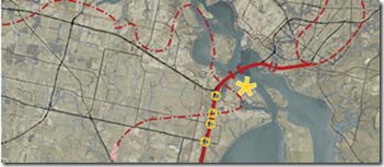


*** HERE is a IKE DIKE proposal that would help SAVE AND PROTECT SHOREACRES, La Porte, SEABROOK, KEMAH, BAYVIEW, BACLIFF, AND SAN LEON.


*** THIS Ike Dike proposal by TAMU does NOT abandon all of us that have lived here all our lives, and this proposal does not sell out to developers ;


Thursday, November 27, 2014


IKE DIKE VS RICE DIKE PUBLIC INPUT SOUGHT PLEASE WRITE IN SUPPORT OF TAMU IKE DIKE FOR IMMEDIATE RELEASE


URGENT !


************UPDATE IKE DIKE SPECIAL INTEREST GAME CHANGE*****************


HOWEVER, in December 2014, seems the concept of the IKE dike vs the SSPEED Rice Dike converged, we had a GAME PLAN CHANGE, and in my opinion, it’s not good, seems big business and special interest won out, and coastal communities inside of Galveston Bay, well, they are all just going to be collateral damage $$$


************UPDATE IKE DIKE SPECIAL INTEREST GAME CHANGE*****************


Working document, not to be referenced.


GAME PLAN: Framework for Flood Risk Reduction in the Galveston Bay Area


VERSION 1 – December 5, 2014


Main report written and edited by: S.N. (Bas) Jonkman (TU Delft), Mathijs van Ledden (RHDHV & TU Delft) Kasper Lendering (TU Delft), Leslie Mooyaart (RHDHV & TU Delft), Bill Merrell (Texas A&M Galveston), Arno Willems (Iv Infra).


With contributions from: Samuel Brody (Texas A&M Galveston), Kayode Atoba (Texas A&M Galveston), Wes Highfield (Texas A&M Galveston), Russell Blessing (Texas A&M Galveston), Jens Figlus (Texas A&M Galveston), Galen Newman (Texas A&M Galveston), Eric Bardenhagen (Texas A&M Galveston), Bruce Ebersole (Jackson State University), Tom Richardson (Jackson State University), Antonia Sebastian (Rice University), Robert Gilmer (Bauer College of Business, Univ. of Houston) and Adam Perdue (Bauer College of Business, Univ. of Houston).


GAME PLAN Flood Risk Reduction for the Galveston Bay area


snip...


Game plan - SSPEED Center statement


Another recent development in Galveston Bay surge suppression research is an agreement between the SSPEED Center at Rice University and Texas A&M University at Galveston to work more closely together. So far, the two research groups have agreed to the following statement.


“The SSPEED Center at Rice University and Texas A&M University at Galveston have been studying strategies for surge suppression for the Galveston Bay Region. SSPEED had been concentrating its efforts on suppressing surge using barriers internal to the Bay system and non-structural alternatives, while Texas A&M Galveston has concentrated on methods to stop the surge at the coast using a continuous coastal barrier – the “Ike Dike” concept. Both Texas A&M Galveston and the SSPEED Center will continue their research efforts, while collaborating with each other, with an eye towards ultimately combining their various strategies to achieve the best overall solution for the region from an economic, environmental and social perspective.


GAME PLAN Flood Risk Reduction for the Galveston Bay area


6


The SSPEED Center and Texas A&M University at Galveston will coordinate their modelling work and analyses so that the knowledge gained by all efforts can be shared and utilized to more efficiently and effectively reach the development of a regional surge defence strategy for the entire Houston-Galveston area. Each institution is committed to finding the best overall solution for the entirety of Galveston Bay and will work together to achieve that result.“


As the two groups work together, more synergies and common interests will appear. It is in everyone’s interest to see that the very best academic research and thinking is fully included in the actionable plans developed for suppressing surge in the Galveston Bay region. As one step in this process, SSPEED researchers have been invited to participate in the December 14-17, 2014 meeting of Ike dike researchers.


common special interest, is what they meant $$$...terry


see how high the tide still was, a day or two after IKE, looking right into our garage and garage apartment, look how high the tide still is, WITHOUT THE RICE SPPEED DAM...dike.


see a shot of our garage and apartment out back of our house and our land from the neighbors video next door (*see how high tide still is several days after Ike*). we need Ike Dike. tourist and money are NOT going to stop a 25+ foot storm surge, when the next big one comes up the ship channel. also, consider Bacliff. this area was the highest around the Bay, back when it was 18+ feet when I was a child. now we are sitting around 14 feet.


see some old history on IKE vs RICE SPPEED Dike ;


=====================


From: Terry S. Singeltary Sr.


Sent: Tuesday, October 09, 2012 5:30 PM


To: William Merrell


Cc: Cherie Coffman


Subject: Re: Ike Dike question ?


fantastic! thank you for your kind reply Sir, and explanation for the layperson such as me. many thanks, I like your proposal much, much, better Sir, considering my backyard is Galveston Bay here in Bacliff, 77518 shoreline. with that rice university plan, the shorelines from Kemah to San Leon and property values there from would tank and the next big one, we would all be marsh land. course, it would not matter much anyway, because that big toxic dredge island I have to look at everyday now, you know the one they propose to double in size now, well all that would be in our houses. ...what were they thinking. ...thanks again. with kindest regards, terry


=====================


From: William Merrell


Sent: Tuesday, October 09, 2012 5:08 PM


To: Terry S. Singeltary Sr.


Cc: Cherie Coffman


Subject: RE: Ike Dike question ?


Again - the Dike you describe is proposed by Rice University. It has nothing whatsoever to do with the Ike Dike. The Ike Dike protects everyone in the Bay because it is along the coast. You can verify this and learn the details of the Ike Dike by going to our website


=====================


From: Terry S. Singeltary Sr. [mailto:flounder9@verizon.net]


Sent: Tuesday, October 09, 2012 5:00 PM


To: William Merrell


Cc: Cherie Coffman


Subject: Re: Ike Dike question ?


Greetings again Dr. Merrell,


Sir, I had a question.


I did not have any ideas, other than the fact, I am concerned and confused on one of rumored proposals of Ike Dike, and we wanted to know the truth, and I was told, you were the person to go to, and my question was as follows ;


i heard that one of the potential designs for the ike dike, would have everyone living south of the Kemah bridge on hwy 146, and everyone east of hwy 146 there from, i.e. Kemah, Bayview, Bacliff, and San Leon, all these fishing communities would be EAST OF SAID IKE DIKE, as the said IKE DIKE would be built west of hwy 146, thus leaving everyone east of 146 to be left for marsh land, as any hurricane after said IKE DIKE built would leave these fishing communities as marsh lands due to any IKE DIKE built west of hwy 146, is any of this true?


is there any proposal on the table to eliminate the Kemah, Bayview, Bacliff, and San Leon shore lines from the Ike Dike?


is the scenario of said rumor, I proposed above, is this one of the proposals?


as home owners, property owners, and business owners, we are concerned, and we have a right to know if this is a proposal or not?


a simple yes or no answer will do. ...


thank you,


kind regards,


terry


=====================


From: William Merrell


Sent: Tuesday, October 09, 2012 4:38 PM To: Terry S. Singeltary Sr.


Cc: Cherie Coffman


Subject: RE: Ike Dike question ?


The 146 dike is proposed by the SSPEED Center at Rice. I agree with your ideas on it. The Ike Dike is a coastal spine which would protect everyone. Details on website http://www.tamug.edu/ikedike/


Best regards, Bill


William Merrell George P Mitchell Chair Texas A&M University at Galveston Po Box 1675 Galveston, Texas 77553-1675 409-740-4732 work 409-740-4787 fax 409-771-2225 cell


=====================


 From: Terry S. Singeltary Sr. [mailto:flounder9@verizon.net]


Sent: Tuesday, October 09, 2012 12:50 PM


To: William Merrell


Subject: Ike Dike question ?


Greetings Dr. Merrell,


I am a bit concerned and confused, and hoping you might be able to help straighten out any confusion on the IKE DIKE.


i heard that one of the potential designs for the ike dike, would have everyone living south of the Kemah bridge on hwy 146, and everyone east of hwy 146 there from, i.e. Kemah, Bayview, Bacliff, and San Leon, all these fishing communities would be EAST OF SAID IKE DIKE, as the said IKE DIKE would be built west of hwy 146, thus leaving everyone east of 146 to be left for marsh land, as any hurricane after said IKE DIKE built would leave these fishing communities as marsh lands due to any IKE DIKE built west of hwy 146.


is any of this true ?


can you please show me where all the said potential designs and drawings might be for the public to view on any said IKE DIKE ?


thank you,


kindest regards, terry


===================


END...TSS


Dr. Merrell, a marine scientist from Texas A&M, will be talking about his proposal December 11, 2012 at 7 P.M. to explain his proposal, at a Town Hall Meeting in San Leon, Texas, at the San Leon Fire Station. ...


=====================================


see officials from surrounding Galveston Bayshore communities I have spoken with, and how they feel about the Rice SSPEED dike, VS the IKE dike by TAMU ;


Kemah Mayor


From: Bob Cummins Sent:


Monday, November 18, 2013 1:51 PM


To: Terry S. Singeltary Sr.


Cc: Rick Beverlin


Subject: RE: Is your community just collateral damage? RICE DIKE VS IKE DIKE


Mr. Singeltary, The City has Dr. Merrill speak on several occasions to help educate our citizens. We have sent letters to the state and federal bodies to show our support for the much needed Ike Dike. Dr. Merrell has spoken to every group in the Bay area and has done a great job to help all of us. If you know of anyway we can be of greater support of this cause please let me know. Respectfully, Mayor Bob Cummins City of Kemah


========================


Seabrook Mayor


From: Glenn Royal


Sent: Monday, November 18, 2013 4:56 PM


To: 'Terry S. Singeltary Sr.'


Subject: RE: Is your community just collateral damage? RICE DIKE VS IKE DIKE


Dear Terry,


Rice University has not bothered to ask the opinion of Seabrook about the Centennial Gate. Had they asked, our reaction is similar to LaPorte. Prior to receiving your email, council has discussed our own resolution in opposition to this plan.


Recent discussions that I have had with area groups about the Centennial Gate give me hope that it is not going to be implemented given its relative cost versus storm surge protection. The Ike Dike gives us the greatest cost/benefit value.


Thank you for reaching out and sharing these articles with me. Please continue you to do so.


Best regards,


Glenn Royal


Mayor


City of Seabrook


========================


La Porte City Council At Large “A” councilman


From: John Zemanek


Sent: Monday, November 18, 2013 1:58 PM


To: 'Terry S. Singeltary Sr.'


Subject: RE: Is your community just collateral damage? RICE DIKE VS IKE DIKE


Terry,


City passed resolution opposing the Rice Dike. If you hear anything down the road, please let us know. We are keeping our eyes & ears open as well. FYI, I am the At Large “A” councilman.


Regards,


John Zemanek


Zemanek Marine Services, Inc.


From: Terry S. Singeltary Sr. [mailto:flounder9@verizon.net]


Sent: Monday, November 18, 2013 12:28 PM


To: mayorsoffice@laportetx.gov


Cc: atlargea@laportetx.gov; atlargeb@laportetx.gov; district1@laportetx.gov; cengelken@att.net; district3@laportetx.gov; district4@laportetx.gov; district5@laportetx.gov; district6@laportetx.gov


Subject: Is your community just collateral damage? RICE DIKE VS IKE DIKE


Say there Honorable Mayor Louis Rigby, and Council Members et al in the great city of LaPorte, Texas.


snip...end...tss


==============================


kind regards,

terry


Terry S. Singeltary Sr.

Bacliff, Texas 77518

Wednesday, March 11, 2015

MORGAN'S POINT GALVESTON BAY SHIP COLLISION UPDATE

UPDATE THURSDAY 8:44 AM

LA PORTE, Texas – The Houston Ship Channel was reopened Thursday morning, after responders completed initial salvage plans on a damaged chemical tanker and successfully moved the vessel to Barbour's Cut turning basin. The Carla Maersk incurred significant damage following a collision earlier in the week between it the and the Conti Peridot. Responders finished removing the liquid cargo from the ship’s two breached tanks early Thursday morning. The partial removal of cargo, Me...thyl Tertiary Butyl Ether, was a necessary step before the ship could be moved to a safe harbor. Plans also included checking the structural integrity of the vessel before moving it to another location. High-density foam was used to suppress flammable vapors from the damaged tanks on the Carla Maersk. Extensive air monitoring around the ship showed no sign of vapors seeping from the vessel. Responders continue to conduct air and water tests, which show no public health or environmental concerns. The Conti Peridot was moved Tuesday to the Port Authority’s Turning Basin terminal. "Safety of persons, environment and property continue to remain our highest priorities," said Capt. Brian Penoyer, Captain of the Port and Commander of Coast Guard Sector Houston-Galveston. "We will continue to keep you informed as efforts progress; and I would like to thank everyone involved with this Unified Command’s response." The cause of the collision remains under investigation. For claims call: 1-888-334-6446 For media inquiries call: 281-946-9437 Additional information is available at: ctcac.us <http://pier.me/5KH/>Photos and video can be accessed at: DVIDShub.net <http://pier.me/5KJ>


Dozens of ships delayed as section of Houston Ship Channel still closed: Pilots


in Port News 11/03/2015


Houston port 04.jpg More than 60 ships have been delayed since a section of the Houston Ship Channel was closed Monday following a vessel collision that caused MTBE to spill into the waterway, a Houston Pilots dispatcher said Tuesday.


The dispatcher said 35 inbound and 30 outbound vessels were in the queue late Tuesday afternoon.


The ship channel is closed to all traffic from the Fred Hartman Bridge to ship channel light 86 while salvage operations continue.


US Coast Guard Capt. Brian Penoyer said it was not yet possible to estimate when the section would reopen.


“I’d like to give an estimate that would be helpful, but we have to proceed step by step with the response,” he said. “Candidly, it has to be that way until we secure the vapor from the MTBE.”


About 12:40 pm CDT (1740 GMT) Monday, the chemical tanker Carla Maersk and dry bulker Conti Peridot collided just south of Morgan’s Point during a heavy fog. The impact pierced two cargo tanks on the Carla Maersk and MTBE began leaking into the ship channel.


Penoyer said there was little sign of MTBE on the water’s surface.


“With the single exception of a trace release from the damaged area of the hull on the Carla Maersk, we were unable to locate any evidence of sheen on the water,” he said.


The ship was carrying 216,000 barrels of the gasoline additive, but Penoyer said the entire cargo was not spilled as the crew was able to transfer MTBE out of the affected tanks and into other tanks on board.


The suspension of ship movements in the Houston Ship Channel impacts the delivery and loading schedules of crude oil and petroleum and petrochemical products. The 52-mile ship channel provides access from the Gulf of Mexico through Galveston Bay to various ports in Houston and other cities in the area that have many industrial facilities, including refineries and petrochemical plants. Source: Platts


 FOR IMMEDIATE RELEASE


DATE: March 11, 2015 2:38:11 PM CDT


Seafood Safety Notice


The Texas Department of State Health Services (DSHS) will issue “Fish and Shellfish Consumption Advisories” as needed during the Morgan’s Point Collision.


DSHS recommends that fishermen need to exercise common sense: do not eat fish or shellfish that has a chemical odor (similar to turpentine).


Q: Is the seafood safe to eat?


A: Recreationally caught fish and shellfish that do not smell like chemicals should be safe to eat. Persons who have a shellfish allergy should always avoid eating shrimp, crab, lobster, and oysters.


Q: Is fishing closed because of the MTBE release?


A: The DSHS has not closed any areas to the harvesting of fish, shrimp or crabs. People should always check the status of oyster harvesting areas prior to harvest. Further, MTBE does not build up in fish tissue, so there is not expected to be long-term effect on seafood in the area. The U.S. Environmental Protection Agency says studies have shown the chemical evaporates relatively quickly from surface water.


Q: Is seafood in restaurants and stores affected by the MTBE release?


A: There is no indication that seafood in the marketplace has been impacted by the MTBE release.


NOTE: For further inquires on Seafood Safety contact DSHS at: 512-776-7400 or the Seafood and Aquatic Life Group at: 512-834-6757.


For more information contact:


Morgan's Point Response JIC (281) 946-9437 MorgansPointResponse@gmail.com


Houston Ship Channel spill cleanup to take several days


By: Juan A. Lozano


Posted: 8:27 PM, Mar 10, 2015 Tag: state


LA PORTE — Efforts to clean up one of the nation's busiest seaports after a collision between two vessels on the Houston Ship Channel spilled a flammable chemical were expected to take at least several days, U.S. Coast Guard officials said Tuesday.


About a 4-mile to 8-mile stretch of the ship channel remained closed as crews worked to deal with the gasoline additive that spilled after two 600-foot ships collided on Monday in foggy conditions.


U.S. Coast Guard Capt. Brian Penoyer said the immediate goal is ensuring that there is no danger from the spilled additive — methyl tert-butyl ether or MTBE — as it is highly flammable and can be dangerous to people if inhaled in high doses. No injuries were reported from the collision.


Three cargo tanks of the chemical on the Danish-flagged Carla Maersk were ruptured when it collided with the Liberian bulk carrier Conti Peridot. A cause of the collision has not been determined. The Carla Maersk, which remains in the channel, was carrying approximately 216,000 barrels of MTBE before the collision but officials were still trying to determine how much had been spilled.


"We have to proceed step by step, making sure the flammability, the toxicity of this cargo is absolutely safe," said Penoyer, commander of the Houston-Galveston Coast Guard District. "We need to recognize this is an enormously complex salvage operation. ... We are driven by factors on the ground, not by a desired time frame. We all live here. We want to get back to business as usual. But we have to make sure people are safe."


Penoyer said officials have found no detectable concentrations of MTBE in the air in the shoreline communities around the spill since about midnight Monday and no sheens of the chemical have been found on the water.


"This indicates to us the risk to the public from toxic vapors or flammability of this cargo is virtually nil," he said.


There were no shelter-in-place orders on Tuesday for communities near the 50-mile channel that connects the Gulf of Mexico to the Port of Houston.


However, there was limited access into the Morgan's Point area, a city of about 350 residents located 30 miles east of Houston and adjacent to Galveston Bay at the entry point to the ship channel. The limited access included the area around Barbours Cut Container Terminal on the ship channel and at least one road into Morgan's Point, said Jeff Suggs, emergency management coordinator for the nearby city of La Porte.


The Port of Houston, a major part of the ship channel, is home to the nation's largest and one of the world's largest petrochemical complexes. It typically handles about 70 ships per day, plus 300 to 400 tugboats and barges, and consistently ranks first in the nation in foreign waterborne tonnage, U.S. imports and U.S. export tonnage.


The financial impact of the closure of the ship channel was not immediately known. But the Barbours Cut Container Terminal, run by the Port of Houston Authority, was closed on Tuesday due to the cleanup efforts.


On Tuesday, there were 28 ships waiting to go into the Houston Ship Channel and 24 waiting to come out, said Coast Guard Petty Officer Andy Kendrick.


Officials were also working to determine what kind of impact the spill might have on wildlife by taking and testing water samples, Penoyer said. The Texas Parks and Wildlife Department and other agencies were helping with this effort.


Update: GBF has remained in contact throughout the day with the U.S. Coast Guard and Incident Command, and at this time there have been no reports of affected wildlife. As shown in this map, authorities continue to monitor air and water quality throughout and around the safety zone, but levels initially appear to show that there is no health concern to the public. As a reminder, if you see any chemical sheen or affected wildlife, please report it by phone to 281-842-8100 or online through GBF’s mobile reporting site: www.galvbay.org/GBAN


see Morgan’s Point Collision Situation Status Map


HOUSTON
OPEN WITH RESTRICTIONS OPEN WITH RESTRICTIONS
THE COTP HOUSTON/ GALVESTON HAS ESTABLISHED A SAFETY ZONE IN THE HOUSTON SHIP CHANNEL FROM THE FRED HARTMAN BRIDGE TO HSC LIGHT 86 DUE TO COLLISION AND CHEMICAL SPILL. NO VESSEL MAY TRANSIT THE SAFETY ZONE." 03/10/2015


what’s going to happen when those great big super tankers start to show up after the Panama Canal is refitted and in full service and full steam ahead, and start cruising up the ship channel from Galveston to Houston, (besides the shoreline erosion there from)? we may have to start charging admission for the crash tanker derby show. set up the bleachers out on that new big GLIT island behind the house here. somebody better get a handle on why these collisions are happening, and fix it. fog has been here for some time, long before the ships https://www.youtube.com/watch?v=WiTsSGEhiVs


also, please, no more GLIT islands from the dredge either. dear steve has the definition for what a GLIT island is. I don’t know how much more of this our beloved Galveston Bay can handle. ...


flounder


Thursday, November 27, 2014

IKE DIKE VS RICE DIKE PUBLIC INPUT SOUGHT PLEASE WRITE IN SUPPORT OF TAMU IKE DIKE

FOR IMMEDIATE RELEASE


Re: Gulf Coast Community Protection and Recovery District Hosts Public Information Session on October 9, 2014 at 2:00 p.m., Harris County Commissioners Court


CONTACT: Robert Eckels President, Gulf Coast Community Protection and Recovery District, Inc. Email: Info@gccprd.com


HOUSTON (October 10, 2014) – The Gulf Coast Community Protection and Recovery District (GCCPRD) held a public information session on Thursday, October 9, 2014 hosted by Harris County Judge Ed Emmett and GCCPRD President Robert Eckels. The session provided details about the GCCPRD Storm Surge Suppression Study.


Following three major hurricanes, the last of which (Hurricane Ike) was the most expensive in Texas’ history, Governor Perry issued an Executive Order creating the Governor’s Commission for Disaster Recovery and Renewal. One of the Commission’s recommendations was to conduct a study to determine how coastal communities can reduce the damage of future storms. In conjunction with that recommendation, Brazoria, Chambers, Galveston, Harris, Jefferson, and Orange Counties formed the GCCPRD as a local government corporation. The GCCPRD is leading the Storm Surge Suppression Study, a technical, scientific-based study funded to investigate opportunities to alleviate the vulnerability of the upper Texas coast to storm surge and flooding from events like Hurricane Ike. The study is funded by the Texas General Land Office through a $3.9 million federal Housing and Urban Development, Community Development Block Grant that was awarded in September 2013. Since then, the GCCPRD has been collecting data as well as analyzing existing studies and reports. This study is an opportunity for the GCCPRD to assume a leadership role and work collaboratively with federal, state, local, and public and private institutions to develop a comprehensive coastal protection plan that meets the needs of the region and the nation.


The Storm Surge Suppression Study will yield a variety of storm surge suppression alternatives that may consist of natural, structural, and nonstructural methods. Using these findings, the GCCPRD will recommend a cost-effective and efficient system of flood damage reduction and storm surge suppression measures to help protect the six-county region. It is anticipated that this study will conclude in fall 2016. Public feedback and participation is encouraged throughout the life of the study. Public scoping meetings will be held in winter 2014 and at key milestones in the study. Future large-scale public scoping meetings will be noticed in advance in local newspapers. For more information or to join the mailing list visit: http://www.gccprd.com/


About the Gulf Coast Community Protection and Recovery District (GCCPRD): The GCCPRD is a local government corporation governed by a Board of Directors comprised of the County Judge of each participating county and three additional appointed members serving three-year terms. Former Harris County Judge Robert Eckels was appointed by the Board to serve as President of the District. # # #


CONTACT:


Robert Eckels

President, Gulf Coast Community Protection and Recovery District, Inc.


IKE DIKE VS RICE DIKE INPUT SOUGHT FROM PUBLIC


Gulf Coast residents asked for ideas on surge suppression


December 3, 2014 chron.com


By Robert Stanton


The Gulf Coast Community Protection and Recovery District will host a series of public meetings in December to gain public feedback on protection from hurricanes as part of the state's Storm Surge Suppression Study, created by Gov. Rick Perry.


The first public meeting will take place from 6-8 p.m, Dec. 4 at League City Civic Center, 400 W. Walker St. in League City.


Others meetings will take place from 6-8 p.m. on Dec. 9 at J.D. Walker Community Center,


7613 Wade Road in Baytown;


and from 6-8 p.m. Dec. 11 at the Jefferson County Courthouse, 1001 Pearl St. in Beaumont.


Comments will be accepted at the public meetings and throughout the duration of the study.


Written comments may be mailed to the Gulf Coast Community Protection and Recovery District in care of Col. Christopher Salles at 3100 West Alabama St., Houston, Texas 77098 or emailed to info@gccprd.com.


"There are a number of different studies that are under way or in progress, and, they all offer part of the solution, but the efforts have not been coordinated and there are still gaps between the Work of the various studies," said district president Robert Eckels.


Two major ideas have emerged to prepare and protect the Houston-Galveston region from severe storms and hurricanes in the aftermath of Hurricane Ike in 2008.


No funding has been secured as of yet


Storms from page 1


Rice University's Severe Storm Prediction, Education and Evacuation from Disasters Center has proposed a Centennial Gate to provide storm-surge protection to the Houston Ship Channel.


The Centennial Gate near the Fred Hartman Bridge would protect industries along the Houston Ship Channel.


The Ike Dike proposed by Texas A&M University involves a coastal spine concept that would combine barriers and gates to keep storm surge out of internal waters.


Seabrook Mayor Glenn Royal said he supports the coastal storm surge suppression system plan, also known as the coastal spine - a 15- to 17- foot barrier that would stretch from High Island on Bolivar Peninsula to the San Luis Pass on Galveston's West End.


"We have to be ready and have a plan in place when we go ask for funding, which is estimated to be about $6 billion," Royal said. "We have to show that we're together, in unison, and have public buy-in." To date, no funding for post-Ike hurricane protection plans has been secured, which is why the upcoming public meetings are so important, Eckels said. Questions: 713-868-1043


chron.com


Greetings Gulf Coast Community Protection and Recovery District in care of Col. Christopher Salles, the Honorable Col. Salles Sir, Honorable GCCPRD President Judge Robert Eckels, Family, Friends, and Neighbors of the surrounding Galveston Bay complex.


I wish to kindly submit the following to Gulf Coast Community Protection and Recovery District in care of Col. Christopher Salles, the Honorable Col. Salles Sir, Honorable GCCPRD President Judge Robert Eckels, about said Hurricane protection proposals.


>>> Two major ideas have emerged to prepare and protect the Houston-Galveston region from severe storms and hurricanes in the aftermath of Hurricane Ike in 2008. <<<


THE BIG DIFFERENCE between the two proposals, the RICE SPPEED dike will NOT protect a great portion of Galveston County, and by the RICE SPPEED dike proposal own words ;


“Furthermore, this proposal leaves waterfront properties and communities east of SH- 146 vulnerable; however, it maintains the possibility of waterfront recreation and other environmental and natural coastal features.”


ALL the Rice SPPEED dike will do, is protect Houston and the Houston Ship channel and all it’s petro-chemical complex, by damming up the North end of Galveston bay and adding a 25 foot seawall down the west side of SH 146 from Baytown to Texas City, making a wasteland and next a recreational park for the rich to come play in, at the expense to tax payers. my biggest concern is the petro-chemical giants getting their way, with the rice SSPEED dike, at the tax payers expense, and that will be signing a death sentence for all of us when the next big one comes up the ship channel. you can’t dam us out, east of SH 146, and just draw a pretty picture replacing us, as the rice dike proposes, and what we all know would happen if you dam up the North end of Galveston bay, and building a 25 feet wall west of SH 146 on the old train tracks. it will be doom for La Porte, Seabrook, Kemah, Bayview, Bacliff, San Leon, up to Texas City, Texas. the Rice Dike is absolutely the wrong way to go. Vote for the Ike Dike T.A.M.U. ! if the petro chemical giants want a wall only to protect them, let them build it by themselves, not on the tax payers backs, and again, at the same time knowing what your signing is your own death certificate. you may as well write your Social Security number on your arms now if the Rice SSPEED Dike goes through. it could be grounds for litigations in courts for decades to come, deliberate loss of property and life, with intent. they knew would it would do from day one, because they drew a damn map drawing all of us out, and replacing us with ‘’waterfront recreation and other environmental and natural coastal features’’.


I am asking for the people of the surrounding Galveston Bay areas to please support the TAMU IKE DIKE, so we can all be protected, not just Houston, and the petro-chemical complex up the Houston Ship Channel.


please see my reference materials and evidence against the Rice SPPEED dike proposal as reference materials below...


REFERENCE MATERIALS


RICE SPPEED DIKE ALREADY HAS BIG PLANS FOR COMMERCIAL PROPERTY EAST OF SH 146 FROM BAYTOWN TO TEXAS CITY, TEXAS.


vote for the IKE dike, if we even will get a vote, and make sure to make the petro-chemical companies pay for their fair share of the protection from the _Ike_ dike proposal by TAMU.


if the Rice SSPEED dike is approved, the federal government should be forced to buy us all out, at top dollar. ...


see 25 foot damn along SH 146 ;


see how high the tide still was, two days after IKE, looking right into our garage and garage apartment, look how high the tide still is, WITHOUT THE RICE SPPEED DAM...dike.
 
 
can you imagine what that would look like with the north end of galveston bay dammed up, and a 25 ft. damn from La Porte to Texas City Texas ?
 
here was the tide the day before Ike from our pier, and please notice what the water level was then, compared to 2 days after Ike. (takes a minute to load, and 28 seconds into video, see water level)


see officials from surrounding Galveston Bayshore communities I have spoken with, and how they feel about the Rice SSPEED dike, VS the IKE dike by TAMU ;
 
 
Kemah Mayor


From: Bob Cummins Sent:


Monday, November 18, 2013 1:51 PM


To: Terry S. Singeltary Sr. Cc: Rick Beverlin


Subject: RE: Is your community just collateral damage? RICE DIKE VS IKE DIKE


Mr. Singeltary, The City has Dr. Merrill speak on several occasions to help educate our citizens. We have sent letters to the state and federal bodies to show our support for the much needed Ike Dike. Dr. Merrell has spoken to every group in the Bay area and has done a great job to help all of us. If you know of anyway we can be of greater support of this cause please let me know. Respectfully, Mayor Bob Cummins City of Kemah


========================


Seabrook Mayor


From: Glenn Royal


Sent: Monday, November 18, 2013 4:56 PM


To: 'Terry S. Singeltary Sr.'


Subject: RE: Is your community just collateral damage? RICE DIKE VS IKE DIKE


Dear Terry,


Rice University has not bothered to ask the opinion of Seabrook about the Centennial Gate. Had they asked, our reaction is similar to LaPorte. Prior to receiving your email, council has discussed our own resolution in opposition to this plan.


Recent discussions that I have had with area groups about the Centennial Gate give me hope that it is not going to be implemented given its relative cost versus storm surge protection. The Ike Dike gives us the greatest cost/benefit value.


Thank you for reaching out and sharing these articles with me. Please continue you to do so.


Best regards,


Glenn Royal


Mayor


City of Seabrook


========================


La Porte City Council At Large “A” councilman


From: John Zemanek


Sent: Monday, November 18, 2013 1:58 PM


To: 'Terry S. Singeltary Sr.'


Subject: RE: Is your community just collateral damage? RICE DIKE VS IKE DIKE


Terry,


City passed resolution opposing the Rice Dike. If you hear anything down the road, please let us know. We are keeping our eyes & ears open as well. FYI, I am the At Large “A” councilman.


Regards,


John Zemanek


Zemanek Marine Services, Inc.


From: Terry S. Singeltary Sr. [mailto:flounder9@verizon.net]


Sent: Monday, November 18, 2013 12:28 PM


Cc: atlargea@laportetx.gov; atlargeb@laportetx.gov; district1@laportetx.gov; cengelken@att.net; district3@laportetx.gov; district4@laportetx.gov; district5@laportetx.gov; district6@laportetx.gov


Subject: Is your community just collateral damage? RICE DIKE VS IKE DIKE


Say there Honorable Mayor Louis Rigby, and Council Members et al in the great city of LaPorte, Texas.


snip...end...tss


==============================


RICE UNIVERSITY IKE DIKE hwy-146-levee proposal, THAT WOULD WASH AWAY SEABROOK, KEMAH, BAYVIEW, BACLIFF, AND SAN LEON


NOVEMBER 2011


Preliminary research results indicate that the most feasible structure will be a levee along SH-146 accompanied by pocket levees, built by private landowners. The levee would connect natural 25 foot elevations near the Houston Ship Channel and the Texas City Dike effectively protecting the properties and critical facilities and infrastructure west of SH-146. However, moveable barriers would need to be placed at Clear Lake and highway underpasses.


*** Furthermore, this proposal leaves waterfront properties and communities east of SH- 146 vulnerable; however, it maintains the possibility of waterfront recreation and other environmental and natural coastal features.


HERE is a IKE DIKE proposal that would help SAVE AND PROTECT SHOREACRES, SEABROOK, KEMAH, BAYVIEW, BACLIFF, AND SAN LEON.


THIS Ike Dike proposal by TAMU does NOT abandon all of us that have lived here all our lives, and this proposal does not sell out to developers ;


=====================


From: Terry S. Singeltary Sr.


Sent: Tuesday, October 09, 2012 5:30 PM


To: William Merrell


Cc: Cherie Coffman


Subject: Re: Ike Dike question ? fantastic! thank you for your kind reply Sir, and explanation for the layperson such as me. many thanks, I like your proposal much, much, better Sir, considering my backyard is Galveston Bay here in Bacliff, 77518 shoreline. with that rice university plan, the shorelines from Kemah to San Leon and property values there from would tank and the next big one, we would all be marsh land. course, it would not matter much anyway, because that big toxic dredge island I have to look at everyday now, you know the one they propose to double in size now, well all that would be in our houses. ...what were they thinking. ...thanks again. with kindest regards, terry


=====================


From: William Merrell


Sent: Tuesday, October 09, 2012 5:08 PM


To: Terry S. Singeltary Sr.


Cc: Cherie Coffman


Subject: RE: Ike Dike question ?


Again - the Dike you describe is proposed by Rice University. It has nothing whatsoever to do with the Ike Dike. The Ike Dike protects everyone in the Bay because it is along the coast. You can verify this and learn the details of the Ike Dike by going to our website


=====================


From: Terry S. Singeltary Sr. [mailto:flounder9@verizon.net]


Sent: Tuesday, October 09, 2012 5:00 PM


To: William Merrell


Cc: Cherie Coffman


Subject: Re: Ike Dike question ?


Greetings again Dr. Merrell,


Sir, I had a question.


I did not have any ideas, other than the fact, I am concerned and confused on one of rumored proposals of Ike Dike, and we wanted to know the truth, and I was told, you were the person to go to, and my question was as follows ;


i heard that one of the potential designs for the ike dike, would have everyone living south of the Kemah bridge on hwy 146, and everyone east of hwy 146 there from, i.e. Kemah, Bayview, Bacliff, and San Leon, all these fishing communities would be EAST OF SAID IKE DIKE, as the said IKE DIKE would be built west of hwy 146, thus leaving everyone east of 146 to be left for marsh land, as any hurricane after said IKE DIKE built would leave these fishing communities as marsh lands due to any IKE DIKE built west of hwy 146, is any of this true?


is there any proposal on the table to eliminate the Kemah, Bayview, Bacliff, and San Leon shore lines from the Ike Dike?


is the scenario of said rumor, I proposed above, is this one of the proposals?


as home owners, property owners, and business owners, we are concerned, and we have a right to know if this is a proposal or not?


a simple yes or no answer will do. ...


thank you,


kind regards,


terry


=====================


From: William Merrell


Sent: Tuesday, October 09, 2012 4:38 PM To: Terry S. Singeltary Sr.


Cc: Cherie Coffman


Subject: RE: Ike Dike question ?


The 146 dike is proposed by the SSPEED Center at Rice. I agree with your ideas on it. The Ike Dike is a coastal spine which would protect everyone. Details on website http://www.tamug.edu/ikedike/


Best regards, Bill


William Merrell George P Mitchell Chair Texas A&M University at Galveston Po Box 1675 Galveston, Texas 77553-1675 409-740-4732 work 409-740-4787 fax 409-771-2225 cell


=====================


From: Terry S. Singeltary Sr. [mailto:flounder9@verizon.net]


Sent: Tuesday, October 09, 2012 12:50 PM


To: William Merrell


Subject: Ike Dike question ?


Greetings Dr. Merrell,


I am a bit concerned and confused, and hoping you might be able to help straighten out any confusion on the IKE DIKE.


i heard that one of the potential designs for the ike dike, would have everyone living south of the Kemah bridge on hwy 146, and everyone east of hwy 146 there from, i.e. Kemah, Bayview, Bacliff, and San Leon, all these fishing communities would be EAST OF SAID IKE DIKE, as the said IKE DIKE would be built west of hwy 146, thus leaving everyone east of 146 to be left for marsh land, as any hurricane after said IKE DIKE built would leave these fishing communities as marsh lands due to any IKE DIKE built west of hwy 146.


is any of this true ?


can you please show me where all the said potential designs and drawings might be for the public to view on any said IKE DIKE ?


thank you,


kindest regards, terry


===================


END...TSS


Dr. Merrell, a marine scientist from Texas A&M, will be talking about his proposal December 11, 2012 at 7 P.M. to explain his proposal, at a Town Hall Meeting in San Leon, Texas, at the San Leon Fire Station. ...


=====================================

 
Tuesday, August 5, 2014
 
Ike Dike Scientist Professor William Merrell sees NO chance of compromise !
 
BRAVO!!! Legislators want quick action on Ike Dike


Friday, December 6, 2013
 
IKE DIKE TAMU VS Rice SSPEED Dike Centennial gate from Hell


Sunday, December 9, 2012
 
 
*** RICE DIKE PROPOSAL COULD DESTROY GALVESTON BAY BAYSHORE COMMUNITIES


Thank You...


Respectfully,


Terry S. Singeltary Sr.

P.O. Box 42

Bacliff, Texas USA 77518

Tuesday, September 30, 2014

Living Planet Report 2014 World’s Wildlife Population Dropped By More Than Half In 40 Years, WWF Report Says

World’s Wildlife Population Dropped By More Than Half In 40 Years, WWF Report Says


By Kukil Bora@KukilBora on September 30 2014 6:20 AM


Wildlife


During the period of in 40 years, populations of mammals, birds, reptiles, amphibians and fish around the world dropped 52 percent. Reuters


Wildlife population across the planet halved between 1970 and 2010, raising concerns over the global loss of species, according to a new report from the World Wildlife Fund, or WWF. In addition to the steep decline in wildlife populations, the report also highlighted various warning signs about the overall health of the planet.


Over a period of 40 years, populations of mammals, birds, reptiles, amphibians and fish around the world dropped 52 percent, while the amount of carbon in the Earth’s atmosphere rose to levels not seen in more than a million years, according to the WWF report. And while these developments have altered the planet's climate and destabilized ecosystems, more than 60 percent of the essential “services” provided by nature are also seen to be in decline.


“We're gradually destroying our planet’s ability to support our way of life,” Carter Roberts, president and CEO of WWF, said in a statement. “But we already have the knowledge and tools to avoid the worst predictions. We all live on a finite planet and its time we started acting within those limits.”


According to WWF, the report is based on trends in three major areas, including populations of more than 10,000 vertebrate species; human activities such as consumption of goods and greenhouse gas emissions; and existing biocapacity, which denotes the amount of natural resources available to produce food and freshwater, and sequester carbon -- the process of capturing and storing of carbon dioxide in the atmosphere.


“There is a lot of data in this report and it can seem very overwhelming and complex,” Jon Hoekstra, chief scientist at WWF, said in the statement. “What’s not complicated are the clear trends we’re seeing -- 39 percent of terrestrial wildlife gone, 39 percent of marine wildlife gone, 76 percent of freshwater wildlife gone – all in the past 40 years.”


The report revealed that while high-income countries showed a 10 percent increase in biodiversity, middle-income and low-income countries suffered a decline of 18 percent and 58 percent, respectively. Among all the world's regions, Latin American countries showed the biggest decline in biodiversity, with species populations falling by 83 percent.


The report also put forth recommendations to help save the planet. WWF suggests people should focus more on smarter food and energy production, while being responsible about consuming resources “at the personal, corporate and government levels.”


“We need leadership for change. Sitting on the bench waiting for someone else to make the first move doesn’t work,” Marco Lambertini, director general at WWF International, said in a statement. “Heads of state need to start thinking globally; businesses and consumers need to stop behaving as if we live in a limitless world.”


Living Planet Report 2014 . .


The Living Planet Report is the world's leading, science-based analysis on the health of our planet and the impact of human activity. Knowing we only have one planet, WWF believes that humanity can make better choices that translate into clear benefits for ecology, society and the economy today and in the long term.


This latest edition of the Living Planet Report is not for the faint-hearted. One key point that jumps out is that the Living Planet Index (LPI), which measures more than 10,000 representative populations of mammals, birds, reptiles, amphibians and fish, has declined by 52 per cent since 1970.


 Put another way, in less than two human generations, population sizes of vertebrate species have dropped by half. These are the living forms that constitute the fabric of the ecosystems which sustain life on Earth – and the barometer of what we are doing to our own planet, our only home. We ignore their decline at our peril.


 We are using nature’s gifts as if we had more than just one Earth at our disposal. By taking more from our ecosystems and natural processes than can be replenished, we are jeopardizing our very future. Nature conservation and sustainable development go hand-in-hand. They are not only about preserving biodiversity and wild places, but just as much about safeguarding the future of humanity – our well-being, economy, food security and social stability – indeed, our very survival.


 In a world where so many people live in poverty, it may appear as though protecting nature is a luxury. But it is quite the opposite. For many of the world’s poorest people, it is a lifeline. Importantly though, we are all in this together. We all need nutritious food, fresh water and clean air – wherever in the world we live.


 Things look so worrying that it may seem difficult to feel positive about the future. Difficult, certainly, but not impossible – because it is in ourselves, who have caused the problem, that we can find the solution. Now we must work to ensure that the upcoming generation can seize the opportunity that we have so far failed to grasp, to close this destructive chapter in our history, and build a future where people can live and prosper in harmony with nature.


 We are all connected – and collectively, we have the potential to create the solutions that will safeguard the future of this, our one and only planet.


 / ©: WWF / ESA


 © WWF / ESA


 Too busy to read the full report ?


Download the booklet summary


Read the highlights


Living planet Index


Ecological Footprint


One planet solutions


Food, water and energy


/ ©: NASA


© NASA


 We need leadership for change. Sitting on the bench waiting for someone else to make the first move doesn’t work. Heads of state need to start thinking globally; businesses and consumers need to stop behaving as if we live in a limitless world.


Marco Lambertini, Director General, WWF International . .


 Living planet report partners


Zoological Society of London Founded in 1826, the Zoological Society of London (ZSL) is an international scientific, conservation, and educational organization. Its mission is to achieve and promote the worldwide conservation of animals and their habitats.


Global Footprint Network (GFN) The GFN promotes a sustainable economy by advancing the Ecological Footprint, a tool that makes sustainability measurable. Together with its partners, the Network coordinates research, develops methodological standards, and provides decision makers with robust resource accounts to help the human economy operate within the Earth’s ecological limits.


Water Footprint Network (WFN) The Water Footprint Network is a dynamic a platform connecting diverse communities interested in sustainability, equitability and efficiency of water use.


SEE VIDEO;


Half of Global Wildlife Lost, says new WWF Report


World Wildlife Fund issues 10th edition of “The Living Planet Report”, a science-based assessment of the planet’s health


Date September 30, 2014


Media Contact


Brendan Rohr


202-495-4621


brendan.rohr@wwfus.org


In This Press Release


Carter Roberts


 Keya Chatterjee


 Jon Hoekstra


Between 1970 and 2010 populations of mammals, birds, reptiles, amphibians, and fish around the globe dropped 52 percent, says the 2014 Living Planet Report released today by World Wildlife Fund (WWF). This biodiversity loss occurs disproportionately in low-income countries—and correlates with the increasing resource use of high-income countries.


In addition to the precipitous decline in wildlife populations the report’s data point to other warning signs about the overall health of the planet. The amount of carbon in our atmosphere has risen to levels not seen in more than a million years, triggering climate change that is already destabilizing ecosystems. High concentrations of reactive nitrogen are degrading lands, rivers and oceans. Stress on already scarce water supplies is increasing. And more than 60 percent of the essential “services” provided by nature, from our forests to our seas, are in decline.


"We're gradually destroying our planet’s ability to support our way of life,” said Carter Roberts, president and CEO of WWF. “But we already have the knowledge and tools to avoid the worst predictions. We all live on a finite planet and its time we started acting within those limits.”


The Living Planet Report, WWF’s biennial flagship publication, measures trends in three major areas:


• populations of more than ten thousand vertebrate species;


• human ecological footprint, a measure of consumption of goods, greenhouse gas emissions; and


• existing biocapacity, the amount of natural resources for producing food, freshwater, and sequestering carbon.


“There is a lot of data in this report and it can seem very overwhelming and complex,” said Jon Hoekstra, chief scientist at WWF. “What’s not complicated are the clear trends we’re seeing -- 39 percent of terrestrial wildlife gone, 39 percent of marine wildlife gone, 76 percent of freshwater wildlife gone – all in the past 40 years.”


The report says that the majority of high-income countries are increasingly consuming more per person than the planet can accommodate; maintaining per capita ecological footprints greater than the amount of biocapacity available per person. People in middle- and low-income countries have seen little increase in their per capita footprints over the same time period.


While high-income countries show a 10 percent increase in biodiversity, the rest of the world is seeing dramatic declines. Middle-income countries show 18 percent declines, and low-income countries show 58 percent declines. Latin America shows the biggest decline in biodiversity, with species populations falling by 83 percent.


“High-income countries use five times the ecological resources of low-income countries, but low income countries are suffering the greatest ecosystem losses,” said Keya Chatterjee, WWF’s senior director of footprint. “In effect, wealthy nations are outsourcing resource depletion.”


The report underscores that the declining trends are not inevitable. To achieve globally sustainable development, each country’s per capita ecological footprint must be less than the per capita biocapacity available on the planet, while maintaining a decent standard of living.


At the conclusion of the report, WWF recommends the following actions:


1. Accelerate shift to smarter food and energy production


2. Reduce ecological footprint through responsible consumption at the personal, corporate and government levels


3. Value natural capital as a cornerstone of policy and development decisions


WWF In The News World’s Wildlife Population Dropped By More Than Half In 40 Years, WWF Report SaysSeptember 30, 2014 – International Business Times WWF: The Earth Has Lost Half Its Wildlife Since 1970September 30, 2014 – VOX Half the World's Wildlife Gone Over Last 40 Years September 30, 2014 – CBS News Too busy to read the full report ? Download the booklet summary Read the highlights Living planet Index Ecological Footprint One planet solutions Food, water and energy


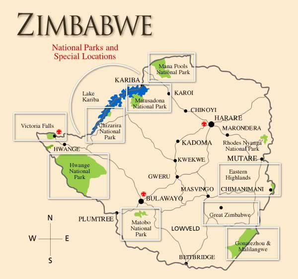
CYANIDE POISONING, ELEPHANTS - ZIMBABWE (02): (HWANGE NATIONAL PARK)


********************************************************************


A ProMED-mail post <http://www.promedmail.org> ProMED-mail is a program of the International Society for Infectious Diseases <http://www.isid.org>


Date: Sun 29 Sep 2013 Source: IOL (Independent Online, South Africa) [edited] <http://www.iol.co.za/news/africa/zim-elephant-deaths-soar-1.1584080#.Uk2IP4ZLOrh>


While African heads of state made measured long-range commitments to intensify anti-wildlife poaching measures at a UN summit in New York this week [23-29 Sep 2013], conservation authorities in Zimbabwe were continuing to count the cost of what could be the single worst poaching incident on the continent in living memory.


By yesterday [28 Sep 2013], 91 elephant carcasses had been found in Zimbabwe's Hwange National Park, victims of cyanide added to salt licks at watering holes inside the reserve.


Meanwhile, reports have indicated the poison has led to widespread devastation of the ecosystems in the area, with large, though at this stage untallied, numbers of other wildlife including lions, zebras, wildebeest, hyenas, leopards, cheetahs, and several species of birds also included in the list of victims. Especially vulnerable have been vultures feeding from elephant carcasses.


"This is the worst ecological disaster we have seen, and the fallout is going to be massive," said Johnny Rodrigues, Chairman of the Zimbabwe Conservation Task Force.


"Watering holes and the ground are contaminated, and the entire wildlife food chain is threatened."


"Already predators and vultures and other birdlife species are dying from the chain reaction or secondary poisoning, and a lot more animals are going to suffer and die."


Conservationists believe the final tally -- which has steadily risen after the discovery of some 40 carcasses in August [2013] -- could climb to 3 figures before the poisons introduced into the watering holes lose their toxicity.


Hwange covers an area of 14 650 sq km [5656 sq mi] and is Africa's 3rd largest wildlife sanctuary. The Zimbabwe Wildlife Authority employs just 50 rangers to protect the park where earlier this year [2013] it was reported the last southern white rhino at Hwange had been poached.


Hwange received no mention at this week's [23-29 Sep 2013] UN-hosted deliberations in New York, where Gabon's President Ali Bongo called for the appointment of a UN rapporteur on wildlife crime, a call supported by the UK and Germany among others.


Somewhat more proactive were the Zimbabwean prosecutorial authorities, arresting 8 suspected poachers since August [2013] in connection with the cyanide outrage, and securing confessions from at least 2 suspects that elephants had been targeted for their ivory in poisoning the watering holes.


This week [23-29 Sep 2013], 3 of the suspects were convicted in the Hwange Regional Court. 2 were sentenced to 15 years imprisonment, and an order for the restitution of USD 600 000 (R 5.9 million) to the Parks and Wildlife Management Authority of Zimbabwe. The 3rd was handed down a 16-year sentence with labour, and an order for restitution in the value of USD 200 000 [about R 2 million].


Zimbabwe's political responses have been less pertinent, however, with Robert Mugabe's Zanu-PF blaming Western sanctions for the poaching crisis. Claiming it had conducted a week-long investigation into the cyanide poisoning, government mouthpiece the Zimbabwe Herald said last week it attributed the elephant killing to "the West's illegal economic sanctions that affected Zimbabwe's once-vibrant wildlife management system."


Conservation authorities have pointed out that cyanide is a highly controlled substance, and virtually unobtainable. The single exception lies in the mining sector. In recent years, several gold mining concessions in the Hwange region have been handed out -- nearly all of them to Chinese interests.


While investigators of the Hwange atrocity have not connected the provision of the cyanide to mining operators in the area, circumstantial corroboration is lent to the suspicion by organic chemist and toxicologist Gerhard Verdoorn. According to Verdoorn, the Chinese "colonisation of parts of Africa" has led to a situation where a "very large quantity of unregistered and uncontrolled Chinese pesticides and other toxins enter Africa without any control."


Verdoorn says the use of poisons in poaching goes back some years, and that in the past 2 years [2011-2012] he has received several reports of mass poisonings of wildlife in Zimbabwe, Botswana, and Namibia, but has been under pressure from investigative authorities to "keep a lid on the information" in the light of ongoing investigations.


Ivory trafficking has become one of the world's most lucrative criminal industries, with an estimated value of USD 7-10 billion a year, nonprofit advocacy groups say.


Since 1980, the estimated population of African elephants has fallen from 1.2 million to less than 420 000. In 2012 alone, 35 000 elephants were slaughtered, data show.


Ivory seizures data indicates that most ivory smuggled from Africa goes to China, according to Tom Milliken, an expert from world wildlife monitoring network Traffic. Bulawayo's Milliken, who runs the Elephant Trade Information System (ETIS), has tracked the illegal flow of ivory from Africa for the past 22 years.


"In every analysis that we've done since 2004, illegal trade in ivory has been escalating. The last time we did a major assessment, in 2009, it was escalating at a rate faster and greater than we had seen previously. Looking at large-scale ivory seizures in 2011, it's going off the charts. There were just 13 seizures that generated over 23 tons of ivory," he said.


On Thursday [26 Sep 2013] in New York, Hillary Rodham Clinton announced a new global effort to protect Africa's wild elephants from poaching, part of a personal crusade. "Unless the killing stops, African forest elephants are expected to be extinct within 10 years," Clinton said. "I can't even grasp what a great disaster this is ecologically, but also for anyone who shares this planet to lose a magnificent creature like the African forest elephant seems like such a rebuke to our own values," she said.


[Byline: Simon Bloch]


-- Communicated by: ProMED-mail from HealthMap Alerts


[Cyanide poisoning occurs when an animal is exposed to a compound that produces cyanide ions when dissolved in water. The cyanide ion halts cellular respiration by inhibiting an enzyme in the mitochondria called cytochrome c oxidase.


Gold cyanidation (also known as the cyanide process or the MacArthur-Forrest process) is a metallurgical technique for extracting gold from low-grade ore by converting the gold to a water soluble coordination complex. It is the most commonly used process for gold extraction. [A coordination complex or metal complex, consists of an atom or ion (usually metallic), and a surrounding array of bound molecules or anions, that are in turn known as ligands or complexing agents. (Wikipedia). - Mod.JW]


In South Africa, poachers have also used a toxic compound, aldicarb, to kill large mammals see <http://www.health24.com/Lifestyle/Pet-Health/News/Temik-killer-on-the-loose-20120721>.


A HealthMap/ProMED-mail interactive map of Zimbabwe can be seen at <http://healthmap.org/r/8Fl->. Hwange National Park can be located on the map at <http://chandrashekharasandprints.files.wordpress.com/2013/02/hwangenationalpark.jpg>- Mod.PMB


Joseph Dudley comments: Aldicarb, a carbamate insecticide that is extremely toxic to mammals, has been widely used by wildlife poachers in South Africa for many years for poisonng rhinos and other wildlife species. It is also used in South Africa by burglars to poison sentry dogs, and to poison rats and stray dogs. Although banned in South Africa, it is still readily available in Zimbabwe & Mozambique, and large quantities are smuggled into South Africa for illegal sale there. http://www.rhinoconservation.org/2012/03/27/south-africa-poison-seized-from-game-farmer-suspected-of-rhino-crimes/ http://www.health24.com/Lifestyle/Pet-Health/News/Temik-killer-on-the-loose-20120721


Criminals in South Africa wishing to gain access to a property where dogs are present typically insert aldicarb granules into cheap meat baits, such as sausages or polony, to kill the resident dog(s). Pieces of bait are clandestinely thrown over property fences for the dogs to consume, with criminals gaining access to the property once the dogs have been eliminated. The use of a ldicarb to poison animals is, however, not only restricted to South Africa, with reports indicating large-scale intentional malicious poisoning of dogs and other species from the USA and Spain. It has also been reported that aldicarb is illegally used as a household rodenticide in Brazil and the Caribbean Islands and that humans are sometimes poisoned.


[see also: Cyanide poisoning, elephants - Zimbabwe 20130908.1930015] .................................................sb/pmb/mj/jw


*##########################################################*

END...TSS

************************************************************


HUGE OIL SPILL GALVESTON BAY UPDATES


Seafood Consumption Advisories


While Galveston Bay is an outstanding place to fish, you need to be aware of seafood consumption advisories!


Tuesday, May 14, 2013


Report challenges state pollutant de-listing effort in Texas City


Premature To Remove Texas City From The Air Pollution Watch List


By Elena Craft, PhD | Bio | Published: May 13, 2013


Monday, March 25, 2013


TCEQ Proposes Removal of Two Pollutants from the Texas City APWL Area--Benzene and Hydrogen Sulfide


Thursday, September 18, 2014


*** Risk behaviors in a rural community with a known point-source exposure to chronic wasting disease


Saturday, September 20, 2014


*** North Carolina Captive cervid licenses and permits Senate Bill 744 Singeltary Submission


Description The proposed changes to 15A NACA 10H .0301 would allow the Commission to issue new captivity licenses and permits for the purpose of holding cervids in captivity and allow certified herd owners to sell or transfer cervids to any licensed facility. Also, mandatory testing for CWD will be raised from all cervids that die at age 6 months or older to all cervids that die at age 12 months or older.


Rule Text Click here


North Carolina Captive cervid licenses and permits Senate Bill 744 Singeltary Submission


*** p.s. please add this to my submission, very important information...


Saturday, February 04, 2012


*** Wisconsin 16 age limit on testing dead deer Game Farm CWD Testing Protocol Needs To Be Revised


Approximately 4,200 fawns, defined as deer under 1 year of age, were sampled from the eradication zone over the last year. The majority of fawns sampled were between the ages of 5 to 9 months, though some were as young as 1 month.


*** Two of the six fawns with CWD detected were 5 to 6 months old.


All six of the positive fawns were taken from the core area of the CWD eradication zone where the highest numbers of positive deer have been identified.


Saturday, February 04, 2012


*** Wisconsin 16 age limit on testing dead deer Game Farm CWD Testing Protocol Needs To Be Revised


*** Conclusion. CWD prions (as inferred by prion seeding activity by RT-QuIC) are shed in urine of infected deer as early as 6 months post inoculation and throughout the subsequent disease course. Further studies are in progress refining the real-time urinary prion assay sensitivity and we are examining more closely the excretion time frame, magnitude, and sample variables in relationship to inoculation route and prionemia in naturally and experimentally CWD-infected cervids.


SNIP...SEE FULL TEXT ;


Saturday, September 20, 2014


*** North Carolina Captive cervid licenses and permits Senate Bill 744 Singeltary Submission


Thursday, July 03, 2014


*** How Chronic Wasting Disease is affecting deer population and what’s the risk to humans and pets?


=============================================================================


Tuesday, July 01, 2014


*** CHRONIC WASTING DISEASE CWD TSE PRION DISEASE, GAME FARMS, AND POTENTIAL RISK FACTORS THERE FROM ***


=============================================================================


North America Game Farms


slaughtering cattle, or killing deer ?


IN THE UNITED STATES DISTRICT COURT FOR THE NORTHERN DISTRICT OF INDIANA SOUTH BEND DIVISION UNITED STATES OF AMERICA, vs. RUSSELL G. BELLAR, Defendant.


___________________________


Cause No.: 3:04cr00068-AS South Bend, Indiana January 4, 2005 9:30 a.m.


TRANSCRIPT EXCERPT OF JURY TRIAL (TESTIMONY OF: RONNIE DUNN AND RUSTY CAMP) BEFORE THE HONORABLE ALLEN SHARP


snip...


Ronnie Dunn Cross Examination


Q. Mr. Dunn, at one point I believe you told the federal agents that Mr. Bellar told you that this was a private deer farm and shooting deer on that farm was like slaughtering cattle; is that correct?


A. I don't know if I used the word "slaughter," but it was, yeah, like that.


Q. You don't know if that was your word, "slaughtering cattle"?


A. I don't know that.


Q. Well, did he give you the idea of killing cattle?


A. Yes, it was the same principle.


snip...


see full text ;


BUCK FEVER


Transmissible Spongiform Encephalopathy TSE Prion Disease North America 2014


Transmissible Spongiform Encephalopathy TSE Prion Disease have now been discovered in a wide verity of species across North America. typical C-BSE, atypical L-type BASE BSE, atypical H-type BSE, atypical H-G BSE, of the bovine, typical and atypical Scrapie strains, in sheep and goats, with atypical Nor-98 Scrapie spreading coast to coast in about 5 years. Chronic Wasting Disease CWD in cervid is slowly spreading without any stopping it in Canada and the USA and now has mutated into many different strains. Transmissible Mink Encephalopathy TME outbreaks. These Transmissible Spongiform Encephalopathy TSE Prion Disease have been silently mutating and spreading in different species in North America for decades.


The USDA, FDA, et al have assured us of a robust Triple BSE TSE prion Firewall, of which we now know without a doubt, that it was nothing but ink on paper. Since the 1997 mad cow feed ban in the USA, literally tons and tons of banned mad cow feed has been put out into commerce, never to return, as late as December of 2013, serious, serious breaches in the FDA mad cow feed ban have been documented. The 2004 enhanced BSE surveillance program was so flawed, that one of the top TSE prion Scientist for the CDC, Dr. Paul Brown stated ; Brown, who is preparing a scientific paper based on the latest two mad cow cases to estimate the maximum number of infected cows that occurred in the United States, said he has "absolutely no confidence in USDA tests before one year ago" because of the agency's reluctance to retest the Texas cow that initially tested positive.


see ;


The BSE surveillance and testing have also been proven to be flawed, and the GAO and OIG have both raised serious question as to just how flawed it has been (see GAO and OIG reports). North America has more documented TSE prion disease, in different documented species (excluding the Zoo BSE animals in the EU), then any other place on the Globe. This does not include the very likelihood that TSE prion disease in the domestic feline and canine have been exposed to high doses of the TSE prion disease vid pet food. To date, it’s still legal to include deer from cwd zone into pet food or deer food. Specified Risk Material i.e. SRM bans still being breach, as recently as just last month.


nvCJD or what they now call vCJD, another case documented in Texas last month, with very little information being released to the public on about this case? with still the same line of thought from federal officials, ‘it can’t happen here’, so another vCJD blamed on travel of a foreign animal disease from another country, while ignoring all the BSE TSE Prion risk factors we have here in the USA and Canada, and the time that this victim and others, do spend in the USA, and exposed to these risk factors, apparently do not count in any way with regard to risk factor. a flawed process of risk assessment.


sporadic CJD, along with new TSE prion disease in humans, of which the young are dying, of which long duration of illness from onset of symptoms to death have been documented, only to have a new name added to the pot of prion disease i.e. sporadic GSS, sporadic FFI, and or VPSPR. I only ponder how a familial type disease could be sporadic with no genetic link to any family member? when the USA is the only documented Country in the world to have documented two different cases of atypical H-type BSE, with one case being called atypical H-G BSE with the G meaning Genetic, with new science now showing that indeed atypical H-type BSE is very possible transmitted to cattle via oral transmission (Prion2014). sporadic CJD and VPSPR have been rising in Canada, USA, and the UK, with the same old excuse, better surveillance. You can only use that excuse for so many years, for so many decades, until one must conclude that CJD TSE prion cases are rising. a 48% incease in CJD in Canada is not just a blip or a reason of better surveillance, it is a mathematical rise in numbers. More and more we are seeing more humans exposed in various circumstance in the Hospital, Medical, Surgical arenas to the TSE Prion disease, and at the same time in North America, more and more humans are becoming exposed to the TSE prion disease via consumption of the TSE prion via deer and elk, cattle, sheep and goats, and for those that are exposed via or consumption, go on to further expose many others via the iatrogenic modes of transmission of the TSE prion disease i.e. friendly fire. I pondered this mode of transmission via the victims of sporadic FFI, sporadic GSS, could this be a iatrogenic event from someone sub-clinical with sFFI or sGSS ? what if?


Two decades have passed since Dr. Ironside first confirmed his first ten nvCJD victims in 1995. Ten years later, 2005, we had Dr. Gambetti and his first ten i.e. VPSPR in younger victims. now we know that indeed VPSPR is transmissible. yet all these TSE prion disease and victims in the USA and Canada are being pawned off as a spontaneous event, yet science has shown, the spontaneous theory has never been proven in any natural case of TSE prion disease, and scientist have warned, that they have now linked some sporadic CJD cases to atypical BSE, to atypical Scrapie, and to CWD, yet we don’t here about this in the public domain. We must make all human and animal TSE prion disease reportable in every age group, in ever state and internationally, we must have a serious re-evaluation and testing of the USA cattle herds, and we must ban interstate movement of all cervids. Any voluntary effort to do any of this will fail. Folks, we have let the industry run science far too long with regards to the TSE prion disease. While the industry and their lobbyist continues to funnel junk science to our decision policy makers, Rome burns. ...end


REFERENCES


Sunday, June 29, 2014


Transmissible Spongiform Encephalopathy TSE Prion Disease North America 2014


Tuesday, August 12, 2014


MAD COW USDA TSE PRION COVER UP or JUST IGNORANCE, for the record AUGUST 2014


Tuesday, August 19, 2014


Former Rancho Employees Charged With 11 Felonies processed meat from 101 condemned cattle, including 79 with “cancer eye''


Saturday, June 14, 2014


Rep. Rosa DeLauro (D-CT) Calls for Briefing on Beef Recalled for Mad Cow Potential Rep. Rosa DeLauro (D-CT)


*** Because typical clinical signs of BSE cannot always be observed in nonambulatory disabled cattle, and because evidence has indicated these cattle are more likely to have BSE than apparently healthy cattle, FDA is designating material from nonambulatory disabled cattle as prohibited cattle materials.


Friday, March 21, 2014


Rancho Dead Stock Cancer Downers Recall Explained FSIS March 20 2014 ?


“As of March 20, 2014, FSIS has completed all checks (effectiveness checks and disposition verification checks) for recalls 002-2014 and 013-2014 regarding Rancho Feeding Corporation. FSIS has determined that based on the number of successful checks (see Directive 8080.1, Attachment 1, Table 3) where businesses were notified of the recall and removed affected products from commerce that the recall activities were effective.”


Thursday, March 20, 2014


JACK IN THE BOX NOW CAUGHT UP IN MASSIVE RANCHO DEAD STOCK DOWNER CANCER COW RECALL


Thursday, March 6, 2014


TEXAS RECALL LIST MASSIVE FROM DEAD STOCK DOWNER CANCER COWS OFFAL from Class I Recall 002-2014 and 013-2014 Health Risk: High Jan 13, 2014 and Feb 8, 2014 shipped to Texas, Florida, and Illinois UPDATE FEBRUARY 14, 2014


Thursday, February 27, 2014


BEEF, CANCER, PRIONS, AND OTHER DANGEROUS AND DEADLY PATHOGENS, APPARENTLY, IT'S WHAT'S FOR DINNER


Thursday, November 28, 2013


Department of Justice Former Suppliers of Beef to National School Lunch Program Settle Allegations of Improper Practices and Mistreating Cows


seems USDA NSLP et al thought that it would be alright, to feed our children all across the USA, via the NSLP, DEAD STOCK DOWNER COWS, the most high risk cattle for mad cow type disease, and other dangerous pathogens, and they did this for 4 years, that was documented, then hid what they did by having a recall, one of the largest recalls ever, and they made this recall and masked the reason for the recall due to animal abuse (I do not condone animal abuse), not for the reason of the potential for these animals to have mad cow BSE type disease (or other dangerous and deadly pathogens). these TSE prion disease can lay dormant for 5, 10, 20 years, or longer, WHO WILL WATCH OUR CHILDREN FOR THE NEXT 5 DECADES FOR CJD ???


Saturday, September 21, 2013


Westland/Hallmark: 2008 Beef Recall A Case Study by The Food Industry Center January 2010 THE FLIM-FLAM REPORT


DID YOUR CHILD CONSUME SOME OF THESE DEAD STOCK DOWNER COWS, THE MOST HIGH RISK FOR MAD COW DISEASE ??? this recall was not for the welfare of the animals. ...tss


you can check and see here ; (link now dead, does not work...tss)


try this link ;


Sunday, September 21, 2014


Is your pizza topped with horrific animal cruelty?


vCJD can have an incubation period of over 30 years. ..TSS


USA 4TH CASE VCJD (aka nvCJD) HUMAN MAD COW, THE SILENCE IS DEAFENING BSE, CWD, AND SCRAPIE TSE PRION DISEASE


Greetings DSHS, Dr. Fishcer, et al,


I know that most in the USA could care less about the CJD TSE prion disease aka mad cow type disease. but there are some of us here that will never forget.


you can cover up what ever you want. we all know. I have seen it happen too many times here in Texas with BSE TSE prion, either the typical or the atypical strains, or with the feed, or, with cwd, or scrapie as that goes, but we are still here, and we will never forget...


kind regards, terry


Creutzfeld-Jacob Disease (CJD) Emerging & Acute Infectious Disease Branch Michael Fischer


Marilyn Felkner


512-776-7676


512-776-7676


Chronic Wasting Disease Zoonosis Control Branch Eric Fonken


512-776-2155


Lab tests have confirmed a diagnosis of variant Creutzfeldt-Jakob Disease (CJD) in a patient who recently died in Texas. Variant CJD is a rare, fatal brain disorder, first described in 1996 in the United Kingdom and associated with beef consumption overseas.


This is the fourth case ever reported in the United States. In each of the three previous cases, infection likely occurred outside the United States, including the United Kingdom and Saudi Arabia. The history of this fourth patient includes extensive travel to Europe and the Middle East, and infection likely occurred outside the United States. The CDC and DSHS continue to investigate the case.


There are no Texas public health concerns or threats associated with this case.


CDC Confirmation Information:


CDC Fact Sheet:


Texas CJD Information:


Last updated June 02, 2014


CONFIRMED HUMAN BSE AKA MAD COW DISEASE vCJD TEXAS USA


CONFIRMED HUMAN BSE AKA MAD COW DISEASE vCJD TEXAS USA


Monday, June 02, 2014
 
*** Confirmed Variant CJD Case in Texas ***


SO, 4 months after the fact and still no word on this case. no information what so ever.
 
the silence is deafening $$$


CONFIRMED HUMAN BSE AKA MAD COW DISEASE vCJD TEXAS USA


Monday, June 02, 2014
 
Confirmed Variant CJD Case in Texas


Monday, February 24, 2014

Sporadic Fatal Insomnia in an Adolescent ???
http://sporadicffi.blogspot.com/2014/02/sporadic-fatal-insomnia-in-adolescent.html
 

it’s all Man, and his lust for the almighty dollar, nothing else matters $$$, over fishing, factory farming, pollution, clear cutting, build, build, build, pour more concrete, we will pay for our own demise. ...TSS


Terry S. Singeltary Sr.