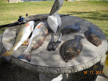
Coastal Barrier (previously known as the Ike Dike) Galveston Bay Update Army Corp. Engineers Statement
I was wrong, and having reassessed the Army Corp of Engineers statement that came out with this new assessment on the Ike Dike (now called coastal barrier), i now support Mr. Stokes and Galveston Bay Foundation in regards to their call on this issue. i was very much against their decision at first. now, after reassessing the Army Corp. statement, and risk factors to the bay there from, i think they should leave well enough alone, i do NOT want to take the risk that are addressed in this new assessment with our precious Galveston, imo.
GALVESTON BAY FOUNDATION
Coastal Barrier Position Statement
Hurricane Ike brought a big storm surge and was catastrophic for many who live or work near Galveston Bay—but a future hurricane could be even bigger and do even more damage. The vulnerability of Industry along the Houston Ship Channel to a large storm surge raises both economic and environmental concerns and may warrant incurring the cost of building a large, expensive storm surge system. However, the placement of large storm surge protection structures in and around the Bay could also present major threats to its natural processes and productivity. It is therefore important to fully evaluate potential impacts to Galveston Bay from any proposed structure and ensure we have mitigated those impacts.
Galveston Bay serves as a nursery for the important commercial and recreational fish and shellfish that so many Texans enjoy eating and provides for a robust economy built around the harvest of shrimp, crabs, finfish, and oysters. In fact, Galveston Bay is one of the most productive estuaries in the country and the most productive in Texas, accounting for a third of both the commercial and recreational harvests of seafood in the state.
A floodgate across the mouth of Bolivar Roads (the pass between Galveston Island and Bolivar Peninsula) could restrict the flow of water in and out of Galveston Bay to and from the Gulf of Mexico. Fewer fish, shrimp, and crabs would float in and out of the Pass. Water flow in the Bay could slow down, meaning there will be less flushing of the Bay. Less salt water entering the Bay means that the Bay’s salinity will decrease. And sediment will fall out of the water column faster because the water will be moving more slowly. This will lead to increased sedimentation in the Houston Ship Channel and throughout the Bay. Major impacts have occurred on many of these parameters in The Netherlands, the location from which much of the structural examples are being drawn.
The U.S. Army Corps of Engineers, in partnership with the Texas General Land Office, began an examination in November 2015 of the feasibility of constructing projects for coastal storm risk management and ecosystem restoration along the Texas coast. The study is scheduled for five and a half years. The length of the study is justified by the fact that a coastal spine on the Texas Coast could be the biggest engineering project contemplated in the United States in the 21st Century. It is essential, that if we move forward on this path, we get it right.
Before any one solution is chosen, all appropriate environmental studies should be completed so that an accurate accounting of all benefits and costs of any structural alternative can be determined. At a minimum, we should understand potential impacts to water quality, circulation, and crabs, shrimp, oysters and fish in the Bay. Should structural components be used to address storm surge, it is imperative that we use the best technology available to minimize restriction of flow through Bolivar Roads. We must also fully mitigate any direct and indirect impacts to the Galveston Bay ecosystem from the construction and operation of such a structure. And to the maximum extent practicable, designers, planners and decision-makers should work with, rather than against nature and seek to keep people and critical infrastructure out of harm’s way through such methods as adoption of strict development and building standards, use of coastal geo-hazard maps, and improved emergency management and evacuation procedures.
If the Corps does move forward with such a project, the total cost for such a structure is estimated to be $12 billion or more. In today’s federal funding climate, even if a good benefit/cost argument is made for the structure, it is not clear funding at that level would ever be appropriated to build the full project. Even if the funding is appropriated, it could be a decade or more to go through all the eminent domain proceedings to condemn land for the project and build the structures.
It is important that we not simply wait to see how this process develops over the next decade, but that we act now to protect our Bay. The most significant driver of a coastal spine is to protect industry along the Houston Ship Channel. We should ensure that industry is as protected and prepared as possible now for a hurricane. Each facility should undertake a risk assessment to determine the potential risk of spills of product from storage tanks during a large hurricane that could flow into local waterways or Galveston Bay. Large storms are predictable events that we can prepare for now. All plants should have a hurricane plan in place and should look at improving their own existing protection or levees. We should also not abandon the idea of building a more affordable flood gate at the upper end of Galveston Bay or in the mid-Bay area. This gate could provide needed protection now while we work towards a more comprehensive coastal barrier. We should also look at constructing levees or gates now in places like the east end of Galveston Island and Clear Lake, that may tie into a larger coastal structure later.
We should get past the idea that this is an all or nothing proposition. Let’s take the appropriate time and money to design, engineer and study a large scale coastal spine before deciding that a large scale coastal spine is the answer. And let’s continue to look at complementary protection measures that can be taken in the short-term to protect the Bay now.
Joint Notice of Availability for the Coastal Texas Protection and Restoration Study Draft Integrated Feasibility Report and Environmental Impact Statement
A Notice by the Engineers Corps on 10/26/2018
This document has a comment period that ends in 73 days. (01/09/2019)
AGENCY: Department of the Army, U.S. Army Corps of Engineers, DoD.
ACTION: Notice of availability.
SUMMARY: Pursuant to the National Environmental Policy Act (NEPA), the U.S. Army Corps of Engineers, Galveston District (USACE) announces the release of the Draft Integrated Feasibility Report and Environmental Impact Statement (DIFR-EIS) for the Tentatively Selected Plan (TSP) of the Coastal Texas Protection and Restoration Study, Texas. The DIFR-EIS documents the existing condition of environmental resources in and around areas considered for development, and potential impacts on those resources as a result of implementing the alternatives.
This public notice is also issued for the purpose of advising all known interested parties that there is pending before the Texas Commission on Environmental Quality (TCEQ) a decision on water quality certification. A copy of the public notice, with a description of work, has been made available for review in the TCEQ's Austin office.
DATES: USACE will accept written public comments on the DIFR-EIS from October 26, 2018 to January 9, 2019. Comments on the DIFR-EIS must be postmarked by January 9, 2019.
ADDRESSES: Public comments can be mailed to: USACE, Galveston District, Attn: Mrs. Jennifer Morgan, Environmental Compliance Branch, Regional Planning and Environmental Center, P.O. Box 1229, Galveston, TX 77553-1229 or emailed to CoastalTexas@usace.army.mil. See website: http://coastalstudy.texas.gov/ for additional information.
FOR FURTHER INFORMATION CONTACT: Mrs. Jennifer Morgan, (409) 766-3131.
SUPPLEMENTARY INFORMATION: Authority: The lead agency for this proposed action is the USACE. This study has been prepared under the standing authority of Section 4091, Water Resources Development Act of 2007, Public Law 110-114. The non-Federal sponsor is the Texas General Land Office.
Background: This DIFR-EIS was prepared as required by the National Environmental Policy Act (NEPA) to present an evaluation of potential impacts associated with the Coastal Texas Protection and Restoration Feasibility Study (Coastal Texas) TSP. The USACE and the non-Federal sponsor for the study, the Texas General Land Office (GLO), have conducted this study and prepared the DIFR-EIS.
The study area for the Coastal Texas Study consists of the entire Texas Gulf coast from the mouth of the Sabine River to the mouth of the Rio Grande, and includes the Gulf and tidal waters, barrier islands, estuaries, coastal wetlands, rivers and streams, borrow sources, and adjacent areas that make up the interrelated ecosystems along the coast of Texas. The study area encompasses 18 coastal counties along the Gulf coast and bayfronts.
This report presents the proposed alternatives that would reduce the risk of storm damage to industries and businesses critical to the Nation's economy and protect the health and safety of Texas coastal communities. The study analyzed alternatives that involved structural and nonstructural measures. Additionally, the report discusses alternatives intended to address critical coastal ecosystems in need of restoration, including wetlands, seagrass beds, sea turtle nesting habitat, piping plover critical habitat, and bird rookery islands, as well as numerous Federal and State wildlife refuges.
Tentatively Selected Plan: The TSP consists of the Coastal Barrier Coastal Storm Risk Management (CSRM) System, South Padre Island CSRM measure, and a comprehensive set of ecosystem restoration (ER) measures. The Coastal Barrier is a risk reduction system made up of the following features: Floodwalls, floodgates, seawall improvements, drainage structures, pump stations, and surge barrier gates. One fundamental feature of the TSP is surge barrier structures that include floating sector gates for navigation traffic and environmental lift gates across the span at Bolivar Roads between Bolivar Peninsula and Galveston Island. The alternative includes four reaches: Eastern Tie-in Reach, Bolivar Peninsula Reach, Galveston Ring Levee/Floodwall Reach, and West Galveston Island Reach in addition to features located at Clear Creek Channel and Dickinson Bayou. The South Padre Island CSRM measure consists of approximately 2.2 miles of dune and beach restoration along the barrier island on the Gulf, including renourishment cycles. The ER component of the TSP has been formulated to address the habitat loss and degradation from coastal processes. ER measures restore and create habitat and support structural CSRM efforts by providing a natural buffer from coastal storms. ER measures proposed in this study include a combination of features formulated in specific geographic locations to restore diverse habitats and coastal features that provide multiple lines of defense against coastal storms and long term coastal processes. Restoration measures include beach and dune complexes, oyster reefs, bird rookery islands, wetland and marsh complexes, and protection of submerged aquatic vegetation.
A final decision will be made following the reviews and higher-level coordination within the USACE to select a plan for feasibility-level design and recommendation for implementation. The decision will be documented in the Final Integrated Feasibility Report (FIFR)-EIS. Coordination with the natural resource agencies will continue throughout the study process.
Project Impacts and Environmental Compliance: Preliminary studies indicate that the recommended plan's surge barrier gates (proposed as features of the Coastal Barrier) may alter wetland functions by constricting tidal exchange and associated sediment transport, altering hydrosalinity gradients, reducing flow into and out of Galveston Bay, and increasing velocities near the gate openings at specific times. The TSP was formulated to reduce the risk of damages from coastal storms as well as avoid disturbance to environmentally significant resources. Where impacts could not be avoided, they were quantified, and a conceptual mitigation plan was formulated. Impacts would be fully compensated with the restoration of palustrine and estuarine emergent marsh in the amount determined during final feasibility planning. The Coastal Barrier would provide a level of protection to tidal and freshwater wetlands north of the barrier location by serving as a physical barrier against Start Printed Page 54097storm surge during coastal storms. The South Padre Island CSRM feature would restore the beach and dune complex; therefore, providing reduced risk to the area while sustaining and increasing beach habitat, and helping preserve existing wetland habitat on the bayside of the measure. Ecosystem restoration measures would restore the natural features of the Texas coast that provide habitat for many Federally threatened and endangered species and State species of concern. These measures will also maintain a natural buffer for upland areas from coastal processes, relative sea level rise (RSLR), and storm surge, while stabilizing the coastline by absorbing energy from waves and vessel wakes.
The DIFR-EIS presents an evaluation of the potential impacts to soils, waterbottoms, water quality, protected wildlife species, benthic organisms, essential fish habitat, coastal barrier resources, air quality, and noise. Additionally, potential impacts to floodplains, flood control, protected/managed lands, and minority or low-income populations have been evaluated. Steps would be taken to avoid, minimize, and mitigate any potential impacts to the best extent practicable. The USACE is proposing to execute a Programmatic Agreement among USACE, the Texas State Historic Preservation Office, and any NFS, in coordination with the Advisory Council on Historic Preservation and Tribal Nations, to address the identification and discovery of cultural resources that may occur during the construction and maintenance of proposed or existing facilities.
Solicitation of Comments: The USACE is soliciting comments from the public, Federal, State, and local agencies, elected officials, Tribal Nations, and other interested parties in order to consider and evaluate the impacts of this proposed activity. Comments will be used in preparation of the FIFR-EIS. Any comments concerning water quality certification may be submitted to the TCEQ, 401 Coordinator, MSC-150, P.O. Box 13087, Austin, Texas 78711-3087.
Meetings: The Galveston District will hold public meetings at 5:30 p.m. for the DIFR-EIS on the following dates and locations: November 27, 2018 at Bauer Community Center, 2300 TX-35, Port Lavaca, TX 77979; November 28, 2018 at Harte Research Institute at Texas A&M Corpus Christi, 6300 Ocean Dr., Corpus Christi, TX 78412; November 29, 2018 at Port Isabel Event & Cultural Center, 309 Railroad Ave., Port Isabel, TX 78578; December 11, 2018 at Winnie Community Building, 335 South Park St., Winnie, TX 77665; December 12, 2018 at Galveston Island Convention Center, 5600 Seawall Blvd., Galveston, TX 77551; and December 18, 2018 at Bay Area Community Center, 5002 E NASA Parkway, Seabrook, TX 77586.
Document Availability: Compact disc copies of the DIFR-EIS are available for viewing at county libraries throughout the 18 county study area. The document can also be viewed and downloaded from the Galveston District website: http://www.swg.usace.army.mil/Business-With-Us/Planning-Environmental-Branch/Documents-for-Public-Review/.
Lars N. Zetterstrom,
Colonel, U.S. Army, Commanding.
[FR Doc. 2018-23450 Filed 10-25-18; 8:45 am]
BILLING CODE 3720-58-P
Planning and Environmental Documents for Public Review
DRAFT COASTAL TEXAS PROTECTION AND RESTORATION FEASIBILITY STUDY - DRAFT INTEGRATED FEASIBILITY REPORT - ENVIRONMENTAL IMPACT STATEMENT (Coastal Texas Study DIFR-EIS)
Public Meeting Information for Coastal Texas Study
You may also submit comments by email address CoastalTexas@usace.army.mil or by mailing to this address:
USACE, Galveston District Attention: Ms. Jennifer Morgan Environmental Compliance Branch, RPEC Post Office Box 1229 Galveston, Texas 77553-1229
Public Review Documents: All comments must be postmarked by January 9, 2019.
snip...see full text;
9/14/17 Terry Singeltary I am extremely disappointed that Mr. Bob Stokes and the GBF caved to the petro chemical industry, on a flimsy notion that the centennial gate will save Galveston Bay. by endorsing this notion when we had momentum finally going for the IKE DIKE after all these years, again, i am extremely disappointed and disturbed by this.
IF anyone thinks that the powers that be, after some 50+ inches of rain or more ever floods Houston again from rain, while 500 gallons or more of gasoline in just one spill, who knows about other spilled fuel, runoff from waste sites, lawn and agricultural fertilizers, pesticides, other pollutants from the regions many other petro chemical plants,enough raw sewage to fill up the grand canyon, that by building the centennial gate @ Fred Hartman bridge and damming up the North end of Galveston Bay and after such a horrible catastrophe such as Tropical Storm Harvey, that the powers that be would ever close those gates and keep them closed with all those poisonous cancer causing toxins up inside Houston, just to save Galveston Bay, well you are dreaming. it will never happen, and the tax payer will suffer just to build a flood gate to only protect the industry, not the people and homes around Galveston Bay.
Houston or Galveston either one does not bat an eye when one of the sewage waste water treatment plants malfunctions and all of that waste is sent down stream into Galveston Bay.
any Centennial Gate must be paid for by the petro chemical industry.
say NO to the Rice Dike and the Centennial Gate.
SAY YES TO THE IKE DIKE THAT MIGHT PROTECT US ALL!
kind regards, terry
IF anyone thinks that the powers that be, after some 50+ inches of rain or more ever floods Houston again from rain, while 500 gallons or more of gasoline in just one spill, who knows about other spilled fuel, runoff from waste sites, lawn and agricultural fertilizers, pesticides, other pollutants from the regions many other petro chemical plants,enough raw sewage to fill up the grand canyon, that by building the centennial gate @ Fred Hartman bridge and damming up the North end of Galveston Bay and after such a horrible catastrophe such as Tropical Storm Harvey, that the powers that be would ever close those gates and keep them closed with all those poisonous cancer causing toxins up inside Houston, just to save Galveston Bay, well you are dreaming. it will never happen, and the tax payer will suffer just to build a flood gate to only protect the industry, not the people and homes around Galveston Bay.
Houston or Galveston either one does not bat an eye when one of the sewage waste water treatment plants malfunctions and all of that waste is sent down stream into Galveston Bay.
any Centennial Gate must be paid for by the petro chemical industry.
say NO to the Rice Dike and the Centennial Gate.
SAY YES TO THE IKE DIKE THAT MIGHT PROTECT US ALL!
kind regards, terry
===
Galveston Bay Foundation GBF has not caved to anyone. We are looking for solutions to a complex problem and are asking for complete environmental studies so that potential solutions do not harm the Bay irreparably. We are open to solutions that employ multiple lines of defense as long as those solutions do not ruin the Bay, and we are open to phasing projects if money and environmental studies (or the lack thereof) dictate. Coastal spine gate structures, regardless of whether the levee alignment is on the wet beach (Ike Dike), on raised existing roads (SSPEED), or near the roads (GCCPRD), can have profound negative effects on the Bay's fish and crab populations and on its ecology. The gates will effectively reduce the width of Bolivar Roads by about one half, changing water velocities, currents, and turbulence in the pass and possibly the movement of species such as redfish, flounder, shrimp, and blue crab as they make their way to the passes and to and from the Gulf to reproduce. NO ONE knows the effects on living species or the Bay ecology at the present time. The burden of proof is on the proponents of massive structural solutions to the storm surge threat.
===
10/28/18 Terry Singeltary Galveston Bay Foundation i was wrong, and have reassessed this issue with after the Army Corp of Engineers came out with this new assessment on the Ike Dike (now called coastal barrier), i support Mr. Stokes and Galveston Bay Foundation in regards to their call on this issue...i think they should leave well enough alone, i do NOT want to take the risk that are addressed in this new assessment with our precious Galveston, imo. Bacliff, Texas 77518 Galveston Bay
FRIDAY, SEPTEMBER 15, 2017
GBF Stokes Caves to Petro Chemical Industry abandons Ike Dike for Centennial gate: Cost must be considered in building storm surge barrier
Terry S. Singeltary Sr.
