DICKINSON
BAYOU NEEDS TO BE SAVED, NO MORE TREATED OR NON TREATED WATER DISCHARGE
PERMITS
Workshop
to look at efforts to protect, improve Dickinson Bayou
By Annette Baird
Updated 1:10 pm, Tuesday, July 14, 2015
The almost 23-mile-long Dickinson Bayou with its numerous tributaries,
including Gum Bayou, Cedar Creek and associated wetlands play a vital role in
the area's ecosystem as well as providing recreational activities such as
fishing, canoeing and swimming.
But the 100-square-mile watershed, from which water flows into Dickinson
and Galveston bays, has been tested with unacceptably high levels of bacteria,
posing possible health and environmental risks.
Livestock, faulty septic systems, agricultural activities, urban run-off
and waste from pets and wildlife such as feral hogs have pushed bacteria levels
upward, according to the Texas Commission on Environmental Quality.
Water-quality experts hope to increase awareness of the pollution and how
to reduce it through an upcoming workshop to educate residents, educators and
professionals such as geoscientists about what they can do to protect, preserve
and restore water quality in the watershed and bayou.
Texas A&M AgriLife Extension Service in cooperation with Clear Creek
Independent School District will host the Texas Watershed Steward workshop from
8 a.m. to noon July 21 at Clear Falls High School, 4380 Village Way, in League
City.
The workshop will include an overview of water quality and watershed
management in Texas but will primarily focus on area water quality issues,
including current efforts to improve and protect Dickinson Bayou. There will be
a discussion of watershed systems, types and sources of water pollution and ways
to improve water quality, as well as a group discussion on community-driven
watershed protection and management.
"We want to educate people about the best management practices," said
Michael Kuitu, AgriLife Extension program specialist and coordinator for the TWS
program, which is funded through a Clean Water Act grant from the Texas State
Soil and Conservation Board and the Environmental Protection Agency.
Kuitu said pollution from industrial facilities is easier to identify and
monitor, whereas pollution from other sources is much more difficult to
address.
He said the amount of bacteria varies depending on numerous factors such as
rainfall levels.
"We look at measurements to see how they trend over time," Kuitu
said.
The workshop is part of a four-day summer training program about awareness
of watersheds and wetlands for educators in Clear Creek ISD.
Terri Berry, the district's secondary science coordinator, said the
workshop aligns with the district's science curriculum and supports what
teachers are doing at the district's retention pond and wetlands site, created a
few years ago behind Education Village on Village Way.
Berry said the training program as a whole will give teachers a deeper
understanding of water stewardship so that they can help their students make the
most of work with the retention facility and help instill a desire to improve
and preserve wetlands areas where they live.
"We are trying to create awareness of the watershed and how what you do in
your yard and at your house can influence a huge area," Berry said.
The free workshop provides an opportunity to earn continuing education
credits for professionals, including engineers, certified crop advisers,
certified planners, landscape architects, professional geoscientists, Texas
Department of Agriculture pesticide license holders, certified teachers,
certified floodplain managers and some TCEQ occupational license holders.
To register for the workshop, visit tws.tamu.edu/workshops/registration.
The almost 23-mile-long Dickinson Bayou with its numerous tributaries,
including Gum Bayou, Cedar Creek and associated wetlands play a vital role in
the area's ecosystem as well as providing recreational activities such as
fishing, canoeing and swimming.
But the 100-square-mile watershed, from which water flows into Dickinson
and Galveston bays, has been tested with unacceptably high levels of bacteria,
posing possible health and environmental risks.
Livestock, faulty septic systems, agricultural activities, urban run-off
and waste from pets and wildlife such as feral hogs have pushed bacteria levels
upward, according to the Texas Commission on Environmental Quality.
what about the industry’s along Dickinson bayou that get permits to dump
more pollution into a water way that is already polluted ?
what about the ones that are already there ?
enough is enough.
what about the dredging that HL&P or HP Robbinson was suppose to do to
keep the mouth of Dickinson Bayou open, so that Bayou could flush?
what about the inlet and outlet that use to flow water through the power
plant, that drained Dickinson bayou to the Bacliff Side and helped the water
oxygen levels when it was flowing, now it’s dead and filled in, what happened
there?
who’s asleep at the wheel?
Terry S. Singeltary Sr.
Clean Harbors San Leon, Inc. 2700 Avenue S. San Leon, Texas 77539
PERMIT NO. WQ0004086000
Location of facility
http://www.tceq.texas.gov/assets/public/hb610/index.html?lat=29.469722&lng=-94.966666&zoom=13&type=r
SEE ALSO ;
REFERENCES AND HISTORY
From: Roger Miranda
Sent: Friday, August 30, 2013 4:28 PM
To: Terry S. Singeltary Sr.
Cc: mailto:cyork@tamu.edu ; Linda Broach
Subject: RE: NOTICE OF REQUEST FOR PUBLIC COMMENT AND NOTICE OF A PUBLIC
MEETING FOR AN IMPLEMENTATION PLAN TO ADDRESS BACTERIA IN DICKINSON BAYOU AND
THREE TIDAL TRIBUTARIES
Dear Mr. Singeltary,
We have received your comment. It will be accepted as part of public
comment on the Dickinson Bayou and Tidal Tributaries Bacteria TMDL I-Plan and
you will receive a response from the TCEQ after the end of the Public Comment
Period.
Also, please feel free to contact me anytime.
Sincerely,
Roger Miranda, P.G. Texas Commission on Environmental Quality MC203 P.O.
BOX 13087 Austin, Texas 78711-3087 (512) 239-6278 (voice) (512) 239-1414 (fax)
Roger.Miranda@tceq.texas.gov
NOTICE OF REQUEST FOR PUBLIC COMMENT AND NOTICE OF A PUBLIC MEETING FOR AN
IMPLEMENTATION PLAN TO ADDRESS BACTERIA IN DICKINSON BAYOU AND THREE TIDAL
TRIBUTARIES
Singeltary Comment ;
The TCEQ efforts to bring back quality water, instead of polluted water to
the Dickinson Bayou and it’s Tributaries, are greatly appreciated. However, I
think it all will be futile, IF the Dickinson Bayou is not dredged out to where
the water can flow freely with the tidal movements.
We all know that Dickinson Bayou is and has been blocked up for some time.
Dickinson Bayou is like peeing in your own bathtub. eventually, you have to pull
the plug. the water has been bad for some time due to not much tidal movement in
and out of the spillway inlet and outlet. Via the FOIA, I received the HL&P
construction permits back in the 60’s, and the dredging that the Army Corp of
engineers said would come, and be maintained constantly, never happened. This
constant maintaining of a dredge was to be done all the way to the ship channel,
to prevent just what has happened, and it says so in the permit. In my opinion,
all the precautions put forth in this plan, will be futile and for nothing, IF
this dredge is not finally done, and I mean properly, all the way to the ship
channel, as was stipulated in the permit, and maintained. just look at the
problems in the past we have had with flounder fish kills along the Bacliff and
San Leon Shore Lines, and fish kills inside of Dickinson Bayou. something is
wrong, something has been wrong for years, and I believe that due to Dickinson
Bayou not being dredged and maintained properly, to allow for a maximum flow, by
HL&P is/was a cause to a great many of our problems in Dickinson Bayou, and
surrounding waters. I also believe that HL&P should foot the total bill for
this, or the Army Corp of engineers, for not making sure HL&P maintained the
dredge over the past 5 decades or so. ...
Thank You,
Kindest Regards,
Terry S. Singeltary Sr. P.O. Box 42 Bacliff, Texas 77518
flounder9@verizon.net
==============================================
Executive Summary
On February 8th, 2012, the Texas Commission on Environmental Quality (TCEQ)
adopted Eight Total Maximum Daily Loads for Indicator Bacteria in Dickinson
Bayou and Three Tidal Tributaries (Segments 1103, 1103A, 1103B, 1103C, 1104).
The U.S. Environmental Protection Agency (EPA) approved the total maximum daily
loads (TMDLs) on June 6th, 2012. This Implementation Plan (I-Plan) de-scribes
the strategy and activities watershed stakeholders and the TCEQ will carry out
to improve water quality in Dickinson Bayou and three of its tidal
tributaries.
This I-Plan is based on the TMDL report and its subsequent revisions, which
are documented in updates to the state’s Water Quality Management Plan (WQMP).
The TMDL identified potential regulated and unregulated sources of indicator
bac-teria. Regulated dischargers in the Dickinson Bayou watershed include
domestic wastewater treatment facilities, sanitary sewer overflows, industrial
facilities, a municipal solid waste facility, and regulated stormwater
dischargers. Potential un-regulated bacteria sources identified in the TMDL
include livestock, wildlife, exotic animals, domestic pets, and malfunctioning
on-site sewage facilities.
This implementation plan, or I-Plan:
describes the steps watershed stakeholders and the TCEQ will take to
achieve the pollutant reductions necessary to restore and protect water
quality,
identifies the means by which these activities will be implemented,
outlines the schedule for implementation of these activities, and
describes how stakeholders and the TCEQ will track implementation of
these activities and monitor improvements in water quality.
The ultimate goal of this I-Plan is the reduction of bacteria
concentrations in each of the assessment units of Dickinson Bayou Tidal (Segment
1103), Bensons Bayou (1103A), Bordens Gully (1103B), and Geisler Bayou (1103C)
and Dickinson Bayou Above Tidal (Segment 1104) to levels that meet the criteria
defined in the state wa-ter quality standards to support contact
recreation.
In concert with the TCEQ, the stakeholders of the Dickinson Bayou watershed
de-veloped seven management measures and four control actions that will be used
to reduce bacteria contributions.
Implementation Plan for Eight TMDLs for Dickinson Bayou and Three Tidal
Tributaries
Texas Commission on Environmental Quality 2 For Public Comment, September
2013
Management Measures (Voluntary Activities)
1) Improve management of on-site sewage facilities (OSSFs).
2) Improve wastewater treatment facilities (WWTFs).
3) Promote increased participation in existing conservation and cost-share
pro-grams.
4) Restore and repair riparian zones.
5) Preserve and restore natural wetlands.
6) Construct treatment wetlands.
7) Provide demonstrations and encourage installation of stormwater best
man-agement practices including rain gardens, bioswales, and rain water
harvesting.
Control Action (Regulatory Activities)
1) Implement stricter bacteria limits and stricter enforcement measures for
WWTF effluents.
2) Increase compliance and enforcement by the TCEQ.
3) Revise penalties and violations for sanitary sewer system (SSSs) and
WWTFs.
4) Improve reporting requirements for sanitary sewer overflows
(SSOs).
This I-Plan identifies responsible parties, technical and financial needs,
monitoring and outreach efforts, and a schedule of activities for each
management measure and control action. It describes the process that the TCEQ
and stakeholders will use to assess progress and adjust the plan
periodically.
The TCEQ will track the progress of this I-Plan in restoring the affected
use. Water quality data will be collected for five years to identify trends and
compliance with the water quality standards. If standards are not attained by
the end of the moni-toring period, the TCEQ and watershed stakeholders should
reevaluate the TMDL and the I-Plan and take appropriate action. The TCEQ will
report the results of im-plementation tracking and evaluation on its web site,
at regional forums and to stakeholders as needed.
Introduction
snip...
From: Terry S. Singeltary Sr. [mailto:flounder9@verizon.net]
Sent: Friday, August 30, 2013 2:49 PM
To: cyork@tamu.edu Cc: Roger Miranda; Linda Broach
Subject: NOTICE OF REQUEST FOR PUBLIC COMMENT AND NOTICE OF A PUBLIC
MEETING FOR AN IMPLEMENTATION PLAN TO ADDRESS BACTERIA IN DICKINSON BAYOU AND
THREE TIDAL TRIBUTARIES
From: Terry S. Singeltary Sr.
Sent: Friday, August 30, 2013 2:40 PM
To: rules@tceq.texas.gov
Subject: NOTICE OF REQUEST FOR PUBLIC COMMENT AND NOTICE OF A PUBLIC
MEETING FOR AN IMPLEMENTATION PLAN TO ADDRESS BACTERIA IN DICKINSON BAYOU AND
THREE TIDAL TRIBUTARIES
please accept my comment...kind regards, terry
From: Terry S. Singeltary Sr.
Sent: Friday, August 30, 2013 12:56 PM
To: tmdl@tceq.texas.gov
Cc: Roger.Miranda@tceq.texas.gov
Subject: NOTICE OF REQUEST FOR PUBLIC COMMENT AND NOTICE OF A PUBLIC
MEETING FOR AN IMPLEMENTATION PLAN TO ADDRESS BACTERIA IN DICKINSON BAYOU AND
THREE TIDAL TRIBUTARIES
NOTICE OF REQUEST FOR PUBLIC COMMENT AND NOTICE OF A PUBLIC MEETING FOR AN
IMPLEMENTATION PLAN TO ADDRESS BACTERIA IN DICKINSON BAYOU AND THREE TIDAL
TRIBUTARIES
The Texas Commission on Environmental Quality (TCEQ or commission) has made
available for public comment a draft Implementation Plan for Eight Total Maximum
Daily Loads for Indicator Bacteria in Dickinson Bayou and Three Tidal
Tributaries.
The purpose of the public meeting is to provide the public an opportunity
to comment on the draft Implementation Plan for Eight Total Maximum Daily Loads
(TMDLs) for Indicator Bacteria in Dickinson Bayou and Three Tidal Tributaries in
Brazoria and Galveston Counties.
The Implementation Plan is a flexible tool that governmental agencies and
non-governmental organizations involved in TMDL implementation will use to guide
their program management. The commission requests comment on each of the major
components of the Implementation Plan: description of control actions and
management measures, implementation strategy and tracking, review strategy, and
communication strategy. After the public comment period, TCEQ may revise the
draft Implementation Plan, if appropriate. The final Implementation Plan will
then be considered for approval by the commission. Upon approval of the
Implementation Plan by the commission, the Implementation Plan will be made
available on the TCEQ Web site.
A public comment meeting for the draft Implementation Plan will be held on
September 12, 2013, at 6:30 p.m., at City of Dickinson, City Council Chambers,
4403 Highway 3, Dickinson, Texas 77539.
At this meeting, individuals have the opportunity to present oral
statements when called upon in order of registration. An agency staff member
will give a brief presentation at the start of the meeting and will be available
to answer questions before and after all public comments have been received.
Written comments should be submitted to Roger Miranda, Water Quality Planning
Division, Texas Commission on Environmental Quality, MC 203, P.O. Box 13087,
Austin, Texas, 78711-3087 or faxed to (512) 239-1414. Comments may be submitted
electronically to www5.tceq. texas.gov/rules/ecomments by midnight on October 7,
2013, and should reference the Implementation Plan for Eight Total Maximum Daily
Loads for Indicator Bacteria in Dickinson Bayou and Three Tidal
Tributaries.
For further information regarding the proposed Implementation Plan, please
contact Roger Miranda at (512) 239-6278 or Roger.Miranda@tceq.texas.gov. Copies
of the draft Implementation Plan will be available and can be obtained via the
commission's Web site at:
www.tceq.texas.gov/implementation/water/tmdl/tmdlnews.html or by calling (512)
239-6682.
Persons with disabilities who have special communication or other
NOTICE OF REQUEST FOR PUBLIC COMMENT AND NOTICE OF A PUBLIC MEETING FOR AN
IMPLEMENTATION PLAN TO ADDRESS BACTERIA IN DICKINSON BAYOU AND THREE TIDAL
TRIBUTARIES
Adopted February 8, 2012Approved by EPA June 6, 2012
Implementation Plan for Eight Total Maximum Daily Loads for Indicator
Bacteria in Dickinson Bayou and Three Tidal Tributaries
http://www.tceq.texas.gov/assets/public/waterquality/tmdl/80dickinsonbac/80-dickinsonTMDLadopted.pdf
Adopted February 8, 2012 Approved by EPA June 6, 2012
Implementation Plan for Eight Total Maximum Daily Loads for Indicator
Bacteria in Dickinson Bayou and Three Tidal Tributaries
http://www.tceq.texas.gov/assets/public/waterquality/tmdl/80dickinsonbac/80-dickinsonTMDLadopted.pdf
Greetings TCEQ et al,
I would kindly like to comment on this NOTICE OF REQUEST FOR PUBLIC COMMENT
AND NOTICE OF A PUBLIC MEETING FOR AN IMPLEMENTATION PLAN TO ADDRESS BACTERIA IN
DICKINSON BAYOU AND THREE TIDAL TRIBUTARIES, and my comments are as follows.
please be advised that I tried submitting this comment to ;
it said it would not accept any html, Error Message: Please do not use HTML
in the body of your comments.
and even after removing all the html links, the form still would not let me
submit. so I submit my comments to you as follows ;
NOTICE OF REQUEST FOR PUBLIC COMMENT AND NOTICE OF A PUBLIC MEETING FOR AN
IMPLEMENTATION PLAN TO ADDRESS BACTERIA IN DICKINSON BAYOU AND THREE TIDAL
TRIBUTARIES
Singeltary Comment ;
The TCEQ efforts to bring back quality water, instead of polluted water to
the Dickinson Bayou and it’s Tributaries, are greatly appreciated. However, I
think it all will be futile, IF the Dickinson Bayou is not dredged out to where
the water can flow freely with the tidal movements.
We all know that Dickinson Bayou is and has been blocked up for some time.
Dickinson Bayou is like peeing in your own bathtub. eventually, you have to pull
the plug. the water has been bad for some time due to not much tidal movement in
and out of the spillway inlet and outlet. Via the FOIA, I received the HL&P
construction permits back in the 60’s, and the dredging that the Army Corp of
engineers said would come, and be maintained constantly, never happened. This
constant maintaining of a dredge was to be done all the way to the ship channel,
to prevent just what has happened, and it says so in the permit. In my opinion,
all the precautions put forth in this plan, will be futile and for nothing, IF
this dredge is not finally done, and I mean properly, all the way to the ship
channel, as was stipulated in the permit, and maintained. just look at the
problems in the past we have had with flounder fish kills along the Bacliff and
San Leon Shore Lines, and fish kills inside of Dickinson Bayou. something is
wrong, something has been wrong for years, and I believe that due to Dickinson
Bayou not being dredged and maintained properly, to allow for a maximum flow, by
HL&P is/was a cause to a great many of our problems in Dickinson Bayou, and
surrounding waters. I also believe that HL&P should foot the total bill for
this, or the Army Corp of engineers, for not making sure HL&P maintained the
dredge over the past 5 decades or so. ...
Thank You,
Kindest Regards,
Terry S. Singeltary Sr. P.O. Box 42 Bacliff, Texas 77518
flounder9@verizon.net
Tuesday, January 8, 2013
Dickinson Bayou: A TMDL Project and Use Assessment for Bacteria Troubled
Waters
Dickinson Bayou: A TMDL Project and Use Assessment for Bacteria
Saturday, August 11, 2012
Galveston County BACLIFF TEXAS FLOUNDER FISH KILL MASSIVE AUGUST 11, 2012
(see video of the dead flounder floating)
VIDEO FLOUNDER KILL
Galveston County BACLIFF TEXAS FLOUNDER FISH KILL MASSIVE AUGUST 11, 2012
see video of massive flounder kill with Seabreeze article September 6, 2012
; Thousands of Flounder Killed on San Leon Bacliff Shoreline (AGAIN)
additional sources for flounder kill video;
September 6, 2012
Thousands of Flounder Killed on San Leon Bacliff Shoreline (AGAIN)
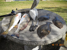
There was a major flounder kill on August 12th, 2012. Flounder up to 4
pounds were floating down the shoreline of the San Leon/Bacliff area. “This is
the 6th year in a row that this has happened” said angry Bacliff resident, Terry
Singletary. He said, “I’ve reported it to the Texas Parks and Wildlife in 2010,
2011 and of course this year in 2012. It is not the red tide.” I agree with him.
He also reported it to the Galveston Bay Foundation. Their representative told
Singletary that they were very concerned and that they would look into it. As of
press time, he has not heard back from them.
The only thing killed and floating this year again was thousands of
flounder. The red tide kills a variety of fish. Mr. Singletary reported to the
Seabreeze, along with resident Robert Redfield last year, and we reported on it.
This year Singletary reported it to the Texas Parks and Wildlife in Dickinson
and also to the T.P & W. laboratory on Todville Road. He has pictures and
videos. He talked to the Dickinson office of Texas Parks and Wildlife on August
14th and on the same day he sent them pictures and a video. Three days later
they returned his call. They tried to convince him, like they did in 2010, that
it is a blue algae bloom. Singletary asked them if they saw the video. The
biologist said they have not even looked at it. He called the laboratory on
Todville and they did not even want him to send them the video. The lady said,
“If we want to look at the video we will ask you for it at a later date.” Two
weeks later they are still not interested.
The flounder kill appears to have started around the HL&P Spillway
mouth dumping into Galveston Bay. This morning as this paper was being printed,
I was in my boat with a representative from an independent lab catching mud
samples from each end of the H.L.& P. canal. We do not know where the
contamination is coming from but at least we are doing something about it unlike
the Texas Parks and Wildlife who are once again sitting on their ass doing
nothing.
As we reach press time, September the 5th, we are waiting on the results of
these samples. We already know that the H.L.&P. canal was not dug to the
specifications of the original permit. The canal was required to tie into
Dickinson Bayou on one end and they were to dig the Bayou out wide and 18 feet
deep all the way to the channel. This side called the “inlet” side of the canal
was not properly dug according to the permit. Two miles up from the Dickinson
Bayou bridge, the bayou runs 20 feet deep or more. On the “Bay” side of the
Dickinson Bayou bridge it averages 8 feet in depth. As anybody should know,
water does not run uphill. So, all containments would stay in the bayou unable
to escape. A good question would be who was overseeing the digging of the
H.L.&P. canal and why did no one catch this colossal mistake? Or was it a
mistake at all?
As of this time we have not jumped to any conclusions and we are not saying
that the canal is at fault for the flounder kills. We will have to wait until
the sample results are returned.
Dickinson Bayou is almost completely dead. The state has posted signs at
all boat ramps saying do not eat fish from this bayou or swim in the water. Does
this sound like a healthy vibrant bayou to you? We have been fighting a new
sewer plant proposed to dump an additional one million gallons per day of
treated water into Dickinson Bayou. Do you think this bayou can take any more
abuse and survive? What do you readers think of this? Your comments would be
greatly appreciated.
We will be reporting on this next month as we know more.
Steve
On May 10, 1972, Mr. D. E. Simmons, Vice President of Environmental and
Inter-Utility Affairs for Houston Lighting and Power stated in writing to the
Corp of Engineers that
"continued maintenance is planned." In response, the Corp of Engineers
issued a Public Notice on November 9, 1972 announcing plans for the HL&P
proposals which included the obligation for the utility company to perform
continued maintenance dredging. It was understood and agreed upon that the
utility would maintain the canal by periodically dredging it and the adjoining
bayou, in order to prevent what has now happened. As stated earlier, no such
dredging has ever been performed since that 1972 statement. Due to the fact that
the dredging maintenance was never performed, the HL&P canal and Dickinson
Bayou have both filled in on the ends. This has caused what is called a
''Hydraulic Effect". Hydraulic Effect on Dickinson Bayou means the bayou is
twenty-five to thirty feet deep until it gets close to the bay where it shoals
to just six or eight feet. That that the bayou cannot ever flow correctly and
get properly flushed out. All of the sediment from runoff collects into the mud
of the bayou (ie: fertilizer, pesticides, and the waste from the sewer plants.)
If the mouth of this bayou and both sides of the HL&P canal were continually
dredged as stipulated in the original permit, this hydraulic effect would not be
in play. If the bayou was dredged as stipulated in the permit, the lab analyst
said that Dickinson Bayou would healing itself immediately. He said, "Mother
Nature will eat up all the black muck with natural bacteria once there is a
normal oxygen level and good tidal flow. This applies to the canal as
well.
Dickinson Bayou and the shoreline can be fixed. It can be a vibrant,
aquatic productive estuary once again. Dolphins, alligators, and all manner of
wildlife once lived there. The reason our bayou has died is because someone
didn't do what they said they were going to do, what they were in fact obligated
to do legally.
Who is responsible for this major screw-up? I believe it is a combination
of HL&P not doing the dredging they agreed to do, and the Army Corps of
Engineers not verifying that work was performed. It all has to do with money. We
have put all of the documentation on our web site. To see the flounder kill
video and copies of the permits and the drawings of the proposed dredging that
was never done please visit ; www.SeabreezeNews.com/bayou
You do not need to be a subscriber to see this information.
A special thanks to Terry Singeltary of Bacliff for all of his help and
support. Also, thanks to Texas A&M Galveston Marine Biology Department for
their input. We are not finished with our investigation. Look for continued
coverage in the next issue of the Seabreeze News. We will be in contact with the
Galveston Bay Foundation and their attorney, seeking their knowledge and
expertise.
We hope to find some way to open up Dickinson Bayou and both sides of the
HL&P canal in order to facilitate the healing and restoration of our bayou
and shorelines, as was expressly promised in the contract.
I have never been a ''tree hugger", but we cannot stand by and allow our
coastal waters to be destroyed in the name of the almighty dollar, especially
when the solution to the main problem is so simple. If you have any information
to share or "comments please write us at the Seabreeze News or send an email to:
steve@Seabreezenews.com. Steve Hoyland Sr. www.SeabreezeNews.com Spillway inlet
outlet canal Permit 5972 Hwy 146 Bacliff Texas pdf file HL&P HP ROBINSON
Spillway inlet outlet canal Permit 5972 Hwy 146 Bacliff Texas pdf file
Department of the Army December 9, 1963
August 6, 2010
Got Flounder? Not in San Leon.
During the month of July, flounder and stingray have been floating up dead
all along the San Leon/Bacliff shoreline on the north side. Our freelance
reporter, Terry Singeltary, ob- served dead flounder floating by in groups of
twos and three's with an occasional five or six. These are big, mature flounder,
from two to seven pounds. Along with these flounder, dead stingrays have been
seen floating by. Mr. Bobby Redfield, who lives on Bayshore Drive, also observed
the same thing and gave me a call. This went on for several days. We received
eight more calls where someone people left messages regarding dead flounder
floating around the spillway, but did not leave their names and numbers. Our
reporter contacted Lance Robinson, the Texas Parks and Wildlife Biologist
located at the Dickinson office and expressed his concern about the destruction
of these fish. Mr. Robinson said that they were aware of this problem and knew
the cause. It turns out that a water treatment plant in the Bacliff area has a
discharge pipeline that dumps into the HL&P outlet canal and goes out by way
of the spillway and follows the tide. Since there is no longer any pressured
flow discharging from HL&P, the chemicals from this treated water build up,
removing all of the oxygen from the bottom of the water along the shoreline. The
fish that live on the bottom of the bay, like flounder and stingray, cannot
survive. This has been going on for years and has not been addressed. With the
three sewer plants dumping into Dickinson Bayou and the de- pletion of flounder
it makes you wonder why anyone in their right mind would want to put another
sewer plant dumping into our precious, fragile resources. Mr. Robinson said they
were having a meeting on this very subject. The meeting was to take place one
week ago from this newspaper printing. Our reporter has put a call in to Mr.
Robinson three days prior to this publication and at this time has not been
called back. Maybe the Texas Parks and Wildlife has to contact the CCA and ask
them how they should handle it. As we know more, you will know more. Do you
fisherman ever wonder why there may be a shortage of flounder? With all of the
sewer plants up and down the Texas coast dumping water treatment chemicals into
our bays, creeks, rivers, bayous, estuaries, it's no wonder that the flounder
are disappearing. What are you going to do about it Texas Parks & Wildlife?
Are you going to keep cutting back the limits with the fisherman until you stop
fishing for flounder forever, or are you actually going to address the problem?
It's time for you Texas fishermen to wake up and let your voices be heard.
Subject: The TCEQ Proposes Removal of Two Pollutants from the
Texas City APWL Area--Benzene and Hydrogen Sulfide
The TCEQ Proposes
Removal of Two Pollutants from the Texas City APWL
Area--Benzene and Hydrogen Sulfide
Central Registry Query - Regulated Entity Information
Regulated Entity Information
RN Number: RN100890235 Name: DURATHERM View Prior Names Primary Business:
STORMWATER INDUSTRIAL
Street Address: 2700 AVENUE S, SAN LEON TX 77539
County: GALVESTON Nearest City: TEXAS CITY State: TX Near ZIP Code: 77539
Physical Location: INTX OF 27TH AND AVENUE S ABOUT .75 MI OF HWY 146 IN SAN LEON
2700 AVENUE S SAN LEON KEY MAP 661Y
--------------------------------------------------------------------------------
Affiliated Customers - Current
Your Search Returned 3 Current Affiliation Records (View Affiliation
History) 1-3 of 3 Records
CN Number
Customer Name
Customer Role
Details
CN600564165 DURATHERM INC OWNER OPERATOR Affiliation Info CN600564165
DURATHERM INC OWNER OPERATOR Affiliation Info CN603349820 DURATHERM ASSET
ACQUISITION CORP OWNER OPERATOR Affiliation Info
--------------------------------------------------------------------------------
Industry Type Codes
Code
Classification
Name
562211 NAICS Hazardous Waste Treatment and Disposal 1311 SIC Crude
Petroleum and Natural Gas 4953 SIC Refuse Systems 9999 SIC Nonclassifiable
Establishments
--------------------------------------------------------------------------------
Permits, Registrations, or Other Authorizations
There are a total of 18 programs and IDs for this regulated entity. Click
on a column name to change the sort order. 1-18 of 18 Records
Program
ID Type
ID Number
ID Status
AIR EMISSIONS INVENTORY ACCOUNT NUMBER GB0101M ACTIVE AIR NEW SOURCE
PERMITS ACCOUNT NUMBER GB0101M ACTIVE AIR NEW SOURCE PERMITS AFS NUM 4816700042
ACTIVE AIR NEW SOURCE PERMITS PERMIT 7237 CANCELLED AIR NEW SOURCE PERMITS
REGISTRATION 14291 ACTIVE AIR NEW SOURCE PERMITS REGISTRATION 85676 ACTIVE AIR
NEW SOURCE PERMITS REGISTRATION 87443 ACTIVE IHW CORRECTIVE ACTION SOLID WASTE
REGISTRATION # (SWR) 34814 INACTIVE INDUSTRIAL AND HAZARDOUS WASTE EPA ID
TXD981053770 ACTIVE INDUSTRIAL AND HAZARDOUS WASTE PERMIT 50355 ACTIVE
INDUSTRIAL AND HAZARDOUS WASTE SOLID WASTE REGISTRATION # (SWR) 34814 ACTIVE
POLLUTION PREVENTION PLANNING ID NUMBER P03840 ACTIVE PUBLIC WATER SYSTEM/SUPPLY
REGISTRATION 0840217 ACTIVE USED OIL EPA ID TXD981053770 ACTIVE USED OIL
REGISTRATION A86130 ACTIVE WASTEWATER EPA ID TX0117757 ACTIVE WASTEWATER PERMIT
WQ0004086000 ACTIVE WATER LICENSING LICENSE 0840217 INACTIVE
Central Registry
Detail of:Industrial and Hazardous Waste Permit 50355
For: DURATHERM (RN100890235)
2700 AVENUE S, SAN LEON Permit Status: ACTIVE
View Earlier Holders
--------------------------------------------------------------------------------
Related Information:
Commissioners' Actions Correspondence Tracking Effective Enforcement Orders
Central Registry
Detail of:Industrial and Hazardous Waste Permit 50355
For: DURATHERM (RN100890235)
2700 AVENUE S, SAN LEON Permit Status: ACTIVE
--------------------------------------------------------------------------------
Effective Enforcement Orders Current TCEQ Rules
Type
Effective Date
Docket Number
Citation/Requirement Provision
Violation Allegation
Classification
ADMINISTRATIVE ORDER 09/29/2012 2012-0236-MLM-E 40 CFR Chapter 279,
SubChapter I, PT 279, SubPT E 279.51 ; 40 CFR Chapter 279, SubChapter I, PT 279,
SubPT E 279.73 ; 30 TAC Chapter 324, SubChapter A 324.12(2) (Not applicable to
CH) Failed to obtain a used oil registration and EPA ID. No. prior to conducting
used oil activities, in violation of 30 TEX. ADMIN. CODE § 324.12(2) and 40 CFR
§§ 279.51 and 279.73, as documented during an investigation conducted on
September 29, 2011. MODERATE ADMINISTRATIVE ORDER 09/29/2012 2012-0236-MLM-E 40
CFR Chapter 262, SubChapter I, PT 262, SubPT B 262.20 ; 30 TAC Chapter 335,
SubChapter F 335.152(a)(4) ; PERMIT II-C-1-h (Not applicable to CH) Failed to
use a new manifest for rejected wastes, in violation of 30 TEX. ADMIN. CODE §
335.152(a)(4) and 40 CFR § 262.20 and IHW Permit No. 50355, Provision No.
II-C-1-h, as documented during an investigation conducted on September 29, 2011.
Specifically, waste manifests 005440020 JJK, 005373755 JJK, and 006442062 JJK
were received and partially rejected, then sent back to generator without a new
manifest MODERATE ADMINISTRATIVE ORDER 09/29/2012 2012-0236-MLM-E 40 CFR Chapter
264, SubChapter I, PT 264, SubPT CC 264.1089(b) ; 40 CFR Chapter 265, SubChapter
I, PT 265, SubPT CC 265.1090(b) ; 30 TAC Chapter 335, SubChapter E
335.112(a)(21) ; 30 TAC Chapter 335, SubChapter F 335.152(a)(19) (Not applicable
to CH) Failed to record inspections of the air emission control equipment, in
violation of 30 TEX. ADMIN. CODE §§ 335.112(a)(21) and 335.152(a)(19) and 40 CFR
§§ 264.1089(b) and 265.1090(b), as documented during an investigation conducted
on September 29, 2011. Specifically, the Respondent did not maintain a record of
the Subpart CC tank inspections for olfactory odors and visual observations.
MODERATE ADMINISTRATIVE ORDER 09/29/2012 2012-0236-MLM-E 40 CFR Chapter 264,
SubChapter I, PT 264, SubPT J 264.193(e)(1)(iii) ; 30 TAC Chapter 305,
SubChapter F 305.125 ; 30 TAC Chapter 335, SubChapter F 335.152(a)(8) ; PERMIT
II-C-2-h ; PERMIT V-B-3 (Not applicable to CH) Failed to maintain secondary
containment free of gaps and cracks,Specifically, secondary containment A for
tanks PV-18 through PV-21 had a concrete coating crack about four feet long near
PV-20. Secondary containment A-1 for tanks FPV-31, the containment wall
indicated some erosion and the wall edge joining the concrete base had a gap of
approximately two inches. Also, the secondary containment for container storage
area ("CSA")-2 Roll-off area, NOR Unit 044, Permitted unit 01, MODERATE
ADMINISTRATIVE ORDER 09/29/2012 2012-0236-MLM-E 30 TAC Chapter 335, SubChapter A
335.2(b) ; PERMIT IV-A and IV-B (Not applicable to CH) Failed to prevent the
acceptance of a shipment of unauthorized hazardous waste at the Facility, in
violation of 30 TEX. ADMIN. CODE § 335.2(b) and IHW Permit No. 50355, Provision
Nos. IV-A and IV-B, as documented during an investigation conducted on September
29, 2011. Specifically, the Respondent accepted and processed a shipment of
corrosive hazardous waste (hazardous waste code D002) that the Facility was not
authorized to accept and process. MODERATE
Complaints
Complaint Tracking #: Glossary of Terms 158471
Complaint Received Date: 08/25/2011 Number Complaining: 1
Status: Glossary of Terms CLOSED Status Date: Glossary of Terms 11/08/2011
Nature: Glossary of Terms INDUSTRIAL Frequency: Glossary of Terms CURRENT
Duration: Glossary of Terms ACTUAL Media: Glossary of Terms WASTE Program:
Glossary of Terms INDUSTRIAL AND HAZARDOUS WASTE Priority: Glossary of Terms
Within 30 Calendar Days Effect: Glossary of Terms ENVIRONMENTAL
Receiving Water Body: Glossary of Terms
Regulated Entity: Glossary of Terms DURATHERM County: Glossary of Terms
GALVESTON
Description:
The complainant alleged that Waste (oils, metals, etc...) are poured all
over the ground causing contamination. Consequently, storm water outfalls have
to be contaminated. The place is a waste disposal nightmare.
Comment:
On September 20 and 27, 2011, Mr. Aron Athavaley of the Texas Commission on
Environmental Quality (TCEQ) Region 12-Houston Office evaluated the complaint's
allegations by conducting record review and the site investigation. The
complaint's allegations regarding "oil being poured on the ground" were not
confirmed during this site investigation. The details of the site evaluation and
regulatory issues are addressed in a separate compliance evaluation
investigation (CEI) report.
Action Taken:
This incident was received by the TCEQ Houston Office and was assigned to
the TCEQ Environmental Investigator, Aron Athavaley, for investigating the
allegations and compliance status of the entity.
Complaint Tracking #: Glossary of Terms 91331
Complaint Received Date: 05/11/2007 Number Complaining: 1
Status: Glossary of Terms CLOSED Status Date: Glossary of Terms 06/18/2007
Nature: Glossary of Terms INDUSTRIAL Frequency: Glossary of Terms CURRENT
Duration: Glossary of Terms ESTIMATED Media: Glossary of Terms WASTE Program:
Glossary of Terms INDUSTRIAL AND HAZARDOUS WASTE Priority: Glossary of Terms
Within 30 Calendar Days Effect: Glossary of Terms ENVIRONMENTAL
Receiving Water Body: Glossary of Terms
Regulated Entity: Glossary of Terms DURATHERM County: Glossary of Terms
GALVESTON
Description:
MIS-MANAGEMENT OF OILS IN SEVERAL WASTE MANAGEMENT UNITS AND UNAUTHORIZED
DISCHARGES FROM THE CONTAINMENT AND INTO THE SITE'S DRAINAGE SYSTEM.
Comment:
INCIDENT LOCATION IS FACILITY'S DRAINAGE DITCH AT THE NORTHWESTERN SIDE OF
THE PLANT AND WASTE MANAGEMENT UNITS.
Action Taken:
The complaint was investigated on June 4, 2007. Please see the
investigation number 563131 for details.
Emergency Response Events Investigations Notice of Violations
Central Registry
Detail of:Industrial and Hazardous Waste Permit 50355
For: DURATHERM (RN100890235)
2700 AVENUE S, SAN LEON Permit Status: ACTIVE
--------------------------------------------------------------------------------
Notice of Violations Current TCEQ Rules
NOV Date
Status
Citation/Requirement Provision
Allegation
Classification
Self Reporting Indicator
02/23/2010 RESOLVED 30 TAC Chapter 335, SubChapter A 335.9(a)(1)(G) Failed
to have a description of the SAAs within the facility or during the review of
the exit interview form. MODERATE NO 02/23/2010 RESOLVED 40 CFR Chapter 264,
SubChapter I, PT 264, SubPT C 264.15(d) ; 30 TAC Chapter 335, SubChapter F
335.152(a)(1) ; PERMIT Permit Provision III.D. Failed to adequately complete
daily inspection logs on tanks, loading and unloading areas, and container
storage areas. MODERATE NO 02/23/2010 RESOLVED 40 CFR Chapter 262, SubChapter I,
PT 262, SubPT C 262.34(a)(3) ; 30 TAC Chapter 335, SubChapter C 335.69(a)(3)
Failed to properly label a three cubic yard container with the words "Hazardous
Waste." MODERATE NO
http://www12.tceq.state.tx.us/crpub/index.cfm?fuseaction=iwr.novdetail&addn_id=259556092002233
Permit Information http://www12.tceq.state.tx.us/crpub/index.cfm?fuseaction=iwr.viewAddnDetail&addn_id=259556092002233&return=regent
================================================================
kind regards, terry
Terry S. Singeltary Sr.
P.O. Box 42
Bacliff, Texas USA 77518
flounder9@verizon.net


