Monday, August 13, 2012

Texas Department of State Health Services has confirmed a bloom of Karenia brevis, also known as red tide, in Galveston Bay

Texas Department of State Health Services has confirmed a bloom of Karenia brevis, also known as red tide, in Galveston Bay


August 13, 2012


The Texas Department of State Health Services has confirmed a bloom of Karenia brevis, also known as red tide, in Galveston Bay. As a result, the following portions of Galveston Bay have been closed to shellfish harvesting:


Conditionally Approved Area 1 of Galveston Bay, Central and East Approved Areas of Galveston Bay and the Smith Point Approved Area of Galveston Bay. TPWD has received reports of fish kills from Sea Rim State Park, Sargent Beach and Surfside. Information is still being gathered and subsequent updates will be posted accordingly.


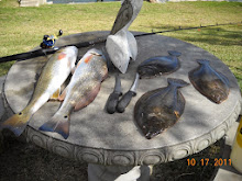
Galveston County BACLIFF TEXAS FLOUNDER FISH KILL MASSIVE AUGUST 11, 2012


Saturday, August 11, 2012

Galveston County BACLIFF TEXAS FLOUNDER FISH KILL MASSIVE AUGUST 11, 2012


Galveston County BACLIFF TEXAS FLOUNDER FISH KILL MASSIVE AUGUST 11, 2012


A sad day in Bacliff Texas 77518. a massive flounder fish kill off the shoreline of Bacliff, Texas. I know that heat has a factor, but it's been hot before, and i have never in my life seen this many flounder killed at one time, in one kill. we know that the spillway dead zone is a factor too, you can see that history below, where i posted about another flounder fish kill in 2010. the Toxic Island Dump of the Bacliff Shoreline, on the Houston ship channel, is probably not helping either. you can see toxic Galveston Bay dump off Bacliff, Shoreline here ;


see some history on annual flounder fish kills here ;


Aug. 3, 2010, 10:37PM


Subject: deadzone reply tss


WE have a dead zone right here in Bacliff Texas, on Galveston Bay, caused by ZERO oxygen level towards the bottom, flowing out of the Reliant spillway park, due to treated sewer being dumped into the discharge canal. i was told by TPWD, from that pipe down to the mouth of the bay, via the discharge pipe, there is a blue green algae that has created the ZERO oxygen levels towards the bottom. the ZERO oxygen levels once the water discharges into the bay, runs both North and South up and down Bacliff, and San Leon shore line. Both FLOUNDER AND STINGRAYS have been seen floating belly up in large numbers. this has been going on for about 4 or 5 years, every year about this same time we saw it this year, and is generally seen around no tide movement days. BUT, we have had a significant reduction in the numbers of flounders in our area over this same time frame. i guess that's why we smell fece's in Galveston bay from time to time also. isn't progress wonderful. ...not///


check out the next addition of the SEABREEZE newspaper.


here is the article in the Seabreeze news about this ;


UPDATE OCTOBER 6, 2012


WHY THE FISH ARE DYING (Part two in a series by Steve Hoyland Sr. of the Seabreeze News) Galveston Bay Area


The voice of the beautiful bayside communities www.seabreezenews.com PH: 281.235.8885


Serving: San Leon, Bacliff, Bayview, Dickinson, Texas City, Kemah, League City, Seabrook & Clear Lake Shores


October 4, 2012


Why The Fish Are Dying

 
(Part two in a series by Steve Hoyland Sr. of the Seabreeze News)

 
In our last issue, we reported on the massive fish kill in the area along the shore just north of the Spillway in San Leon. While that issue was still being printed I took two experts from an independent laboratory out in my boat to take mud and oxygen samples at the inlet and outlet of the HL&P (Houston Lighting & Power Co.) canal which passes through our scenic little community. The results finally came back from the lab just three days ago, and they are startling. On the HL&P canal inlet side that ties into Dickinson Bayou the chemical oxygen demand (COD) was 368 (normal being 40 or less.) The dissolved oxygen was 0.3. This dissolved oxygen level is so low where Dickinson Bayou and the HL&P canal meet that it cannot sustain any aquatic life. The lab analyst stated, "With the combination of these numbers this water is the equivalent of sewer water."


Coincidentally, there are currently five sewage plants that dump into Dickinson Bayou and the HL&P canal. On top of that, Texas City is rumored to have plans to turn the twelve hundred acres of HL&P property into a housing project. They have proposed building a sewage treatment facility on Dickinson Bayou between the inlet canal and the bridge, where it would dump one million gallons of treated sewage into Dickinson Bayou every day. What are they thinking?
 
 
On the canal outlet at the Spillway, we found the chemical oxygen demand (COD) was 358. The dissolved oxygen level was 2.8. Once again, the water there will not sustain aquatic life. The only good news from the testing we paid for is that there were no heavy metals detected in the mud samples.

 
The HL&P canal was initially dredged in 1972. According to specifications contained in the permit, it was to be 18 feet deep all the way from Galveston Bay to Dickinson Bayou. The same permit contained provisions that Dickinson Bayou was to be dredged out all the way out to the Houston Ship Channel. This was never done, not even one time.

 
This is the specific wording used by the US Army Corps of Engineers in writing to HL&P, before they issued the initial permit which created the canal:

 
"The decision as to where a permit will be issued will be based on an evaluation of the impact of the proposed work on the public interest. Factors affecting the public interest include, but are not limited to, navigation, fish and wildlife, water quality, economics, conservation aesthetics, recreation, water supply, flood damage prevention, ecosystems, and in general the needs and welfare of the people."

 
The above was written by the district engineer of the Galveston District, Corp of Engineers.


On May 10, 1972, Mr. D. E. Simmons, Vice President of Environmental and Inter-Utility Affairs for Houston Lighting and Power stated in writing to the Corp of Engineers that

 
"continued maintenance is planned."
 
 
In response, the Corp of Engineers issued a Public Notice on November 9, 1972 announcing plans for the HL&P proposals which included the obligation for the utility company to perform continued maintenance dredging. It was understood and agreed upon that the utility would maintain the canal by periodically dredging it and the adjoining bayou, in order to prevent what has now happened. As stated earlier, no such dredging has ever been performed since that 1972 statement. Due to the fact that the dredging maintenance was never performed, the HL&P canal and Dickinson Bayou have both filled in on the ends. This has caused what is called a ''Hydraulic Effect". Hydraulic Effect on Dickinson Bayou means the bayou is twenty-five to thirty feet deep until it gets close to the bay where it shoals to just six or eight feet. That that the bayou cannot ever flow correctly and get properly flushed out. All of the sediment from runoff collects into the mud of the bayou (ie: fertilizer, pesticides, and the waste from the sewer plants.) If the mouth of this bayou and both sides of the HL&P canal were continually dredged as stipulated in the original permit, this hydraulic effect would not be in play. If the bayou was dredged as stipulated in the permit, the lab analyst said that Dickinson Bayou would healing itself immediately. He said, "Mother Nature will eat up all the black muck with natural bacteria once there is a normal oxygen level and good tidal flow. This applies to the canal as well.

 
Dickinson Bayou and the shoreline can be fixed. It can be a vibrant, aquatic productive estuary once again. Dolphins, alligators, and all manner of wildlife once lived there. The reason our bayou has died is because someone didn't do what they said they were going to do, what they were in fact obligated to do legally.

 
Who is responsible for this major screw-up? I believe it is a combination of HL&P not doing the dredging they agreed to do, and the Army Corps of Engineers not verifying that work was performed. It all has to do with money.
 
 
We have put all of the documentation on our web site. To see the flounder kill video and copies of the permits and the drawings of the proposed dredging that was never done please visit ;


You do not need to be a subscriber to see this information.

 
A special thanks to Terry Singeltary of Bacliff for all of his help and support. Also, thanks to Texas A&M Galveston Marine Biology Department for their input.


We are not finished with our investigation. Look for continued coverage in the next issue of the Seabreeze News.
 
 
We will be in contact with the Galveston Bay Foundation and their attorney, seeking their knowledge and expertise.

 
We hope to find some way to open up Dickinson Bayou and both sides of the HL&P canal in order to facilitate the healing and restoration of our bayou and shorelines, as was expressly promised in the contract.

 
I have never been a ''tree hugger", but we cannot stand by and allow our coastal waters to be destroyed in the name of the almighty dollar, especially when the solution to the main problem is so simple.


If you have any information to share or "comments please write us at the Seabreeze News or send an email to: steve@Seabreezenews.com. Steve Hoyland Sr.


Spillway inlet outlet canal Permit 5972 Hwy 146 Bacliff Texas pdf file


VIDEO FLOUNDER KILL


Galveston County BACLIFF TEXAS FLOUNDER FISH KILL MASSIVE AUGUST 11, 2012
 
 
see video of massive flounder kill with Seabreeze article September 6, 2012 ;
 
 
Thousands of Flounder Killed on San Leon Bacliff Shoreline (AGAIN)


additional sources for flounder kill video;


September 6, 2012


Thousands of Flounder Killed on San Leon Bacliff Shoreline (AGAIN)


There was a major flounder kill on August 12th, 2012. Flounder up to 4 pounds were floating down the shoreline of the San Leon/Bacliff area. “This is the 6th year in a row that this has happened” said angry Bacliff resident, Terry Singletary. He said, “I’ve reported it to the Texas Parks and Wildlife in 2010, 2011 and of course this year in 2012. It is not the red tide.” I agree with him. He also reported it to the Galveston Bay Foundation. Their representative told Singletary that they were very concerned and that they would look into it. As of press time, he has not heard back from them.


The only thing killed and floating this year again was thousands of flounder. The red tide kills a variety of fish. Mr. Singletary reported to the Seabreeze, along with resident Robert Redfield last year, and we reported on it. This year Singletary reported it to the Texas Parks and Wildlife in Dickinson and also to the T.P & W. laboratory on Todville Road. He has pictures and videos. He talked to the Dickinson office of Texas Parks and Wildlife on August 14th and on the same day he sent them pictures and a video. Three days later they returned his call. They tried to convince him, like they did in 2010, that it is a blue algae bloom. Singletary asked them if they saw the video. The biologist said they have not even looked at it. He called the laboratory on Todville and they did not even want him to send them the video. The lady said, “If we want to look at the video we will ask you for it at a later date.” Two weeks later they are still not interested.


The flounder kill appears to have started around the HL&P Spillway mouth dumping into Galveston Bay. This morning as this paper was being printed, I was in my boat with a representative from an independent lab catching mud samples from each end of the H.L.& P. canal. We do not know where the contamination is coming from but at least we are doing something about it unlike the Texas Parks and Wildlife who are once again sitting on their ass doing nothing.


As we reach press time, September the 5th, we are waiting on the results of these samples. We already know that the H.L.&P. canal was not dug to the specifications of the original permit. The canal was required to tie into Dickinson Bayou on one end and they were to dig the Bayou out wide and 18 feet deep all the way to the channel. This side called the “inlet” side of the canal was not properly dug according to the permit. Two miles up from the Dickinson Bayou bridge, the bayou runs 20 feet deep or more. On the “Bay” side of the Dickinson Bayou bridge it averages 8 feet in depth. As anybody should know, water does not run uphill. So, all containments would stay in the bayou unable to escape. A good question would be who was overseeing the digging of the H.L.&P. canal and why did no one catch this colossal mistake? Or was it a mistake at all?


As of this time we have not jumped to any conclusions and we are not saying that the canal is at fault for the flounder kills. We will have to wait until the sample results are returned.


Dickinson Bayou is almost completely dead. The state has posted signs at all boat ramps saying do not eat fish from this bayou or swim in the water. Does this sound like a healthy vibrant bayou to you? We have been fighting a new sewer plant proposed to dump an additional one million gallons per day of treated water into Dickinson Bayou. Do you think this bayou can take any more abuse and survive? What do you readers think of this? Your comments would be greatly appreciated.


We will be reporting on this next month as we know more.


Steve


stupid is, as stupid does, and sometimes, you just can't fix stupid...


please see article ;


August 6, 2010


Got Flounder? Not in San Leon.


During the month of July, flounder and stingray have been floating up dead all along the San Leon/Bacliff shoreline on the north side. Our freelance reporter, Terry Singeltary, ob- served dead flounder floating by in groups of twos and three's with an occasional five or six. These are big, mature flounder, from two to seven pounds. Along with these flounder, dead stingrays have been seen floating by. Mr. Bobby Redfield, who lives on Bayshore Drive, also observed the same thing and gave me a call. This went on for several days. We received eight more calls where someone people left messages regarding dead flounder floating around the spillway, but did not leave their names and numbers. Our reporter contacted Lance Robinson, the Texas Parks and Wildlife Biologist located at the Dickinson office and expressed his concern about the destruction of these fish. Mr. Robinson said that they were aware of this problem and knew the cause. It turns out that a water treatment plant in the Bacliff area has a discharge pipeline that dumps into the HL&P outlet canal and goes out by way of the spillway and follows the tide. Since there is no longer any pressured flow discharging from HL&P, the chemicals from this treated water build up, removing all of the oxygen from the bottom of the water along the shoreline. The fish that live on the bottom of the bay, like flounder and stingray, cannot survive. This has been going on for years and has not been addressed. With the three sewer plants dumping into Dickinson Bayou and the de- pletion of flounder it makes you wonder why anyone in their right mind would want to put another sewer plant dumping into our precious, fragile resources. Mr. Robinson said they were having a meeting on this very subject. The meeting was to take place one week ago from this newspaper printing. Our reporter has put a call in to Mr. Robinson three days prior to this publication and at this time has not been called back. Maybe the Texas Parks and Wildlife has to contact the CCA and ask them how they should handle it. As we know more, you will know more. Do you fisherman ever wonder why there may be a shortage of flounder? With all of the sewer plants up and down the Texas coast dumping water treatment chemicals into our bays, creeks, rivers, bayous, estuaries, it's no wonder that the flounder are disappearing. What are you going to do about it Texas Parks & Wildlife? Are you going to keep cutting back the limits with the fisherman until you stop fishing for flounder forever, or are you actually going to address the problem? It's time for you Texas fishermen to wake up and let your voices be heard.


with sad regards,
 
flounder9@verizon.net

Thursday, February 17, 2011

Freeze Impacts hit Fish, Turtles along Entire Texas Coast

News Release – News Images


Media Contact: Steve Lightfoot, 512-389-4701, steve.lightfoot@tpwd.state.tx.us


Feb. 17, 2011


Freeze Impacts hit Fish, Turtles along Entire Texas Coast

AUSTIN – Preliminary assessments by Texas Parks and Wildlife Department coastal fisheries biologists suggest the damage from back-to-back freeze events that impacted marine life from Galveston to Brownsville could have been much worse.


Forecasts of prolonged sub-freezing temperatures along the Texas coast during the first week in February had biologists bracing for major fish kills the likes of which had not been seen in more than two decades. A second, less severe freeze wave hit the Texas coast less than a week later.


Coastal fisheries populations suffered devastating losses during three freeze events in the 1980s, with combined estimates of more than 30 million dead fish. In the aftermath of the freezes of 2011, TPWD officials are breathing collective sighs of relief. Based on early findings, the total numbers of fish impacted will be above that seen during 2010 (51,000 fish killed along the mid and lower coast), 2004 (35,000 fish killed in the lower Laguna Madre) and 1997 (200,000-300,000 fish killed in the upper and lower Laguna Madre) freezes, but lower than the three freezes in the 80s (1983 and two in 1989).


Biologists suggest the total impacts from this year’s fish kill in terms of numbers appear similar to the freeze of 1997, but the species makeup is drastically different. During 1997, spotted seatrout, black drum and red drum comprised roughly 75 percent of the impact. During this year’s freeze, it appears more than 85 percent of the impacted fish are non-recreational species, like silver perch, hardhead catfish, and mullet. Of the recreational species impacted this year, black drum appear to make up a larger component with spotted seatrout, red drum, sand seatrout, sheepshead, whiting, snook, gray snapper, Atlantic croaker and gag grouper making up a much smaller percentage.


“It could be that most fish had time to escape to deeper water before the freeze hit,” theorized Rebecca Hensley, TPWD coastal fisheries regional director. “We didn’t see the beaches covered in ice and very large numbers of dead fish like during the ‘80s freezes.”


Hensley also credits reduced mortality on game fish to conservation measures taken during the freeze, including a temporary fishing closure in deep water thermal refuges and voluntary stoppage of barge traffic in the lower Laguna Madre and through the land cut in the upper Laguna Madre.


“We appreciate the conservation ethic displayed by anglers during and immediately after the freeze when these fish were vulnerable,” said Robin Riechers, TPWD director of coastal fisheries. “It definitely helped reduce fish mortality.”


The recent freeze also saw a huge jump in the number of cold-stunned sea turtles recovered and the high survival rates. More than 1,500 sea turtles were recovered thanks to a massive network of volunteers and state and federal agency efforts.


“There were people out on the water gathering turtles immediately once the freeze hit and that made a huge difference,” said Riechers. “Turtle survival has been fairly high compared to previous freezes.”


In past years for similar coastal freezes, cold-stunned sea turtles in Texas have typically been held in captivity to recuperate for weeks until sea water temperatures rose. But two factors prompted Texas wildlife workers to return turtles to the wild faster this time. First, experts in Florida who’ve had similar recent experiences with cold-stunned turtles advised returning them to the water as soon as possible. Second, the sheer numbers of rescued turtles overwhelmed available facilities, so that many were on floors or wrapped in blankets, and experts say it’s better for them to return to water as soon as possible.


Within days of rescue, sea turtles were returned en masse with volunteers forming assembly-line chains to shuttle turtles down to the water’s edge on beaches near Corpus Christi and along the South Padre Island seashore.


Biologists say they won’t know the full impact to coastal fisheries from the freeze until annual sampling surveys are conducted later in the spring.


Photo Editors: Images associated with this news release are available on the TPWD Web site (http://archive.tpwd.state.tx.us/newsmedia/news_images/).


http://www.tpwd.state.tx.us/newsmedia/releases/?req=20110217c


tss

Friday, February 4, 2011

Galveston Bay Fish Kill Arctic Blast of 2011 ???


Galveston Bay Fish Kill Arctic Blast of 2011 ???


Saturday, February 05, 2011 7:25 PM

I sure hope there is not a major fish kill. it sure was warm just days before this Arctic express came roaring through, and believe it or not, the bait had come back up in here, there were some pelicans and gulls feeding on the bait last week when it was in the 70s. so, I imagine there were some specs and other fish up in here feeding. if I am not mistaken, it was that 83 freeze that took out the specs, and made the limit go from 20 to 10. the bay froze over too in 83 and 89.

water temp at Eagle point Thurs. was 46 degrees (F).

For spotted seatrout, water temperatures below about 45 degrees (F) become lethal. Red drum are a bit more hardy and can tolerate temperatures down to the mid-30's (F); flounder to the low 40's (F).

Water temp at Eagle Point Friday was 41 degrees (F).

Water temp today at Eagle Point today Sat. 42 degrees (F)

let's pray for a miracle. ...TSS


Freeze-triggered coastal fishing ban extended to Monday
By SHANNON TOMPKINS
Copyright 2011 Houston Chronicle Feb. 4, 2011, 6:38PM


Concerned about potential pillaging of speckled trout, redfish and other coastal game fish crowded into harbors, channels and other deep-water sanctuaries to escape frigid temperatures, state fisheries officials extended until noon, Monday, a closure of some areas along the coast to all fishing.

Texas Parks and Wildlife Department had imposed the closure, which affects 21 locations along the coast, Wednesday when it became obvious the days-long siege of freezing or near freezing temperatures would drop inshore water temperatures to levels that would trigger fish to seek refuge in deeper, more insulated waters.

The ban had been set to expire at noon, Saturday.

"This freeze event has lasted longer than was projected earlier in the week and temperatures are not expected to get much above freezing today," said Robin Riechers, TPWD coastal fisheries division director. "We realize an extension through the weekend may inconvenience some anglers and we appreciate their patience and cooperation, but our primary concern is to give fish holding in those thermal refuges a chance to recover." ...


see the picture of Galveston Bay Froze over behind the house here in 1989.
UPDATE Monday February 7, 2011


Fish kill minimal along coast . Monday, 07 February 2011 11:19 Staff report .Relatively small numbers of dead fish have been reported along the Texas coast after a major cold front late last week. Photo by Patrick Thomas. Anglers and Texas Parks and Wildlife officials along the Texas coast are breathing easier this week after a massive cold front Thursday and Friday seemed to have spared many fish along the bays and Intracoastal Waterway.

Robin Riechers, TPWD Coastal Fisheries Division spokesman, characterized the weekend as “dodging a bullet.”

“That may not be what I’m saying Wednesday (after a flyover), but we are still counting dead game fish in the hundreds, which is amazing considering the cold,” he said. “The most notable kills occurred with pinfish, mullet and hardheads.”

Low tides the previous week and already-cold water help save a lot of fish killed because many of them had already moved to deeper water before the freeze hit.

“In past big events, the cold weather came on quick,” Riechers sad. “Having cold weather before the front, the fish were acclimated already. A lot of water was already shoved out of the bays (because of the low tides) and the barge traffic stoppage helped a lot.”

According to a TPWD memo, “many of the fish seen have been along the shoreline and are small (less than 6-10 inches in length). This weekend, additional fish species have been seen, but in low numbers. During field reconnaissance, the water clarity remains high and many fish were seen in canals beginning to come off the bottom (with their tails on the bottom and head in the water column). With the higher water temperatures, many of the dead fish in the deeper water are beginning to float.”

Mid-coast captain Scott Sommerlatte said he flew over the middle bays Sunday and counted several hundred dead trout, but called the fish kill “insignificant.”

“I think we escaped anything too terrible,” he said. “I saw a couple of really big trout, but not a single redfish. East Matagorda had most of the dead fish, but this wasn’t as bad as last year — not even close.”

A small snook kill was reported in the Lower Laguna Madre, but Capt. Eric Glass guided a redfish client Sunday along the southernmost tip of the coast and reported a great day of fly-fishing on the flats.


http://www.lsonews.com/fishing-news/1479-staff-report


TSS

Sunday, January 2, 2011

TEXAS AND IT'S INDUSTRY FRIENDLY ENVIRONMENTAL HAZARDOUS POLLUTING LAWS

TEXAS AND IT'S INDUSTRY FRIENDLY ENVIRONMENTAL HAZARDOUS POLLUTING LAWS


January 2, 2011


Howdy Bay Area Neighbors,


Wasn't it refreshing to read the headlines in the City and State section of the Chronicle Friday December 31, 2010. Three headlines caught my eye. First was 'Texas tries again to foil EPA, second was 'Downpour Sends raw sewage into bayou', and the third was 'Decision to expand dump put on hold'. Puts a light on where we're headed in 2011. More nuke waste material in Texas, More shit in Galveston Bay, and even more shit from the EPA and Austin. Maybe we can redirect Buffalo Bayou and the Nuke waste dump to the Governors office. well, it's just a thought. ...


Buffalo Bayou sewage repairs may take 3 weeks Pipes break from downpour's load

By ALLAN TURNER HOUSTON CHRONICLE Dec. 31, 2010, 9:13AM

City workers on Thursday began assessing damage to a maze of sewer pipes that, gorged with water from heavy rains, spewed more than 100,000 gallons of raw sewage into Buffalo Bayou.

Public works spokesman Alvin Wright said it may take as long as three weeks to repair the damage, but sewer customers should not be inconvenienced in the process.

"They can still flush," Wright said. ...

http://www.chron.com/disp/story.mpl/metropolitan/7360522.html


Texas tries again to foil EPA It asks federal appeals court to stop takeover of rules for permits

By MATTHEW TRESAUGUE HOUSTON CHRONICLE Dec. 30, 2010, 9:09PM

Texas took another swing Thursday at the EPA, asking a federal appeals court to block the agency from seizing the state's authority to regulate the largest industrial sources of greenhouse gas emissions.

The latest legal move comes three days before new nationwide regulations for emissions of carbon dioxide and other heat-trapping gases take effect. Texas is the only state to refuse to implement the rules.

The Texas petition to the U.S. Circuit Court of Appeals for the District of Columbia accuses the Environmental Protection Agency of abusing its powers by taking control of the permitting program without proper public notice. The EPA made the unilateral move Dec. 23.

"Once again, the federal government is overreaching and improperly intruding upon the state of Texas and its legal rights," Texas Attorney General Greg Abbott said in a statement. Typically, the federal government delegates implementation of Clean Air Act rules to the states....

http://www.chron.com/disp/story.mpl/metropolitan/7360473.html


Judge orders halt to radioactive waste dump By JAY ROOT © 2010 The Associated Press

Dec. 30, 2010, 5:11PM

AUSTIN, Texas — A Texas judge ordered a temporary halt Thursday to a proposal that could allow three dozen states to dump their radioactive waste in far West Texas, a ruling that sided with environmentalists and caught the state attorney general's office off guard.

State District Judge Jon Wisser issued a temporary restraining order against the Texas Low-Level Radioactive Waste Disposal Compact Commission, which is scheduled to vote Jan. 4 on rules that could expand how much waste could be processed at a dump in remote Andrews County.

The injunction was issued in the judge's courtroom late Thursday morning, shortly after environmentalists filed the request, with nobody there representing the commission. A few minutes later, shocked lawyers from the Texas Attorney General's Office — which hadn't been officially notified of the pending court action — showed up and convinced the judge to order a new hearing on the injunction.

The hearing is set for Monday in Austin, one day before the commission's scheduled vote. ....

http://www.chron.com/disp/story.mpl/ap/tx/7360256.html


Friday, December 24, 2010

TEXAS NUCLEAR DUMP VOTE SET AMID HOLIDAY RUSH THANKS TO GOVERNOR RICK PERRY

NUCLEAR DUMP VOTE SET AMID HOLIDAY RUSH

CRITICS PROTEST TIMING OF MEETING ON 38-STATE WASTE FACILITY IN TEXAS

http://sciencebushwhacked.blogspot.com/2010/12/texas-nuclear-dump-vote-set-amid.html


WEDNESDAY, JULY 30, 2008

TEXAS WINS TO BE NEXT BIG DUMPING GROUND FOR NUCLEAR WEAPONS RADIOACTIVE WASTE

(see photo's)

http://sciencebushwhacked.blogspot.com/2008/07/texas-wins-to-be-next-big-dumping.html


Monday, July 5, 2010

B.P. Gulf Oil Spill Tar Balls Hit Texas Beaches Galveston and Bolivar

http://galvestonbay.blogspot.com/2010/07/gulf-oil-spill-tar-balls-hit-texas.html


Thursday, August 5, 2010

DEAD ZONES IN THE GULF AND GALVESTON BAY, NORTH AND SOUTH BACLIFF, SAN LEON, SHORELINE

flounders and stingrays floating belly up north and south of spillway part outlet.

http://galvestonbay.blogspot.com/2010/08/dead-zones-in-gulf-and-galveston-bay.html


Wednesday, August 6, 2008

TROUBLED WATERS

(DEAD DOLPHIN washed up on rocks in backyard, on Galveston Bay, in Bacliff, Texas 77518)

http://galvestonbay.blogspot.com/2008/08/troubled-waters.html


Saturday, July 19, 2008

GALVESTON BAY, swimming with the dolphins, PCBs, and FECAL MATTER

Greetings again kind friends and neighbors. ...

http://galvestonbay.blogspot.com/2008/07/galveston-bay-swimming-with-dolphins.html


http://galvestonbay.blogspot.com/


December 20, 2010

Don’t Trash Texas— Unless You Pay Perry $1.1 Million A billionaire gives the governor $500,000 more to make Texas the nation’s nuclear waste dump.


http://info.tpj.org/Lobby_Watch/pdf/SimmonsNukeImport.pdf


http://trailblazersblog.dallasnews.com/archives/2010/12/rick-perrys-nuclear-money-mach.html


Terry S Singeltary Sr.
P.O. Box 42
Bacliff, Texas USA 77518

Thursday, August 5, 2010

DEAD ZONES IN THE GULF AND GALVESTON BAY, NORTH AND SOUTH BACLIFF, SAN LEON, SHORELINE


DEAD ZONES IN THE GULF AND GALVESTON BAY, NORTH AND SOUTH BACLIFF, SAN LEON, SHORELINE 77518


Low-oxygen area now deeper into Texas waters Largest-ever Gulf dead zone spans from Galveston to Mississippi River


By ERIC BERGER HOUSTON CHRONICLE Aug. 3, 2010, 10:37PM

The dead zone off the Texas coast is larger this year than scientists have ever measured, stretching offshore from the Mississippi River to Galveston Island.

An area of low-oxygen water that threatens marine life, the dead zone is at its largest during the summer months.

Scientists have surveyed the Gulf dead zone for a quarter-century, and this year's 7,722-square-mile area of hypoxic water is among the five largest.

"It's been getting larger and larger over the last five to seven years," said Nancy Rabelais, a Louisiana scientist who leads efforts to annually map the dead zone. "As it's been getting larger, it's expanded farther into Texas waters.

"This is the largest such area off the upper Texas coast that we have found since we began this work in 1985."

Discharge from the Mississippi River, which carries nitrogen and phosphorous nutrients from Midwestern states, largely creates the dead zone.

These nutrients, partly from commercial fertilizers, spur the growth of algaeblooms which, after dying, sink to the bottom. There the bacteria which feast upon the algae also bloom, depleting oxygen in the water.

Fish and shellfish often can swim away from these areas but immobile organisms, such as clams, simply die without access to oxygen.

Scientists are beginning to try and quantify the economic effect of dead zones, primarily due to potential disruption of fisheries.

"There are a whole host of biological consequences for fish in hypoxic areas, and when you add up all those different things you might expect there will be less fish to catch," said Martin Smith, an environmental economist at Duke University.

In recent years Smith has studied the effects of hypoxia on North Carolina fisheries at the mouth of the Neuse River, and he said low-oxygen water may have reduced catches by 10 to 15 percent.

Long-term worries Smith is part of a team that recently received a four-year, $700,000 grant to perform the first extensive study of the economic consequences of the Gulf dead zone.

In the short term it may benefit some fisheries, he said, because some species such as shrimp may be more tightly clustered at the edge of hypoxic areas, making them easier to catch.

Nevertheless there are long-term concerns about areas of low-oxygen water because they may reduce the reproduction of fish, or slow their growth rates.

"One would expect that if there's less dissolved oxygen, as the severity of the problem worsens, the consequences are going to get worse, too," he said. "But we're not going to answer that question scientifically until we do the study."

Common in summer Texas has seen dead zones before. Excessive rainfall in 2007 caused the Brazos River to discharge more than twice as much water into the Gulf of Mexico than previously measured since at least 1967.

This large amount of fresh water carrying nitrates led to the creation of a temporary 1,750-square-mile area of oxygen-depleted water, stretching from Freeport to Matagorda Bay.

And the Gulf's summer dead zone — such areas occur most commonly in the summer when winds are lightest - has stretched along the upper Texas coast before.

Now it appears that, absent tropical weather in the summer to break up dead zones by mixing the water, dead zones will become permanent summertime fixtures.

"There's still room for it to grow," Rabelais said. "It just has to do with the pressure of more people and nutrients. It means lower water quality, and larger algae blooms. It's certainly not a good thing."

eric.berger@chron.com


Subject: deadzone reply tss

WE have a dead zone right here in Bacliff Texas, on Galveston Bay, caused by ZERO oxygen level towards the bottom, flowing out of the Reliant spillway park, due to treated sewer being dumped into the discharge canal. you can see the pipe from google search. i was told by TPWD, from that pipe down to the mouth of the bay, via the discharge pipe, there is a blue green algae that has created the ZERO oxygen levels towards the bottom. the ZERO oxygen levels once the water discharges into the bay, runs both North and South up and down Bacliff, and San Leon shore line. Both FLOUNDER AND STINGRAYS have been seen floating belly up in large numbers. this has been going on for about 4 or 5 years, every year about this same time we saw it this year, and is generally seen around no tide movement days. BUT, we have had a significant reduction in the numbers of flounders in our area over this same time frame. i guess that's why we smell fece's in Galveston bay from time to time also. isn't progress wonderful. ...not///

check out the next addition of the SEABREEZE newspaper.

stupid is, as stupid does, and sometimes, you just can't fix stupid...

please see article ;

August 6, 2010

GOT FLOUNDER? Not in San Leon...


GOT FLOUNDER? Not in San Leon...

Got Flounder? Not in San Leon.

During the month of July, flounder and stingray have been floating up dead all along the San Leon/Bacliff shoreline on the north side. Our freelance reporter, Terry Singeltary, ob- served dead flounder floating by in groups of twos and three's with an occasional five or six. These are big, mature flounder, from two to seven pounds. Along with these flounder, dead stingrays have been seen floating by. Mr. Bobby Redfield, who lives on Bayshore Drive, also observed the same thing and gave me a call. This went on for several days. We received eight more calls where someone people left messages regarding dead flounder floating around the spillway, but did not leave their names and numbers. Our reporter contacted Lance Robinson, the Texas Parks and Wildlife Biologist located at the Dickinson office and expressed his concern about the destruction of these fish. Mr. Robinson said that they were aware of this problem and knew the cause. It turns out that a water treatment plant in the Bacliff area has a discharge pipeline that dumps into the HL&P outlet canal and goes out by way of the spillway and follows the tide. Since there is no longer any pressured flow discharging from HL&P, the chemicals from this treated water build up, removing all of the oxygen from the bottom of the water along the shoreline. The fish that live on the bottom of the bay, like flounder and stingray, cannot survive. This has been going on for years and has not been addressed. With the three sewer plants dumping into Dickinson Bayou and the de- pletion of flounder it makes you wonder why anyone in their right mind would want to put another sewer plant dumping into our precious, fragile resources. Mr. Robinson said they were having a meeting on this very subject. The meeting was to take place one week ago from this newspaper printing. Our reporter has put a call in to Mr. Robinson three days prior to this publication and at this time has not been called back. Maybe the Texas Parks and Wildlife has to contact the CCA and ask them how they should handle it. As we know more, you will know more. Do you fisherman ever wonder why there may be a shortage of flounder? With all of the sewer plants up and down the Texas coast dumping water treatment chemicals into our bays, creeks, rivers, bayous, estuaries, it's no wonder that the flounder are disappearing. What are you going to do about it Texas Parks & Wildlife? Are you going to keep cutting back the limits with the fisherman until you stop fishing for flounder forever, or are you actually going to address the problem? It's time for you Texas fishermen to wake up and let your voices be heard.


http://seabreezenews.com/issue/Page_16.pdf


TSS

Monday, July 5, 2010

B.P. Gulf Oil Spill Tar Balls Hit Texas Beaches Galveston and Bolivar


GALVESTON, Texas, July 5, 2010

Gulf Oil Spill Tar Balls Hit Texas Beaches

State Says Responders Have Recovered About 35 Gallons of Waste Material Tainted by Oil on Beaches

(AP) A top Texas official said Monday that tar balls from the Gulf oil spill have been found on state beaches, marking the first known evidence that gushing crude from the Deepwater Horizon well has now reached all the Gulf states.

Special Section: Disaster in the Gulf

http://www.cbsnews.com/2718-201_162-558.html


Land Commissioner Jerry Patterson said two crews were removing tar balls found on the Bolivar Peninsula and Galveston Island on Sunday.

"We've said since day one that if and when we have an impact from Deepwater Horizon, it would be in the form of tarballs," Patterson said in a news release. "This shows that our modeling is accurate. Any Texas shores impacted by the Deepwater spill will be cleaned up quickly and BP will be picking up the tab."

The state said responders have recovered about 35 gallons of waste material tainted by the oil from the two sites.

Signs of landfall by oil from the Deepwater Horizon spill had previously only been reported in Louisiana, Mississippi, Alabama and the Florida Panhandle.

The distance between the western-most reach of the spill in Texas and the eastern-most reports of oil in Florida is about 550 miles.

http://www.cbsnews.com/stories/2010/07/05/national/main6649045.shtml


oh hell,

I see right out of the starting gates they are wanting to blame the tankers on bringing this B.P. oil globs to our Texas beaches. so, back to my question (part of this was omitted in the Galveston Daily News comment submission that was published due to comment length limit), BUT WHAT ABOUT Galveston Bay and all it's estuaries ?


tarball...(flounder)


===================================

From: Terry S. Singeltary Sr.
T o:
Cc: letters@galvnews.com

Sent: Saturday, May 22, 2010 11:24 AM
Subject: do we need an Ike dike, or a BP dike ?

WHAT (if any), is the contingency plan we have to keep that BP oil from getting into Galveston Bay, and all it's estuary's, if it heads our way, and threatens our coast ?

PLEASE NOTE ; the booms do not seem to be working. I have seen them broke up and beached, with oil soaked birds trying to stay afloat on them. we know the entrance between the jetties can be a rough one, sometimes on a calm day, as with San Luis Pass.

SO what is the contingency plan to protect the cuts coming into Galveston bay, and keep the BP oil, or any oil, from entering ?

OUR BEACHES would be very vulnerable too, so another question would be, what is the contingency plan to keep the BP oil off our beaches from High Islands, to Corpus, and beyond, IF the oil was to come our way? the surf would break up any booms, so what plan is it you have for the beaches as well ?

===================================


Thursday, June 3, 2010


Galveston Daily News

Letters to the Editor

May 28, 2010

How Would We Deal With An Oil Spill Here?

Do we need an Ike dike, or a BP dike?

I watch in misery as I see what is happening to our kind neighbors to the east of us, and think to myself, there, but for the grace of God, go we.

All that would have to happen is a change in wind pattern or weather pattern and BP’s God-awful mess could be at our doorsteps in a minute.

What, if any, is the contingency plan to keep that BP oil from getting into Galveston Bay and all its estuaries, if it heads our way? Will the ship channel and cuts be closed to seal off the bay?

Our beaches would be vulnerable, too. What is the contingency plan to keep the BP oil off our beaches from High Island to Corpus Christi and beyond, if the oil were to come our way?

If an oil dispersant is used, how would we keep that from coming into Galveston Bay, and what harm is it to humans and wildlife, including fish?

These are just a few of many questions I would like answered before the BP oil slick, or any oil slick, is seen off our coast, not after it comes ashore.

Terry Singeltary Sr. Bacliff


http://galvestondailynews.com/story.lasso?ewcd=b8f097d3ec4f9965


ORIGINAL SUBMISSION ;


----- Original Message -----

From: Terry S. Singeltary Sr.
To:
Cc: letters@galvnews.com
Sent: Saturday, May 22, 2010 11:24 AM
Subject: do we need an Ike dike, or a BP dike ?

Greetings Mr. Taylor and The Galveston Daily News et al !

I have a few questions please, that I think someone needs to answer for the public.

I watch in misery and pain as I see what is happening to our Kind Neighbors to the East of us, and on around the Gulf Coast to Florida, and think to myself, there for the Grace of God, are us. all that would have to happen is a change in wind pattern, and or weather pattern, or maybe even an early tropical storm coming in from the Florida keys from east to west across the gulf. any of these scenario's would put that God awful mess at our door steps in a minute.

WHAT (if any), is the contingency plan we have to keep that BP oil from getting into Galveston Bay, and all it's estuary's, if it heads our way, and threatens our coast ?

PLEASE NOTE ; the booms do not seem to be working. I have seen them broke up and beached, with oil soaked birds trying to stay afloat on them. we know the entrance between the jetties can be a rough one, sometimes on a calm day, as with San Luis Pass.

SO what is the contingency plan to protect the cuts coming into Galveston bay, and keep the BP oil, or any oil, from entering ?

OUR BEACHES would be very vulnerable too, so another question would be, what is the contingency plan to keep the BP oil off our beaches from High Islands, to Corpus, and beyond, IF the oil was to come our way? the surf would break up any booms, so what plan is it you have for the beaches as well ?

IF OIL DISPERSANTS are used, how would we keep that from coming into Galveston Bay, and what harm would it be to our wildlife and fishing in general ?

THESE are just a few of many questions myself, and I am sure others would like to have answered, BEFORE the BP oil slick, or any oil slick, is seen off our coast. NOT after it is seen.

I am sure, somewhere there is a contingency plan. I am sure it is published somewhere, I would hope so anyway, and we should all have a copy of it for scrutiny, in case it is not sufficient to protect our Galveston Bay, and our Beaches. ...

sincerely concerned,

Terry S. Singeltary Sr. P.O. Box 42 Bacliff, Texas USA 77518


Sunday, May 30, 2010


DO WE NEED AN IKE DIKE, OR A B.P. DIKE, OR BOTH


Wednesday, June 2, 2010


OFFICIALS CLAIM PLAN IS IN PLACE IF OIL HITS TEXAS BEACHES Officials:


Tuesday, June 22, 2010

Will Bacterial Plague Follow Crude Oil Spill Along Gulf Coast?


http://galvestonbay.blogspot.com/2010/06/will-bacterial-plague-follow-crude-oil.html


Governor Perry comments ;


"I want to assure Texans we are taking aggressive actions." ...end


let's hope so. i have my doubts though. ...tarball (flounder)


Terry S. Singeltary Sr.
P.O. 42
Bacliff, Texas USA 77518