Invisible oil beyond the Deepwater Horizon satellite footprint
Igal Berenshtein1,*, Claire B. Paris1,*, Natalie Perlin1, Matthew M. Alloy1, Samantha B. Joye2 and Steve Murawski3
Science Advances 12 Feb 2020: Vol. 6, no. 7, eaaw8863 DOI: 10.1126/sciadv.aaw8863
Abstract
Major oil spills are catastrophic events that immensely affect the environment and society, yet determining their spatial extent is a highly complex task. During the Deepwater Horizon (DWH) blowout, ~149,000 km2 of the Gulf of Mexico (GoM) was covered by oil slicks and vast areas of the Gulf were closed for fishing. Yet, the satellite footprint does not necessarily capture the entire oil spill extent. Here, we use in situ observations and oil spill transport modeling to examine the full extent of the DWH spill, focusing on toxic-to-biota (i.e., marine organisms) oil concentration ranges. We demonstrate that large areas of the GoM were exposed to invisible and toxic oil that extended beyond the boundaries of the satellite footprint and the fishery closures. With a global increase in petroleum production–related activities, a careful assessment of oil spills’ full extent is necessary to maximize environmental and public safety.
snip...
The cumulative satellite oil slick footprint was largely accepted as the DWH oil spill extent from scientific, public, and management perspectives (2, 4, 5). Yet, accumulating field data support a much wider extent of the DWH spill beyond the satellite footprint, reaching the West Florida Shelf (WFS), the Texas Shores (TXS), the Loop Current (LC) system, and the Florida Keys (FK) (see regional map in fig. S1). Specifically, in the WFS, studies indicate high concentrations of oil, including toxic and mutagenic levels, in the water (6), in sediments (7), in sand patties (8), and on the coast (9). Furthermore, high levels of polycyclic aromatic hydrocarbons (PAHs) from DWH oil were found in red snappers’ livers, which co-occurred with a high frequency of skin lesions in bottom-dwelling fish (10). Last, satellite imagery and particle tracking showed that an oil slick present east of Pensacola (north WFS) was transported southeast along the WFS, reaching Tampa and the Dry Tortugas (FK) within a few weeks (11). In TXS, high and toxic levels of oil were found in the water (12) and in sediments (12, 13). In the LC system, the European Space Agency reported the presence of DWH oil during mid-May (14). Later, during early June, NESDIS satellite imagery revealed the presence of 12 oil slicks in the LC system, stretching from FK to the GoM interior. High concentrations of oil were reported in the LC between late June and mid-July west of the fishery closures (15). Furthermore, a deep intrusion (~1000 to 1300 m), which was documented (16) and represented in oil transport simulations (17), included toxic PAH concentrations within 13 km from the well and above-background concentrations extending southwest ~300 km beyond the satellite footprint and closure areas. Overall, these observations indicate that DWH oil extended beyond the satellite footprint and the fishery closures (18).
snip...
The importance of our findings is not only limited to environmental effects but also could have implications for human health. While PAH toxicity for various marine species can be directly obtained from dose-response toxicity experiments, this direct approach cannot be applied for humans. In terms of seafood consumption, the DWH seafood safety protocol (2) considered the LOC of only 13 PAH compounds and did not consider the possible toxicity of photomodified compounds, i.e., the formation of new chemical compounds produced as a result of UV and PAH interaction, or PAH degradation products. Many of these compounds have been shown to be mutagenic and carcinogenic (44–46), and their persistence across trophic levels is not well studied. In addition, the sample size of the DWH food sampling was simply too small to produce meaningful inference regarding the absence of contaminated seafood (section S2). Hence, the possible hazard associated with consumption of seafood containing oil and oil breakdown products, including photomodified compounds, ought to be carefully evaluated in the future.
In conclusion, our results change established perceptions about the consequences of the oil spill by showing that toxic and invisible oil extend beyond the satellite footprint at concentrations that present potentially lethal and sublethal hazards to a wide range of taxa under a range of circumstances found in the GoM. We did so by computing toxicity and visibility thresholds and applying these in an oil transport model. Our results are strongly supported by in situ and remote sensing observations. In future oil spills, toxic and invisible portions could be computed on the basis of the quantitative framework presented here. Similarly, our computed thresholds could be used as null-hypotheses benchmarks until more accurate data are obtained for a given scenario. We do not provide an exact oil concentration benchmark for fishery closures since that involves a trade-off analysis between ecosystem health risks, human health risks, and fishery revenue loss, which is beyond the scope of our current work. Instead, we quantify and highlight the concept of toxic-to-biota and invisible oil that can promote informed decision-making for future oil spills for managers, fishers, and seafood consumers. This is especially important given the global increase in deep-sea drilling efforts and petroleum-related activities.
see full text;
Invisible oil beyond the Deepwater Horizon satellite footprint
Igal Berenshtein1,*, Claire B. Paris1,*, Natalie Perlin1, Matthew M. Alloy1, Samantha B. Joye2 and Steve Murawski3
Science Advances 12 Feb 2020: Vol. 6, no. 7, eaaw8863 DOI: 10.1126/sciadv.aaw8863
Thursday, June 3, 2010
CAUGHT IN B.P. OIL
MONDAY, JULY 5, 2010
B.P. Gulf Oil Spill Tar Balls Hit Texas Beaches Galveston and Bolivar
I see right out of the starting gates they are wanting to blame the tankers on bringing this B.P. oil globs to our Texas beaches. so, back to my question (part of this was omitted in the Galveston Daily News comment submission that was published due to comment length limit), BUT WHAT ABOUT Galveston Bay and all it's estuaries ?
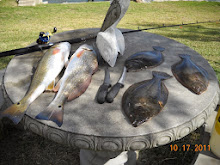
tarball...(flounder)
Sunday, May 30, 2010
DO WE NEED AN IKE DIKE, OR A B.P. DIKE, OR BOTH
sad...terry
